Burns Park in Ann Arbor in Washtenaw County, Michigan — The American Midwest (Great Lakes)
The Corners of South University and East University Avenues
Inscription.
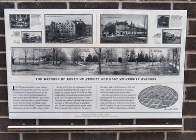
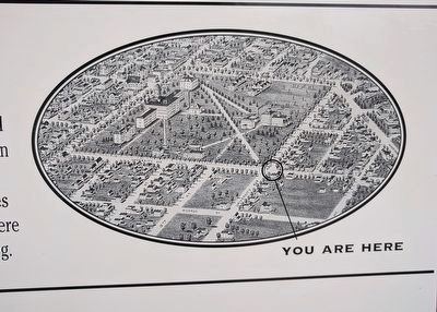
In the 1898 panorama above, campus buildings had not yet reached this corner. The School of Engineering and its shops can be seen in the distance. Cousins and Hall greenhouses and florist shop occupied most of the first block across South University, which was then an unpaved boulevard. Houses lined the avenues surrounding campus as well as both sides of South University all the way to Washtenaw Avenue. (See 1880 birdseye at right.)
Over the next 25 years, the neighborhood changed dramatically as buildings filled the original 40-acre campus and expanded beyond. In 1904 the new Engineering Building with a pedestrian archway was added at this end of the diagonal walk. Houses on South University were replaced by Martha Cook dormitory for women in 1915 and by the Law Quadrangle in 1924. The site of the greenhouses became the athletic field for University High School (later the School of Education), built on East University in 1924. Ann Arbor's second apartment house, the Anberay, was built across the street the year before.
John MacGregor's grocery, the first commercial structure on this block, was built on this corner in 1908. Eight years later shops lined both sides of South University as far as the next corner. Houses on East University (far right in the panorama) were replaced in 1923 by the East Engineering Building.
Photos courtesy of Bob MacGregor, Marjorie O'Brien, and the Bentley Historical Library
Erected by Ann Arbor Historic District Commission.
Topics. This historical marker is listed in these topic lists: Education • Industry & Commerce. A significant historical year for this entry is 1898.
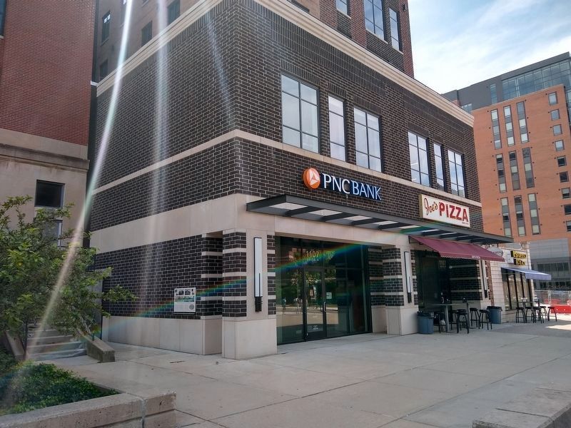
Location. 42° 16.52′ N, 83° 44.142′ W. Marker is in Ann Arbor, Michigan, in Washtenaw County. It is in Burns Park. Marker can be reached from the intersection of South University Avenue and East University Avenue. Touch for map. Marker is at or near this postal address: 1107 South University Avenue, Ann Arbor MI 48104, United States of America. Touch for directions.
Other nearby markers. At least 8 other markers are within walking distance of this marker. McDivitt-White Plaza (a few steps from this marker); Social and Political Change on South University (within shouting distance of this marker); Engineering at Michigan (within shouting distance of this marker); The Denison Archway (within shouting distance of this marker); West Engineering - West Hall (within shouting distance of this marker); East University Avenue Campus Boundary (about 300 feet away, measured in a direct line); Michigan Summer Symposium in Theoretical Physics
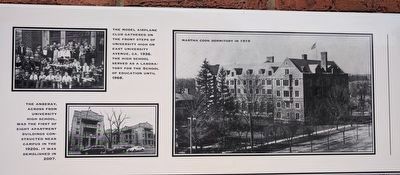
2. The Corners of South University and East University Avenues Marker — top left images
Upper left: The Model Airplane Club gathered on the front steps of University High on East University Avenue, ca. 1936. The high school served as a laboratory for the School of Education until 1968.
Lower left: The Anberay, across from University High School, was the first of eight apartment buildings constructed near campus in the 1920s. It was demolished in 2007.
Right: Martha Cook dormitory in 1919
Lower left: The Anberay, across from University High School, was the first of eight apartment buildings constructed near campus in the 1920s. It was demolished in 2007.
Right: Martha Cook dormitory in 1919
Also see . . . Site 15: Wall Display: The Corners of South University and East University Avenues. Marker on the Downtown Ann Arbor Historical Street Exhibit website. (Submitted on October 18, 2017, by Joel Seewald of Madison Heights, Michigan.)
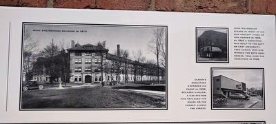
3. The Corners of South University and East University Avenues Marker — top right images
Left: West Engineering Building in 1919
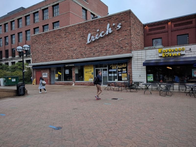
Top Right: John MacGregor stands in front of his new grocery store on this corner in 1908. By 1920 a bookstore was built to the left on East University. Fred Ulrich, who had worked for both businesses, took over the bookstore in 1935.
Lower Right: Ulrich's Bookstore expanded its front in 1959. Decades earlier, a gas station had replaced the house on the corner across the street.
Credits. This page was last revised on February 12, 2023. It was originally submitted on October 18, 2017, by Joel Seewald of Madison Heights, Michigan. This page has been viewed 431 times since then and 25 times this year. Photos: 1. submitted on July 28, 2021, by Joel Seewald of Madison Heights, Michigan. 2, 3, 4, 5. submitted on October 18, 2017, by Joel Seewald of Madison Heights, Michigan. 6. submitted on July 28, 2021, by Joel Seewald of Madison Heights, Michigan. 7. submitted on October 18, 2017, by Joel Seewald of Madison Heights, Michigan.
