Knoxville in Knox County, Tennessee — The American South (East South Central)
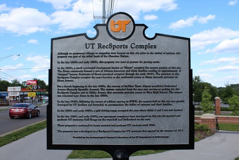
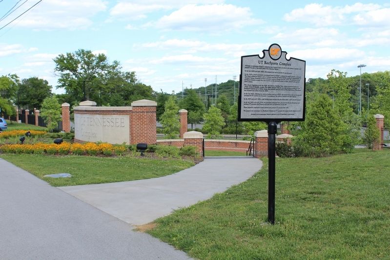
UT RecSports Complex
In the late 1800ís and early 1900ís, this property was used as pasture for grazing cattle.
In the 1920ís, a small residential development known as “Slatey” occupied the eastern portion of this site. The Slatey community housed a mix of African-Americans and white families residing in approximately 15 “shotgun” houses. Remnants of Slatey remained occupied through the early 1960ís. The entrance to this Recsports Complex occupies the same location as the residential access to Slatey formerly provided via Mann Avenue.
For decades beginning in the late 1920ís, the runway of McGhee Tyson Airport paralleled Sutherland Avenue (formerly Sprankle Avenue). The runway extended from the area now serving as parking for this RecSports Complex east to Tobler Avenue that currently provides access to West High School. The airport was relocated near Alcoa in the late 1930ís.
In the late 1940ís, following the return of soldiers serving in WWII, the eastern half of this site was quickly developed by UT (trailers and barracks) to accommodate the influx of veteran and their families.
In the 1950ís and early 1960ís, a golf driving range occupied the area where fields 2 and 3 are now located.
In the late 1960ís and early 1970ís, two apartment complexes were developed on this site for married and graduate UT students; Golf Range on the west half and Sutherland on the east.
Those properties continued to house married and graduate UT students until 2010.
The property was redeveloped as a RecSports Complex for UT students that opened in the summer of 2013.
Erected by Archaeological Research Laboratory of the UT Department of Anthropology.
Topics. This historical marker is listed in this topic list: Notable Places. A significant historical year for this entry is 2010.
Location. 35° 56.779′ N, 83° 58.796′ W. Marker is in Knoxville, Tennessee, in Knox County. Marker is on Sutherland Avenue, on the right when traveling north. Touch for map. Marker is in this post office area: Knoxville TN 37919, United States of America. Touch for directions.
Other nearby markers. At least 8 other markers are within 2 miles of this marker, measured as the crow flies. Medal of Honor Recipients (approx. 0.2 miles away); The Everly Brothers (approx. 0.4 miles away); Sutherland Avenue McGhee Tyson Airport (approx. half a mile away); Herbert H. Hoover (approx. 0.8 miles away); Bleak House (approx. 1.3 miles away); Longstreet's Headquarters (approx. 1.4 miles away); Indian Mound (approx. 1.7 miles away); Burial Mound (approx. 1.7 miles away). Touch for a list and map of all markers in Knoxville.
Credits. This page was last revised on October 30, 2017. It was originally submitted on October 29, 2017, by Tom Bosse of Jefferson City, Tennessee. This page has been viewed 235 times since then and 13 times this year. Photos: 1, 2. submitted on October 29, 2017, by Tom Bosse of Jefferson City, Tennessee. • Bill Pfingsten was the editor who published this page.

