Celaya, Guanajuato, Mexico — The Central Highlands (North America)
The History of Celaya
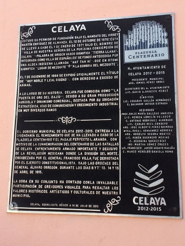
Obtuvo su permiso de fundación bajo el mandato del virrey Martín Enríquez de Almanza, el 12 de octubre de 1570; Ésta se llevó a cabo el 1 de enero de 1571 bajo el nombre de “Villa de Nuestra Señora de la Purísima Concepción de Zalaya” - palabra de origen vasco significa “tierra llana” - integrada como villa de españoles; Se fundó antecedida por una aldea indígena llamada “Nat tah hí”, que en otomí significa “lugar de mezquite" o “la sombra del mezquite”.
El 7 de diciembre de 1668 se expidió oficialmente el título de "Muy Noble y Leal Ciudad”, con derecho a escudo de armas.
A lo largo de su historia, Celaya fue conocida como “La Puerta de Oro del Bajío", debido a su gran producción agrícola y dinamismo comercial. Destaca por su ubicación estratégica. Vías de comunicación y crecimiento industrial en muy diversos ramos
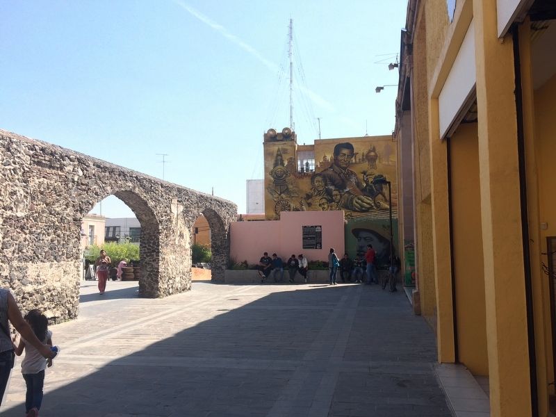
El Gobierno Municipal de Celaya 2012-2015, entrega a la ciudadanía el remozamiento que se ha llevado a cabo de la Plazuela Centenario y el Pasaje Perfecto I. Aranda, con motivo de la conmemoración del centenario de las Batallas de Celaya, enfrentamiento armado importante y decisivo de la Revolución Mexicana donde la División del Norte encabezada por el General Francisco Villa, fue derrotada por el Ejército Constitucionalista, bajo las órdenes del General Álvaro Obregón, durante los días 6 y 7; 13, 14 y 15 de abril de 1915.
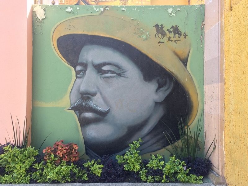
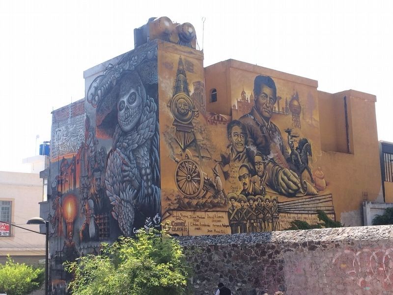
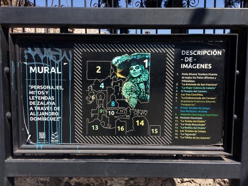
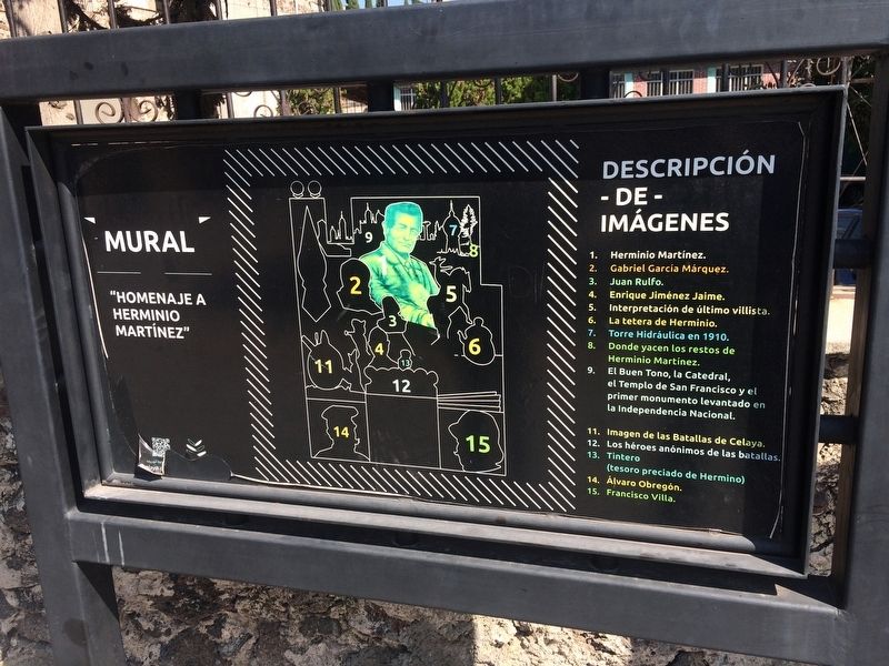
La obra en su conjunto ha contado con la invaluable participación de creadores visuales, para resaltar los valores históricos, artísticos y culturales de nuestro municipio.
Celaya. Guanajuato, México a 14 de julio de 2015
H. Ayuntamiento de Celaya 2012-2015
Presidente Municipal
Arq. Ismael Pérez Ordaz
Secretario del H. Ayuntamiento
Lic. David A. Orozco Pérez
Síndicos
Lic. Eduardo Guillén Hernández
C. Salvador Ortega Estrada
Regidores
Prof. Dulce María Gallego Hinojosa · Lic. Rebeca Lomelín Velasco · C. Antonio Rodríguez Alvarado · Lic. Carlos Reza Cordero · Arq. José Alberto Pérez Quiroga · Mtra. Rosa I. Hernández Herrera · Arq. Rodolfo Segura Montes · Lic. Rubén Guerrero Merino · C. Georgina Suárez Díaz · Ing. Martha Gómez Cruces · Lic. Francisco Javier Aguayo Magaña · C. Marco Heroldo Gaxiola Romo
Permission for the founding of Celaya was obtained under the mandate of Viceroy
Martín Enríquez de Almanza on October 12, 1570. The actual founding was carried out on January 1, 1571 under the name of "Villa of Our Lady of the Immaculate Conception of Zalaya" – a word of Basque origin meaning "flat land". It was integrated as a town for Spaniards. Originally there had been here an indigenous village called "Nat tah hí", which in Otomí means "place of mesquite" or "in the shadow of the mesquite".
On December 7, 1668, the title of "Very Noble and Loyal City" was officially issued to the city, along with the right to a coat of arms.
Throughout its history, Celaya was known as “The Golden Gateway to the Bajío Region" (La Puerta de Oro del Bajío), due to its great agricultural production and commercial dynamism. It is well known for its strategic location, communications and industrial growth in very diverse areas.
The Municipal Government of Celaya 2012-2015, dedicates to the people this renovation of the Plazuela Centenario and the Perfect I. Aranda Walkway, on the occasion of the commemoration of the 100th anniversary of the Battles of Celaya, important and decisive armed confrontations of the Mexican Revolution where the Division of the North headed by General Francisco Villa was defeated by the Constitutionalist Army, under the orders of General Álvaro Obregón, taking place on April 6-7 and 13-15, 1915.
The work as a whole has had the invaluable participation of artists in order to highlight the historical, artistic and cultural values of our municipality.
Celaya, Guanajuato, Mexico, July 14, 2015
Honorable City Council of Celaya, 2012-2015
Names of government officials
Erected 2015 by Honorable Ayuntamiento de Celaya, 2012-2015.
Topics. This memorial is listed in these topic lists: Colonial Era • Native Americans • Settlements & Settlers • Wars, Non-US. A significant historical date for this entry is January 1, 1571.
Location. 20° 31.302′ N, 100° 48.644′ W. Marker is in Celaya, Guanajuato. Memorial can be reached from Calle Venustiano Carranza just north of Calle José María Morelos, on the left when traveling north. The marker is in the Plazuela Centenario (Centennial Plaza) located to the east along the pedestrian only Pajaje Perfecto I. Aranda. Touch for map. Marker is in this post office area: Celaya GTO 38000, Mexico. Touch for directions.
Other nearby markers. At least 8 other markers are within walking distance of this marker. The First Franciscans in Celaya (about 120 meters away, measured in a direct line); The Temple of Saint Francis (about 120 meters away); The Temple of San Francisco - Headquarters of the Patroness of Celaya (about 150 meters away); Celaya's Water Tower (about
150 meters away); Independence Column of Celaya (about 150 meters away); Miguel Hidalgo y Costilla (about 210 meters away); The Ex-Convent of the Temple of Saint Augustine (approx. 0.3 kilometers away); The Temple of Saint Augustine (approx. 0.3 kilometers away). Touch for a list and map of all markers in Celaya.
Also see . . . The Battles of Celaya, from Wikipedia. (Submitted on November 1, 2017, by J. Makali Bruton of Accra, Ghana.)
Credits. This page was last revised on August 12, 2018. It was originally submitted on November 1, 2017, by J. Makali Bruton of Accra, Ghana. This page has been viewed 355 times since then and 19 times this year. Photos: 1, 2, 3, 4, 5, 6. submitted on November 1, 2017, by J. Makali Bruton of Accra, Ghana.
