Near Tendoy in Lemhi County, Idaho — The American West (Mountains)
A Communication Across the Continent by Water
“. . . this I can scarcely hope . . .”
Inscription.
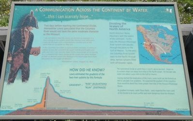
Two days before reaching the Continental Divide, Meriwether Lewis speculated that the Columbia River would not have the same moderate character as the Missouri.
“I do not beleive (sic) that the world can furnish an example of a river running to the extent which the Missouri and Jefferson’s rivers do through such a mountainous country and at the same time so navigable as they are.
if the Columbia furnishes us such another example, a communication across the continent by water will be practicable and safe. but this I can scarcely hope from a knowledge of its having in it comparitively (sic) short course to the ocean the same number of feet to decend which the Missouri and Mississippi have from this point to the Gulph (sic) of Mexico.” -- Meriwether Lewis, August 10, 1805.
North America’s Rocky Mountains split the waters of the continent. To the east, the Missouri-Mississippi River system rolls placidly through the plains to the Gulf of Mexico. To the west, the Columbia River system roars to the Pacific through deep, narrow canyons filled with whitewater rapids.
Lewis estimated the gradients of the two river systems by this formula:
The Continental Divide at Lemhi Pass is 7,373 ft. above sea level. Water on its western slope runs about 600 miles to the Pacific Ocean. On the east side, water runs about 2,400 miles to the Gulf of Mexico.
Having reached the headwaters of the rivers, Lewis could use the formula at the left to calculate river gradients. He suspected the gradient of the Columbia River would be about four times greater than that of the Missouri/Mississippi Rivers.
As gradient increases, water flows faster. Lewis expected the rivers west of the Divide to be much swifter and more dangerous than the Missouri.
Erected by Beaverhead-Deerlodge & Salmon-Chaillis National Forest.
Topics and series. This historical marker is listed in these topic lists: Exploration • Waterways & Vessels. In addition, it is included in the Lewis & Clark Expedition series list. A significant historical date for this entry is August 10, 1805.
Location. 44° 58.872′ N, 113° 26.767′ W. Marker is near Tendoy, Idaho, in Lemhi County. Marker can be reached from Warm Springs Road (Forest Road 185) near Forest Road 158 when traveling south. Touch for map. Marker is in this post office area: Tendoy ID 83468, United States of America. Touch for directions.
Other nearby markers. At least 8 other markers are within walking distance of this marker. "Immence Ranges of High Mountains Still to the West of Us..." (a few steps from this
marker); Agency Creek (approx. 0.2 miles away); Lemhi Pass (approx. 0.2 miles away); From Route ... To Road (approx. 0.4 miles away); Crossing the Great Divide (approx. 0.4 miles away); "Most Distant Fountain" of the Mighty Missouri (approx. ¾ mile away in Montana); The Beginning of the "Endless Missouri" (approx. ¾ mile away in Montana); Sacajawea Memorial Area (approx. ¾ mile away). Touch for a list and map of all markers in Tendoy.
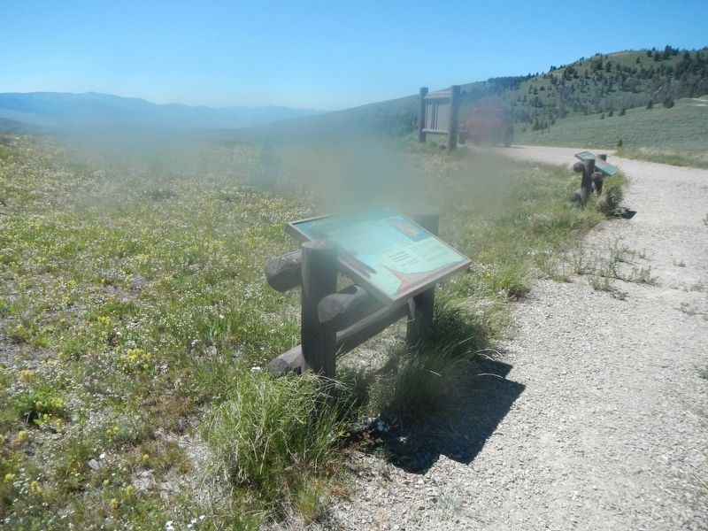
More about this marker. This marker is on the Lewis and Clark National Back Country Byway and Adventure Road. The Byway is a 36 mile loop from Tendoy, Idaho to Lemhi Pass and back to Tendoy over gravel roads with a 4000 foot gain and loss in elevation. There are 10 designated stops with pullouts on the Byway and over two dozen information panels and markers on route. Estimated travel time is about 3 hours.
Credits. This page was last revised on November 3, 2017. It was originally submitted on November 3, 2017, by Barry Swackhamer of Brentwood, California. This page has been viewed 281 times since then and 13 times this year. Photos: 1, 2. submitted on November 3, 2017, by Barry Swackhamer of Brentwood, California.

