Cascade in Valley County, Idaho — The American West (Mountains)
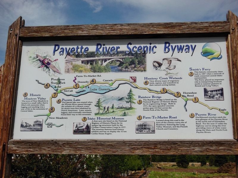
Payette River Scenic Byway
Historic Meadows Valley
The town of New Meadows is located in a small valley that is filled with memories when logging and ranching was a way of life in the mountains of Central Idaho.
Payette Lake
This glacial lake was created when the Payette River passed through the remains of a volcanic crater. Its shores were first inhabited by Native Americans. Later, miners, loggers, and eventually merchants found their way to this mountain.
Idaho Historical Museum
A four-acre site listed on the National Register of Historic Places for its unique log structures built by the Civilian Conservation Corps in 1937. The museum features local history exhibits and has on display the 32-ton Corliss Steam Engine.
Hembrey Creek Wetlands
View diverse types of migratory birds, raptors, and waterfowl in their natural nesting habitat.
Rainbow Bridge
The Rainbow Bridge is listed on the National Register of Historic Places for its engineering design. Built in 1933, the open-spandrel concrete bridge arches span 410 feet across the North Fork of the Payette.
Farm-to-Market-Road
Located along this road is the turn-of-the-century town site of Roseberry featuring the Long Valley Museum, and the Finnish Church and Cemetery.
Smith’s Ferry
This historic community dates back to 1887 when a network of roads connected central Idaho communities. The Ferry played an important role in transporting livestock north to summer pastures in Round and Long Valleys.
Payette River
Northbound travelers catch the first glimpse of the Payette River at the north end of Horseshoe Bend. For the next 25 miles the highway curves along the river providing views of white water along the Main and North Fork Payette Rivers.
Topics. This historical marker is listed in these topic lists: Agriculture • Bridges & Viaducts • Industry & Commerce • Native Americans.
Location. 44° 31.131′ N, 116° 2.668′ W. Marker is in Cascade, Idaho, in Valley County. Marker is at the intersection of North Main Street (State Highway 55) and Old State Highway, on the right when traveling north on North Main Street. Touch for map. Marker is at or near this postal address: 340 North Main Street, Cascade ID 83611, United States of America. Touch for directions.
Other nearby markers. At least 1 other marker is within walking distance of this marker. Long Valley Ambush (within shouting distance of this marker).
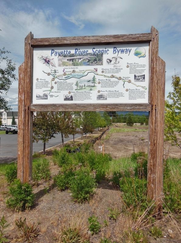
More about this marker. Large wooden marker in good condition
Also see . . .
1. Payette River Scenic Byway.
Starting west of Boise, the Payette River Scenic Byway heads north on Idaho 55 passing the Payette River and the Boise and Payette National Forests. Other great stops along this drive include Cascade Reservoir, Smiths Ferry, Roseberry (one mile east of the byway on Roseberry Road at Donnelly), the city of McCall, and Ponderosa State Park. (Submitted on November 18, 2017, by Cosmos Mariner of Cape Canaveral, Florida.)
2. Historical Qualities of Payette River Scenic Byway.
Fur trappers of the early 1800s, working for Hudson's Bay Company, named the Payette River in honor of their comrade, Francois Payette, a French-Canadian who explored much of southwestern Idaho. After explorers mapped the territory, pioneers began to settle the area. Later, people began the construction of a bridge now called the North Fork Bridge, although locals refer to it as the Rainbow Bridge because of its arch. It crosses the North Fork of the Payette River north of Smiths Ferry. Built in 1938, it displays an open-spandrel design introduced to Idaho in the 1920s. Unlike other bridges of this type, the North Fork Bridge has not been altered over the years and is listed on the National Register of Historic Places. (Submitted on November 18, 2017, by Cosmos Mariner of Cape Canaveral, Florida.)
3. Payette River Scenic Byway.
You reach the end of the Payette River Scenic Byway at New Meadows, a hamlet located half way between Boise and Lewiston in the heart of the heartland of Idaho. It is called New Meadows because after the railroad arrived the buildings of the original town of Meadows was moved several miles to New Meadows by ox car. This was the terminus and corporate headquarters of the Pacific and Idaho Northern Railway. The historic railroad station building is the town’s historic landmark, open for tours. (Submitted on November 18, 2017, by Cosmos Mariner of Cape Canaveral, Florida.)
Credits. This page was last revised on January 9, 2018. It was originally submitted on November 7, 2017, by Cosmos Mariner of Cape Canaveral, Florida. This page has been viewed 267 times since then and 22 times this year. Photos: 1, 2. submitted on November 7, 2017, by Cosmos Mariner of Cape Canaveral, Florida. • Bill Pfingsten was the editor who published this page.

