Near Bear Valley in Alpine County, California — The American West (Pacific Coastal)
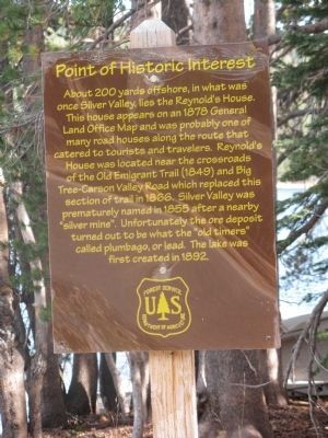
Reynold’s House
Point of Historical Interest
Erected by U.S. Forest Service.
Topics. This historical marker is listed in these topic lists: Notable Places • Railroads & Streetcars • Settlements & Settlers. A significant historical year for this entry is 1878.
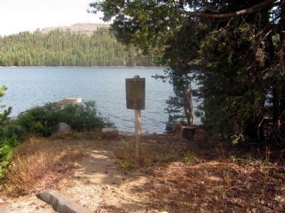
Location. 38° 28.678′ N, 120° 0.13′ W. Marker is near Bear Valley, California, in Alpine County. Marker can be reached from Ebbetts Pass Scenic Byway (State Highway 4). Marker is located at the boat launching dock at Lake Alpine across the highway from Lake Alpine Lodge. Marker may only be seen during the late Spring, Summer and early Fall as the highway is closed during the Winter. Touch for map. Marker is in this post office area: Arnold CA 95223, United States of America. Touch for directions.
Other nearby markers. At least 8 other markers are within 12 miles of this marker, measured as the crow flies. Bedrock Mortars (approx. 0.2 miles away); Old Emigrant Road (approx. 2.7 miles away); Harry Schimke (approx. 2.8 miles away); Camp Tamarack (approx. 4.8 miles away); Hermit Valley (approx. 7.3 miles away); The Last Battle (approx. 10.3 miles away); Route of the Bartleson-Bidwell Party - 1841 (approx. 10.3 miles away); Ebbetts Pass (approx. 11.2 miles away). Touch for a list and map of all markers in Bear Valley.
Regarding Reynold’s House. Also see: Old Emigrant Road (Bear Valley) and Hermit Valley markers
Credits. This page was last revised on July 26, 2018. It was originally submitted on August 29, 2008, by Syd Whittle of Mesa, Arizona. This page has been viewed 1,897 times since then and 11 times this year. Last updated on September 2, 2008, by Syd Whittle of Mesa, Arizona. Photos: 1, 2. submitted on August 29, 2008, by Syd Whittle of Mesa, Arizona. 3. submitted on August 23, 2010, by Syd Whittle of Mesa, Arizona. • Kevin W. was the editor who published this page.


