Straban Township near Gettysburg in Adams County, Pennsylvania — The American Northeast (Mid-Atlantic)
Jones's Artillery Battalion
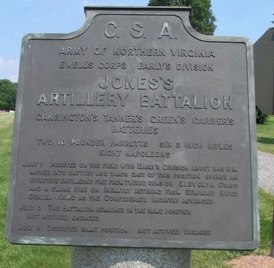
Early's Division - Ewell's Corps
— Army of Northern Virginia —
Army of Northern Virginia
Ewell's Corps - Early's Division
Jones's Artillery Battalion
Carrington's, Tanner's, Green's, Garber's
Batteries
Two 10 Pounder Parrotts, Six 3 Inch Rifles
Eight Napoleons
July 1 Arrived on the field with Early's Division about 2.45 p.m. Moved into battery 400 yards east of this position opened an effective enfilading fire from twelve guns on Eleventh Corps and a flank fire on Infantry retiring from Seminary Ridge. Ceased firing as the Confederate Infantry advanced.
July 2 The battalion remained in the same position. Not actively engaged.
July 3 Occupied same position. Not actively engaged.
Erected 1910 by Gettysburg National Military Park Commission.
Topics. This historical marker is listed in this topic list: War, US Civil. A significant historical month for this entry is July 1796.
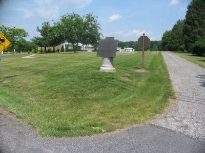
Location. 39° 51.041′ N, 77° 13.076′ W. Marker is near Gettysburg, Pennsylvania, in Adams County. It is in Straban Township. Marker is at the intersection of Old Harrisburg Road (Business U.S. 15) and Jones Avenue, on the right when traveling north on Old Harrisburg Road. Located in Gettysburg National Military Park. Touch for map. Marker is at or near this postal address: 1075 Old Harrisburg Road, Gettysburg PA 17325, United States of America. Touch for directions.
Other nearby markers. At least 8 other markers are within walking distance of this marker. Carrington's Battery - Jones's Artillery Battalion (within shouting distance of this marker); Jacob Kime Farm (about 400 feet away, measured in a direct line); a different marker also named The Jacob Kime Farm (about 500 feet away); Garber's Battery - Jones's Artillery Battalion (approx. ¼ mile away); Tanner's Battery - Jones's Artillery Battalion (approx. ¼ mile away); Green's Battery - Jones's Artillery Battalion (approx. ¼ mile away); From Farm to Hospital (approx. 0.3 miles away); Josiah Benner Farm (approx. 0.4 miles away). Touch for a list and map of all markers in Gettysburg.
Related markers. Click here for a list of markers that are related to this marker. Jones Avenue and Jones Battalion Markers.
Also see . . .
1. Lt. Col. Jones's Official Report. Jones summarizes the action on July 1: On the advance of General Gordon's brigade from our right, we directed our fire farther to the left, on the disordered masses of the enemy that were rapidly retreating before our troops. This was continued until the advance of our men rendered it dangerous to continue firing from that position. I immediately, by order of General Early, sent Captain Carrington's battery across the creek to take position in front of Gettysburg, but, moving with all rapidity, as it did, before it could reach any position the enemy had been driven through the town by Hays' brigade. In the first position we occupied, three guns were temporarily disabled by having shots wedged in the bores, and one Napoleon permanently disabled by being struck on the face of the muzzle and bent by a solid shot from the enemy. (Submitted on September 2, 2008, by Craig Swain of Leesburg, Virginia.)
2. Jones' Battalion Avenue: A Seldom Visited Gettysburg Location. Gettysburg Daily article. (Submitted on December 2, 2008, by Craig Swain of Leesburg, Virginia.)

Photographed By Craig Swain, June 28, 2008
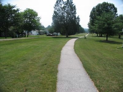
3. Jones Avenue
Looking west down the Avenue toward the Old Harrisburg Road. At the time of the battle this area was open ground, with an unobstructed view to the west and southwest. On July 1, 1863, the slight rise here allowed Confederate gunners to sweep Barlow's Knoll and fire into the back side of Seminary Ridge to the west of Gettysburg.
Credits. This page was last revised on February 7, 2023. It was originally submitted on September 2, 2008, by Craig Swain of Leesburg, Virginia. This page has been viewed 1,043 times since then and 17 times this year. Photos: 1, 2, 3. submitted on September 2, 2008, by Craig Swain of Leesburg, Virginia.

