Waimea in Hawaii County, Hawaii — Hawaiian Island Archipelago (Pacific Ocean)
Farming the Land, Fishing the Sea
Lapakahi State Historical Park

Photographed By Barry Swackhamer, August 26, 2017
1. Farming the Land, Fishing the Sea Marker
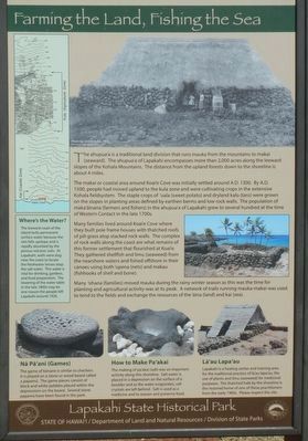
Captions: (bottom, left to right) Nā Pā'ani (Games) The game of kōnane is similar to checkers. It is played on a stone or wooden board called a papamū. The game pieces concept of black and white pebbles placed within the depressions on the board. Several stone papamū have been found in the park.; How to Make Pa'akai The making of pa'akai (salt) was an important activity along this shoreline. Salt water is placed in a depression on the surface of a boulder and as the water evaporates, salt crystals are left behind. Salt is used as a medicine and to season and preserve food.; Lā'au Lapa'au Lapakahi is a healing center and training area for the traditional practice of lā'au lapa'au, the use of plants and limu (seaweed) for medicinal purposes The thatched hale by the shoreline is the restored home of one of there practitioners from the early 1900s. Please respect the site.
The ahupua'a is a traditional land division that runs mauka from the mountains to makai (seaward). The ahupua'a of Lapakahi encompasses more than 2,000 acres along the leeward slopes of the Kohala Mountains. The distance from the upland forests down to the shoreline is about 4 miles.
The makai or coastal area around Koai'e Cove was initially settled around A.D. 1300. By A.D. 1500, people had moved upland to the kula zone and were cultivating crops in the extensive Kohala fieldsystem. The staple crops of 'uala (sweet potato) and drylands kale (taro) were grown on the slopes in planting areas defined by earthen berms and low rock walls. The population of maka'āinana (farmers and fishers) in the ahupua'a of Lapakahi grew to several hundred at the time of Western Contact in the late 1700s.
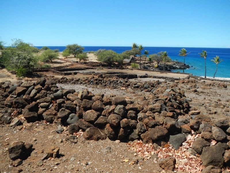
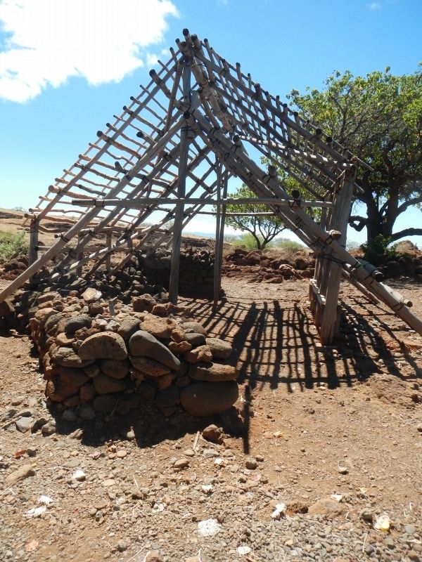
Many families lived around Koai'e Coave where they built pole frame houses with thatched roofs of pili grass atop stacked rock walls. The complex of rock walls along the coast are what remains of this former settlement that flourished at Koai'e. They gathered shellfish and limu (seaweed) from the nearshore wars and fished offshore in their canoes using both 'upena (nets) and makau (fishhooks of shell and bone).
Many 'ohana (families) move mauka during the rainy winter season as this was the time for planting and agricultural activity was at its peak. A network of trails running mauka-makai was used to tend to the fields and exchange the resources of the 'āina (land) and kai (sea).
The leeward coast of the island lacks permanent surface water because the rain falls upslope and is rapidly absorbed by the porous volcanic soils. At Lapakahi, wells were dug near the coast to locate the freshwater lenses atop the salt water. This water is vital for drinking, gardens, and food preparation. The lowering the water table in the late 1800s may be one reason the people left Lapakahi around 1920.
Erected by State of Hawai'i, Department of Land ad Natural Resources, Division of State.
Topics. This historical marker is listed in these topic lists: Agriculture • Anthropology & Archaeology • Asian Americans • Settlements & Settlers. A significant historical year for this entry is 1300.
Location. 20° 10.518′ N, 155° 53.856′ W. Marker is in Waimea, Hawaii, in Hawaii County. Marker can be reached from Akoni Pule Highway (Hawaii Route 270), on the left when traveling north. Touch for map. Marker is in this post office area: Kamuela HI 96743, United States of America. Touch for directions.
Other nearby markers. At least 8 other markers are within 12 miles of this marker, measured as the crow flies. Clues from the Past... The Archaeology of Lapakahi (within shouting distance of this marker); 1st BN., 141st Infantry Regiment (approx. 7˝ miles away); Pelekane (approx. 11.3 miles away); Hale o Kapuni Heiau (approx. 11.3 miles away); Pu'ukohola Heiau (approx. 11.3 miles away); Mailekini Heiau (approx. 11.3 miles away); Pu'ukohlā Heiau (approx. 11.3 miles away); Pu'ukoholā Heiau (approx. 11.4 miles away). Touch for a list and map of all markers in Waimea.
More about this marker. This marker is located at Lapakahi State Historical Park
Additional keywords. Native Hawaiians, Pacific Islanders

Photographed By Barry Swackhamer, August 26, 2017
3. A Walk into Lapakahi's Past
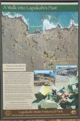
The first settlers of the Lapakahi area sailed into Koai'e Coe over 700 years ago. As you walk the trails of Lapakahi, you will see the remnants of this once thriving settlement at Koai'e. Archaeological research has provided inside into daily life of the families who lived, farmed, fished, and worshipped here.
The trail system consists of 2 loops. Starting here at the trailhead, the primary 0.5-mile loop takes you down to Koai'e Cove when you will see hālau wa'a (canoe sheds), boulders used for making pa'akai (salt), and walled habitation sites.
The second loop is approximately 0.3-mile long and leads further north to a possible heiau or religious site, more house sites, and sweeping views of the North Nohala coastline.
E mālama no kēia mua aku
As you visit Lapakahi, please show respect.
Stay on the designated trail and do not climb or sit on the rock walls. Respect those who came before.
The trail system consists of 2 loops. Starting here at the trailhead, the primary 0.5-mile loop takes you down to Koai'e Cove when you will see hālau wa'a (canoe sheds), boulders used for making pa'akai (salt), and walled habitation sites.
The second loop is approximately 0.3-mile long and leads further north to a possible heiau or religious site, more house sites, and sweeping views of the North Nohala coastline.
As you visit Lapakahi, please show respect.
Stay on the designated trail and do not climb or sit on the rock walls. Respect those who came before.
Credits. This page was last revised on August 23, 2020. It was originally submitted on November 20, 2017, by Barry Swackhamer of Brentwood, California. This page has been viewed 141 times since then and 12 times this year. Photos: 1, 2, 3, 4, 5. submitted on November 20, 2017, by Barry Swackhamer of Brentwood, California.


