Ninety Six in Greenwood County, South Carolina — The American South (South Atlantic)
Ninety Six National Historic Site / Greenwood County
Inscription.
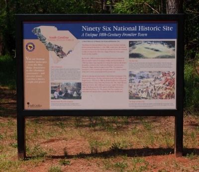
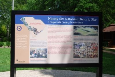
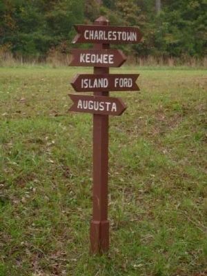
The Ninety Six National Historic Site is an area of unique historical and archaeological significance. In the late 1700s traders gave the town its unusual name because they mistakenly believed this was the estimated number of miles to the Cherokee village of Keowee in the upper South Carolina foothills.
By the mid-1700s European colonists found the town a favorable place to settle in spite of increasing troubles with local Indians. In 1760 Cherokees twice attacked Fort Ninety Six, built for the settlers' protection. Located at the crossroads of twelve roads and paths, Ninety Six village reached its peak in the 1770s. This important backcountry town boasted a growing population. 12 houses, taverns, shops, and a newly constructed courthouse and jail.
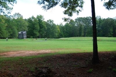
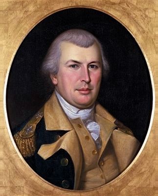
Ninety Six also figured prominently in the Southern Campaign of the American Revolution. The first land battle south of New England was fought here in 1775, and in 1780 the British fortified this strategically important frontier town. From May 22-June 18, 1871, Major General Nathanael Greene, with 1,000 patriot troops, staged the longest siege of the Revolutionary War against 550 British loyalists who were defending Ninety Six. The earthen Star Fort remains as a well-preserved example of an original 18th century fortification.
Park Information
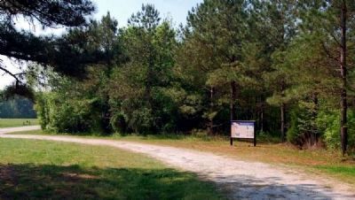
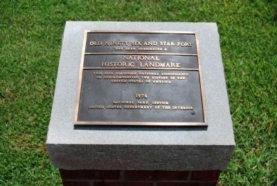
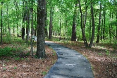
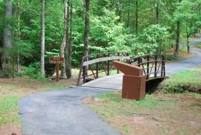
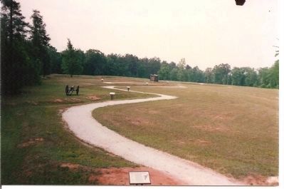
The park is located on Highway 248, two miles south of the town of Ninety Six. The visitor center features a museum with dozens of artifacts and exhibits. A 10-minute orientation video is available upon request. Books and souvenirs may be purchased at the gift shop. A one-mile walking trail allows visitors to explore historic roadbeds, reconstructed siegeworks, the original Star Fort, the reconstructed Stockade Fort, and much more. The site covers just over 989 acres. Because of its importance to the founding of our nation, Ninety Six National Historic Site became part of the National Park Service in 1976.
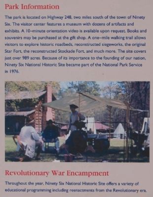
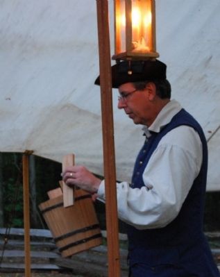
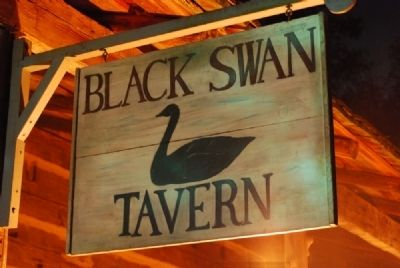
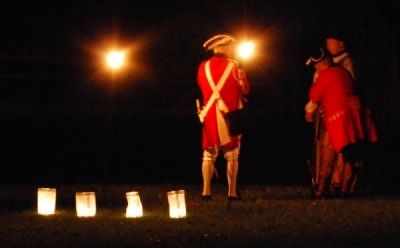
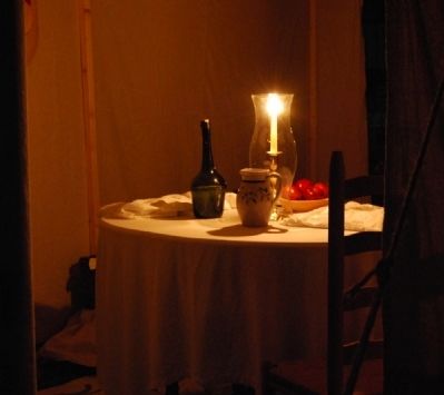
Revolutionary War Encampment
Throughout the year, Ninety Six National Historic Site offers a variety of educational programming including reenactments from the Revolutionary era.
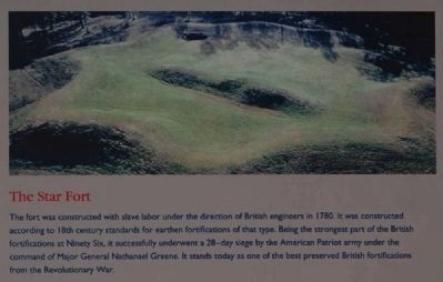
The Star Fort
The fort was constructed with slave labor under the direction of British engineers in 1780. It was constructed according to 18th century standards for earthen fortifications of that type. Being the strongest part of the British fortifications at Ninety Six, it successfully underwent a 28-day siege by the American Patriot army under the command of Major General Nathanael Greene. It stands today as one of the best preserved British
fortifications from the Revolutionary War.
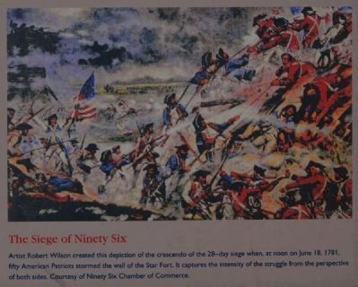
The Siege of Ninety Six
Artist Robert Wilson created this depiction of the crescendo of the 28-day siege when, at noon on June 18, 1781, fifty American Patriots stormed the wall of the Star Fort. It captures the intensity of the struggle from the perspective of both sides.
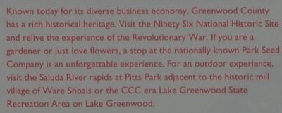
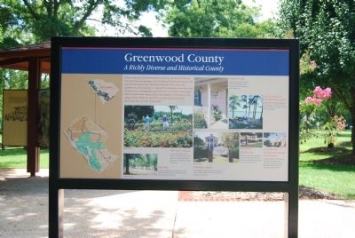
Known today for its diverse business economy, Greenwood County has a rich historical heritage. Visit the Ninety Six Historic Site and relive the experience of the Revolutionary War. If you are a gardener or just love flowers, a stop at the nationally known Park Seed Company is an unforgettable experience. For an outdoor experience, visit the Saluda River rapids at Pitts Park adjacent to the historic mill village of Ware Shoals or the CCC era Lake Greenwood State Recreation Area on Lake Greenwood.
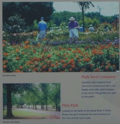
Park Seed Company
Located a short distance from downtown Greenwood, this is the largest mail-order seed company in the world. The gardens are open to the public.
Pitts Park
Located on the banks of the Saluda River in Ware Shoals, this park interprets the natural history of the river and the town's past.
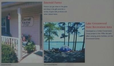
Emerald Farms
Visitors can get close to the goats and shop in the gift store for
a variety of goat milk products and other related items.
Lake Greenwood State Recreation Area
Developed as a Civilian Conservation Corps project in the 1930s, the park offers camping, picnic facilities, and the Drummond Center.
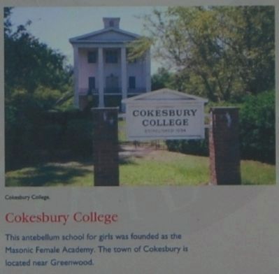
Cokesbury College
This antebellum school for girls was founded as the Masonic Female Academy. The town of Cokesbury is located near Greenwood.
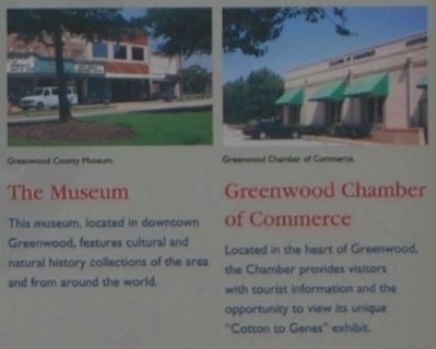
The Museum
This museum, located in downtown Greenwood, features cultural and natural history collections of the area and from around the world.
Greenwood Chamber of Commerce
Located in the heart of Greenwood, the Chamber provides visitors with tourist information and the opportunity to view its unique "Cotton to Genes" exhibit.
Erected by South Carolina Heritage Corridor.
Topics and series. This historical marker is listed in these topic lists: Forts and Castles • Native Americans • Settlements & Settlers • War, US Revolutionary. In addition, it is included in the Civilian Conservation Corps (CCC), the National Historic Landmarks, and the South Carolina Heritage Corridor series lists. A significant historical month for this entry is May 1835.
Location. 34° 8.682′ N, 82° 1.488′ W. Marker is in Ninety Six, South
Carolina, in Greenwood County. Marker is at the intersection of South Cambridge Street (State Highway 248) and County Route 225 on South Cambridge Street. Marker was located at the southeast corner of the parking lot of the Ninety Six National Park. It has since been moved to a parking area just south of the intersection of County Road 225 and SC 248. Touch for map. Marker is in this post office area: Ninety Six SC 29666, United States of America. Touch for directions.
Other nearby markers. At least 10 other markers are within walking distance of this marker. The Lost Town of Cambridge (a few steps from this marker); Ninety Six National Historic Site (a few steps from this marker); First Blood Shed for Liberty (about 300 feet away, measured in a direct line); The Stockade Fort (about 500 feet away); Militiamen (about 500 feet away); "Light Horse Harry" Lee Takes the Stockade Fort (about 500 feet away); Sharpshooter (about 600 feet away); Monument to James Birmingham (about 600 feet away); James Birmingham (about 600 feet away); Logan Log House (about 700 feet away). Touch for a list and map of all markers in Ninety Six.
Also see . . .
1. Ninety Six National Historic Site. Here settlers struggled against the harsh backcountry to survive, Cherokee Indians hunted and fought to keep their land, two towns and a trading post were formed and abandoned to the elements, and two Revolutionary War battles that claimed over 100 lives took place
here. (Submitted on September 6, 2008, by Brian Scott of Anderson, South Carolina.)
2. Ninety Six National Historic Site. Ninety Six National Historic Site, also known as Old Ninety Six and Star Fort, is a United States National Historic Site located about 60 miles (96 kilometers) south of Greenville, South Carolina. (Submitted on September 6, 2008, by Brian Scott of Anderson, South Carolina.)
3. Ninety Six National Historic Site Video Overview. Ninety Six National Historic Site was so named because Charleston traders erroneously thought the stopping place was 96 miles from the Cherokee town of Keowee. (Submitted on May 7, 2010, by Brian Scott of Anderson, South Carolina.)
4. Ninety Six National Historic Site. The historic district of Ninety Six National Historic Site contains numerous historical features associated with the economic and social development of the colonial South Carolina back country. (Submitted on May 7, 2010, by Brian Scott of Anderson, South Carolina.)
5. Greenwood County, South Carolina. Greenwood County is a county located in the U.S. state of South Carolina. (Submitted on September 6, 2008, by Brian Scott of Anderson, South Carolina.)
Additional commentary.
1. Indian maiden's love led her to warn Fort Ninety Six
Indian maiden's love led her to warn Fort Ninety Six
By
Bobby F. Edmonds
Due to a recent treaty concluded by the English governor in Charles Town, the Cherokees were, during the 1750’s, constrained from warring with their contemporary enemies, the Creeks of Georgia.
They were, however, encouraged to drive out French traders from their towns since England and France were currently at war.
According to legend, as time passed the young braves of the Lower Towns of the Cherokee Nation grew restless and became anxious for a fray. Since the Choctaws to the west were allies of the French, the Cherokees felt at liberty to fight them. So, in order to give his braves the needed frolic and recreation, the chief at Keowee (near present Clemson University) derived a plan to launch an attack upon a village of Choctaws.
The chief sounded the war chant and there was immediately a ready response from his Cherokee braves.
The war party set out on the several days trek across Georgia to the Choctaw Nation. At the crack of dawn amid their chilling war whoops, the Cherokees fell upon the village of unsuspecting victims with a ferocious blitz. They set fire to huts and tomahawked the startled Choctaws.
The chief from Keowee rushed into a hut in which he found only a young Choctaw maiden. Apparently resigned to her fate, the maiden, in her native tongue, cried, “Strike!”
The chief, amazed at her attitude and impressed by her courage, dragged her from the fiery hut exclaiming, “I have no daughter! Come!”
Back in Keowee, there was a victory celebration with the young braves proudly displaying their Choctaw scalps. The chief introduced his captive maiden to the tribe as his adoptive daughter and named her Cateechee, which, translated figuratively from the Cherokee language, means “grace and beauty.”
Cateechee grew up to be a beautiful young woman.
The Keowee Path stretched southeastward all the way to Charles Town. At a point on the Keowee Path was a trading post of considerable importance called Ninety-Six, so named for its distance from Keowee.
Trader James Francis had a son named Allen David Francis. As time passed the young son became involved in the trading business with the Cherokees, and traveled to Keowee with his father.
Allen Francis met Cateechee at Keowee. They were immediately attracted to each other and the relationship turned into an affair of the heart. Allen and Cateechee grew so fond of each other that, despite the differences in race and culture, they pledged their love to each other and began to make plans for a future together.
Then the incidents relating to the French and Indian War occurred shattering the good relations between the Cherokees and the whites.
The young chiefs of the Cherokee Lower Towns and Middle Towns cried out for war. At the Keowee town a war council determined that the Cherokees must annihilate the settlements of Long Canes and Ninety Six.
As the warriors met in council, and while filling pipes for chief and his braves, Cateechee learned of the attack plans.
“Ninety Six! Long Canes! “Allen is at Ninety Six,” she whispered to herself, almost unable to conceal her emotions. “Am I really Cherokee? Not really,” she thought. “Do I love the Cherokees more than I love Allen? No, no, no!”
At first, Cateechee slipped away from the council fires and strolled to the place where the horses were kept. She selected a horse and quietly let it to the outskirts of the village. There she quickly mounted. Cateechee dug her heels into the horse, and headed south on the Keowee Path toward Fort Ninety-Six.
Cateechee rode into country she had never before seen. But, Allen had told her of so many landmarks that she had no trouble.
At dawn on the second morning she resumed her daring dash southward and reached Fort Ninety-Six and loving arms of Allen. She was cold, hungry, and near exhaustion.
Cateechee told of what she had heard at the war council at Keowee. Preparations were immediately instigated to reinforce and garrison Fort Ninety Six and
warning was dispatched to the Scots-Irish settlement at Long Canes.
Cateechee and Allen soon were married. They built a cabin at Ninety Six.
The legend continues…The Cherokees were not about to dismiss Cateechee’s treachery. Later, Cherokee braves captured Cateechee and Allen. The captives were carried back to Keowee as slaves.
Cateechee and Allen waited patiently throughout the winter and following spring for an opportunity to escape. They waited for a moment when finally the Cherokee guards were lax and made their escape. Knowing their pursuers would think they would head for Ninety Six, they instead raced into the mountains toward Savannah River.
Near the summit of Stump House Mountain, they stopped and built a temporary shelter near a beautiful waterfall. They scouted the terrain of the mountain locale as they waited. Cateechee gathered berries and caught fish for their needs. Allen cut a tree and fashioned a canoe.
While picking berries, Cateechee had discovered a hidden ledge behind and under the waterfall not visible from the top.
Meanwhile, the Cherokee braves returned from Ninety Six to report that the former captives had not reached their home there. The wise chief instructed his braves to search the mountain trails.
A scouting party was able to pick up the trail that led to Stump House Mountain and to the lovers’ camp. Cateechee saw them and fled into the woods, away from where Allen was building the canoe.
She led them to the waterfall and there hesitated as if she were trapped. As they neared her, Cateechee leaped over the edge. The braves rushed to the spot expecting to see her dashed body on the rocks below. They saw nothing. They searched the base of the waterfall and found not a trace. The braves, so triumphant a few moments before, now shouting with superstitious fear, jumped on their waiting ponies, and fled back to Keowee.
Cateechee crept out from the ledge, climbed to the top of the waterfall, and hurried back to find Allen.
To her joy the braves had not spotted him, and the canoe was complete. They gathered their supplies and launched the canoe in Savannah River. Hiding in the canebrakes by day, they traveled at night. Upon reaching the fort at Augusta, they found Allen’s brother.
After a brief rest, Cateechee and Allen, took the trail back to Ninety Six. There they lived out their lives and raised a family at their cabin, Popular Hill.
So lives on the Legend of Cateechee.
Many tales about Cateechee have been handed down through the years.
Albeit, there are certain historical records to support the phenomenon as to an Indian woman riding from Keowee to warn the unsuspecting settlers at Ninety Six and Long Canes of an imminent attack by the Cherokee Indians.
A letter dated January 31, 1760, (the day before the Long Cane Massacre), signed by James Francis at Ninety-Six related a deposition given to him by an Indian woman. It describes in detail the recent hostile events occurring at Keowee and Fort Prince George, and the intentions of the Cherokees of the Lower Towns to attack.
A London newspaper that reported the breaking news of the Cherokee uprising also recounted the incident of the warning being brought to settlers by an Indian woman.
Had not the brave Indian maiden, according to legend, not dared all to make the spectacular ride there can be little doubt as to what the results would have been.
In an attack upon settlers scattered out amid the countryside, the settlement of Scots-Irish at Long Canes would have most certainly been wiped out. Such a disaster would have altered the ethnic composition and history of the area. (Source: The Making of McCormick County by Bobby Edmunds.)
— Submitted September 9, 2008, by Brian Scott of Anderson, South Carolina.
2. National Register of Historic Places:
Ninety Six National Historic Site *** (added 1969 - District - #69000169)
Also known as Old Ninety Six and Star Fort •
Historic Significance: Event, Information Potential •
Area of Significance: Military, Historic - Non-Aboriginal, Economics, Transportation, Law, Exploration/Settlement, Politics/Government, Commerce •
Cultural Affiliation: Rural Anglo-American •
Period of Significance: 1700-1749, 1750-1799, 1800-1824, 1825-1849, 1850-1874, 1875-1899 •
Owner: Federal •
Historic Function: Commerce/Trade, Defense, Domestic, Funerary •
Historic Sub-function: Air-Related, Camp, Cemetery, Fortification, Road-Related, Village Site •
Current Function: Education, Government, Landscape •
Current Sub-function: Forest, Park, Parking Lot •
— Submitted May 7, 2010, by Mike Stroud of Bluffton, South Carolina.
3. Ninety Six Historic Site
In Greenwood County is the site of the once-flourishing Colonial village of Ninety Six, renamed Cambridge after the Revolution. Even before 1730, the fork lying 96 miles south of the Cherokee Indian town of Keowee was an important post and of Indian and Revolutionary War fortifications, Ninety Six was also a busy courthouse town, its gaol and courthouse described as brick buildings. It has also been described as a "snug little village of 15 or 20 houses and stores." As many as 17 stores were noted at one point...and the population included "4
merchants, as many lawyers, hotel keepers, tailor, blacksmith, carriage and harness shops, and three physicians...there was also belonging to the place a large and well-selected library, and a flourishing academy...there was a church there..."
In the early 1750s, Indian trader Robert Gouedy settled at Ninety Six, his land grant lying astride the Cherokee Path, which later ran through the center of town. Gouedy's store was supposedly the largest house the fall line. Extant from this period is the grave of Gouedy's son, James, in a wooded area south of Star Fort and perhaps near the site of the original Gouedy homeplace.
Gov. William Henry Lyttleton's 1759 expedition built a fort around Gouedy's barn, and this stockade, described as 90' square, provided protection of settlers from a wide surrounding area.
First of the town's Revolutionary fortifications was built in November 1775 at Colonel Savage's plantation, of Savage's Old Field. Separated from Ninety Six courthouse and gaol by a ravine and spring, this was a "temporary stockade fort of fence rails, straws, beeves' hides and other such materials...a square of about 185 yards...the curtains of defense extended from a barn and store to some outhouses; and at a distance of 250 yards from the gaol."
When the British occupied Ninety Six in 1780, they added fortifications to the existing stockade.
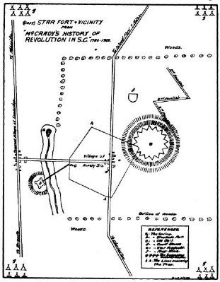
Major defensive features was a redoubt on the southeast tip of the village. There was Star Fort and it was surrounded by a ditch. Three cannon on wheels strengthened by a stockade, and the gaol was fortified. Further strengthening was added by an embankment of earth surrounding the village and by abatis, a type of defense using felled trees with the branched ends stocking outward. Within the village, blockhouses were erected and covered ways built for safe communication. On the north side of the village a small stream supplied the garrison with water. A stockade fort with two blockhouses was built to defend the stream on the side opposite the village palisade. A covered way led to the stream between these two strong points. Added to the military engineering of the British was that of the besieging American forces: three parallels, two trenches, a mine reaching almost to the Star Fort ditch, two log towers for firing into the fort.
The 1964 National Survey of Historic Sites and Buildings (Colonials and Patriots) describes Star Fort as "an earthwork with eight salients and eight reentrant angles, enclosing about one-half acre northeast of the village."
This same authority reports that "the Star Fort outlines are still readily discernible as earthwork embankments 4 or 5 feet high. Scattered brick fragments mark the location of the town, which was burned by
Photographed By National Register Nomination Form, 1822
15. Ninety Six and Star Fort
This sketch of ninety Six and Star Fort was published in 1822 in Johnson's Life of Nathanael Green and has since been copied in several publications. Roberts said the design resembled a child's drawing of a seated cat, with the fort as the hear, the village as the body, and the covered passage to the small stockade as the tail.
Significance
One of the oldest English place names in upper South Carolina, one that is significant in South Carolina history and that had a bearing on U.S. history, Ninety Six was of prime importance in upcountry development of the state. Its early history reflects the activity, color, and romance of the typical frontier community of the Colonial era.
The importance of Ninety Six has three distinct phases:
(1) As a trading and meeting junction in colonial years, reflecting South Carolina's Indian and frontier period. On George Hunter's 1730 map of South Carolina's northwest frontier, "96" appears as a special designation on the Cherokee Path, well-traveled pack trail to and from Charleston before 1700. (The original of this map is in the Library of Congress.) Its importance as a trading post is indicated in the 1738 Journal of the House of Assembly. And Gov. James Glen recognized its strategic location be choosing it for his 1746 Indian conference. (This colorful meeting was attended by the S.C. emperor of the Cherokees and 60 of his headmen; accompanying the governor were 4 companies of troops and 200 additional gentlemen.)
(2) As the northwestern area's farthest English settlement from the coast, a thriving Colonial village from as early as 1740 and a busy courthouse town for huge Ninety Six District from 1768 until shortly after 1800. After the 1768 Commons House of Assembly Bill establishing courts, building jails, appointing sheriffs, etc., the development of Ninety Six as a seat of government and justice was part of a significant South Carolina development -- the growing importance of the state overall. Reflected here is the back country struggle for recognition and representation that led to such significant milestones as the establishment of a new capital city in mid-state, beginning in 1786.
During the Colonial period, Ninety Six was a key location in a number of historic expeditions:
(a) Col. George Chicken's 1715 journey inland during the Yemassee War, his journal possible representing the first English account of a Carolina back country traveler and including the only mention of buffalo hereabouts ("we kill'd a boflow this day").
(b) Gov. Glen's 1746 expedition to confer with the Cherokee.
(c) Gov. Lyttleton's 1759 expedition which built, en route, a stockade
at Ninety Six that protected area settlers during the 1759-61 Cherokee War. (In March 1760, the garrison withstood a 36-hour Cherokee attack.) Ninety Six also served as a supply center and base of operations for ranger and militia companies and from this time until the Revolution had numerous links with Fort Charlotte, built 1766 on the Savannah River.
(d) The 1775 mission to the back country by William Henry Drayton and the Rev. William Tennett, sent from Charleston by the Council of Safety to explain the American-British disputes and to enlist patriot aid.
(3) As a Revolutionary War stronghold and also as a focal point of violent Patriot-Tory strife. Pre-Revolutionary activity included the raising of a Ranger troop in the Ninety Six area (June 1775) which made the first overt act of the Revolution in South Carolina -- the July 1775 seizure of Fort Charlotte from the British. Ranger commander was James Mayson, who lived near Ninety Six village. In August 1775, Ninety Six sent nine representatives to the Second Provincial Congress. One of these as Commander Mayson.
The Revolution's first land battle south of New England took place at Ninety Six, Nov. 19-12, 1775. Patriot forces, besieged inconclusively, finally defeated and dispersed the Tories in December. In this battle, James Birmingham was the first South Carolina Patriot to give up his life in the Revolution. Andrew Pickens, who later became one of South Carolina's three famous partisan generals, was a company commander in this action.
Old Ninety Six reached the peak of its fame in 1780-81 when it was a British garrison an scene of the siege of Star Fort, one of the most interesting and spectacular operations of the revolutionary's closing months.
In 1779, the British returned to their earlier plan of trying to roll up the states from south to north, and after the 1780 capture of Charleston, ordered three expeditions to the interior to gain control of the state. Ninety Six became important as the most advanced British post, supporting the other two posts, at Augusta and Camden, also covering loyalist settlements and serving as a recruiting depot for Tory fighters.
The Star Fort, built at this time, continued as a British outpost, manned by regulars and Tories, until May-June 1781, when Gen. Nathanael Greene's American force invested and assaulted the fort. The siege was unsuccessful since the fort's star form gave the enemy complete command and exposed the attackers to close cross-fire. Advancing British reinforcements spurred American withdrawal. The British, however, evacuated the fort at the end of the 27-day siege. This relinquishment of the inland South Carolina foothold helped weaken the south-to-north British offensive and was a contributing
factor to the war's outcome.
Associated with Old Ninety Six are such historically significant names as Patrick Calhoun (father of John C.), Andrew Pickens, and Sen. John Gervais, who was instrumental in changing the state capital from Charleston.
In post-Revolutionary years, Ninety Six achieved some importance as a college town. Site of one of three colleges authorized by the S.C. General assembly in March 1785, the town changed its name to Cambridge in 1787 in honor of the college. The institution enjoyed no lasting success, however, and by the mid 1820s, the once-flourishing town had almost ceased to exist. (Source: National Register nomination form.)
— Submitted May 9, 2010, by Brian Scott of Anderson, South Carolina.
4. Robert Gouedy
Robert Gouedy, the most famous and influential settler in the area, arrived in 1751. Initially purchasing 250 acres along the Cherokee Path, Gouedy was a trader who intended to establish a permanent post at the site. He imported rum from Charleston for trade with the Cherokee, primarily for deerskins.
Gouedy eventually owned over fifteen hundred acres and raised wheat, tobacco, hemp, corn, indigo and peaches. He owned cattle, sheep and horses. Thirty-four slaves labored on his land as carpenters, wagon drivers, coopers and field hands. Gouedy's trading post became a center of activity, a place where travelers could find lodging, send mail, purchase supplies and obtain news. Colonial records indicate that he sold cloth, beads, needles, thread, tools, gunpowder, lead and rum -- all the necessities of the frontier. But his activities caused some concern among colonial officials who were apprehensive of his selling rum to the Cherokee.
Gouedy wielded tremendous power in the area. He hunted down one trader who defaulted on his debt, and with the help of two constables and six assistants, confiscated four slaves from the man. When he died in 1775, Gouedy had nearly five hundred persons indebted to him. He left property to his wife Mary, son James and daughter Sarah, and left 150 pounds each to his three mixed-blood Cherokee children: Peggy, Kiunague and Nancy. (Source: Old Ninety Six: A History and Guide by Robert Dunkerly, Robert M. Dunkerly, and Eric Williams (2006), pgs 13-14.)
— Submitted May 10, 2010, by Brian Scott of Anderson, South Carolina.
Credits. This page was last revised on November 19, 2020. It was originally submitted on September 6, 2008, by Brian Scott of Anderson, South Carolina. This page has been viewed 5,037 times since then and 24 times this year. Photos: 1, 2, 3, 4, 5. submitted on May 7, 2010, by Brian Scott of Anderson, South Carolina. 6. submitted on September 6, 2008, by Brian Scott of Anderson, South Carolina. 7, 8, 9, 10, 11. submitted on April 9, 2010, by Brian Scott of Anderson, South Carolina. 12. submitted on September 6, 2008, by Brian Scott of Anderson, South Carolina. 13. submitted on May 7, 2010, by Brian Scott of Anderson, South Carolina. 14. submitted on September 6, 2008, by Brian Scott of Anderson, South Carolina. 15, 16. submitted on May 9, 2010, by Brian Scott of Anderson, South Carolina. 17, 18, 19. submitted on September 6, 2008, by Brian Scott of Anderson, South Carolina. 20. submitted on September 8, 2008, by Craig Swain of Leesburg, Virginia. 21. submitted on May 10, 2010, by Brian Scott of Anderson, South Carolina. 22, 23, 24, 25. submitted on October 22, 2008, by Brian Scott of Anderson, South Carolina. • Craig Swain was the editor who published this page.
