Cumberland Township near Gettysburg in Adams County, Pennsylvania — The American Northeast (Mid-Atlantic)
Doles's Brigade
Rodes's Division - Ewell's Corps
— Army of Northern Virginia —
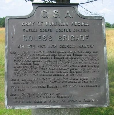
Army of Northern Virginia
Ewell's Corps Rodes's Division
Doles's Brigade
4th. 12th. 21st. 44th. Georgia Infantry
July 1 About 1 p.m. the Brigade formed line in the fields east of Oak Hill and skirmished with Union 2nd Brigade 1st Cavalry Division and aided Gordon's Brigade in dislodging the Union forces from Barlow Knoll and their line from thence to the Heidlersburg Road. Then joined Ramseur and others in their attack upon the rear of the First Corps which after a long struggle was compelled to retire from Seminary Ridge. The Brigades took many prisoners from the First and Eleventh Corps which it pursued to the southern borders of town.
July 2 Lay all day in the town on West Middle Street. After dark moved out to aid in a contemplated attack on Cemetery Hill.
July 3 In line with other brigades in the sunken road southwest of town.
July 4 On Seminary Ridge all day. At night began the march to Hagerstown.
Present 1369 - Killed 66 - Wounded 124 - Missing 31 - Total 241.
Erected 1910 by Gettysburg National Military Park Commission.
Topics. This historical marker is listed in this topic list: War, US Civil. A significant historical month for this entry is July 1871.
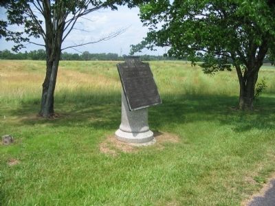
Location. 39° 50.579′ N, 77° 13.933′ W. Marker is near Gettysburg, Pennsylvania, in Adams County. It is in Cumberland Township. Marker is on Howard Avenue, 0.1 miles west of Carlisle Road (Pennsylvania Highway 34), on the left when traveling east. Located in Gettysburg National Military Park. Touch for map. Marker is in this post office area: Gettysburg PA 17325, United States of America. Touch for directions.
Other nearby markers. At least 8 other markers are within walking distance of this marker. 82nd Illinois Infantry (a few steps from this marker); Eleventh Corps (within shouting distance of this marker); 157th New York Infantry (within shouting distance of this marker); 13th New York Independent Light Battery (within shouting distance of this marker); 119th New York Infantry (about 400 feet away, measured in a direct line); Artillery Brigade (about 400 feet away); Battery I, First Ohio Light Artillery (about 600 feet away); 82nd Ohio Volunteer Infantry Regiment (about 600 feet away). Touch for a list and map of all markers in Gettysburg.
Also see . . . Brig. Gen. George Doles' Report. Of the fighting north of Gettysburg, Doles wrote: We found the enemy strongly posted, with infantry and artillery, on the hill from which our skirmishers had been driven. The brigade of General Gordon, of Major-General Early's division, having made a conjunction with our left, we moved forward to attack the enemy in his position. Our effort was successful. He was driven from behind a rock fence, with heavy loss in killed and wounded, and a large number of prisoners sent to our rear. We suffered severely from the enemy's batteries and musketry in this attack. (Submitted on September 6, 2008, by Craig Swain of Leesburg, Virginia.)

Photographed By Craig Swain
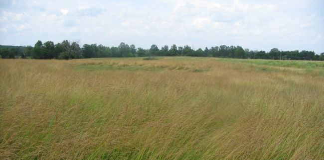
3. Doles' Advance
Looking to the north from near the marker location. Doles Brigade formed in what was then open ground to the north of Gettysburg, on the west side of Carlisle Road. The Brigade was arranged, from left to right, 12th Georgia, 4th Georgia, 44th Georgia and 21st Georgia. On line, the Brigade crossed Blocher's Run, seen in the distance as the far tree line, and encountered the skirmishers of Schimmelfennig's Brigade in the field here.
Credits. This page was last revised on February 7, 2023. It was originally submitted on September 6, 2008, by Craig Swain of Leesburg, Virginia. This page has been viewed 1,094 times since then and 24 times this year. Photos: 1, 2, 3. submitted on September 6, 2008, by Craig Swain of Leesburg, Virginia.

