Brookland in Northeast Washington in Washington, District of Columbia — The American Northeast (Mid-Atlantic)
Fort Bunker Hill
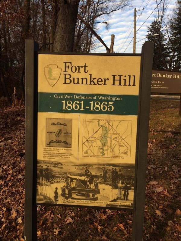
Civil War Defenses of Washington
— 1861-1865 —
[Captions:]
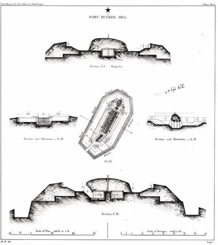
Fort Bunker Hill from U.S. Army Corps of Engineers drawing.
Built by the 11th Massachusetts Volunteer Infantry Regiment who named the fort after the Revolutionary War battle in their home state.
Other Civil War fort locations administered by Rock Creek Park
During the Civil War, Washington's forts overlooked farm land.
Erected by National Park Service, U.S. Department of the Interior.
Topics and series. This historical marker is listed in these topic lists: Forts and Castles • War, US Civil. In addition, it is included in the Defenses of Washington series list. A significant historical year for this entry is 1861.
Location. 38° 56.165′ N, 76° 59.187′ W. Marker is in Northeast Washington in Washington, District of Columbia. It is in Brookland. Marker is at the intersection of 14th Street Northeast and Perry Street Northeast, on the left when traveling north on 14th Street Northeast. On the grounds of Fort Bunker Hill Park. Touch for map. Marker is at or near this postal address: 1340 Perry Street Northeast, Washington DC 20017, United States of America. Touch for directions.
Other nearby markers. At least 8 other markers are within walking distance of this marker. Carlo Angelo Facchina (about 400 feet away, measured in a direct line); Corinthian Capital (about 400 feet away); Grotto of Lourdes (about 400 feet away); a different marker also named Fort Bunker Hill (about 500 feet away); Tomb of the Virgin Mary (about 500 feet away); Aristides Leonori (about 600 feet away); The Catholic Academy of Sciences in the United States of America (about 600 feet away); Agostino Gemelli / Dr. Bernard J. Ficarra (about 600 feet away). Touch for a list and map of all markers in Northeast Washington.
Also see . . . Fort Bunker Hill. (Submitted on December 22, 2017, by Devry Becker Jones of Washington, District of Columbia.)

National Archives
2. Fort Bunker Hill
Fort Bunker Hill from U.S. Army Corps of Engineers drawing.
Built by the 11th Massachusetts Volunteer Infantry Regiment who named the fort after the Revolutionary War battle in their home state.
Records of the Office of the Chief of Engineers, Fortifications Map File Plans of Military Forts, Drawer 169.
Built by the 11th Massachusetts Volunteer Infantry Regiment who named the fort after the Revolutionary War battle in their home state.
Records of the Office of the Chief of Engineers, Fortifications Map File Plans of Military Forts, Drawer 169.

Photographed By Devry Becker Jones (CC0), December 22, 2017
3. Fort Bunker Hill Sign
Fort Bunker Hill
Fort Circle Parks
National Park Service
U.S. Department of the Interior
Credits. This page was last revised on March 11, 2024. It was originally submitted on December 22, 2017, by Devry Becker Jones of Washington, District of Columbia. This page has been viewed 347 times since then and 37 times this year. Photos: 1. submitted on December 22, 2017, by Devry Becker Jones of Washington, District of Columbia. 2. submitted on March 11, 2024, by Allen C. Browne of Silver Spring, Maryland. 3. submitted on December 22, 2017, by Devry Becker Jones of Washington, District of Columbia. • Bill Pfingsten was the editor who published this page.
