Near Stanfield in Umatilla County, Oregon — The American West (Northwest)
Stansfield Rest Area Oregon Trial Kiosk
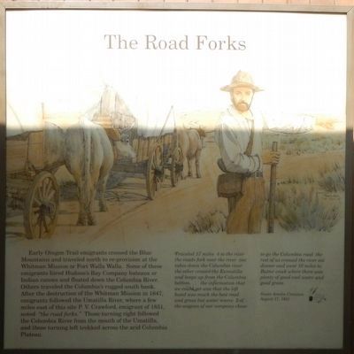
Early Oregon Trail emigrants crossed the Blue Mountains and traveled north to re-provision at the Whitman Mission or Fort Walla Walla. Some of these emigrants hired Hudson's Bay Company bateaux or Indian canoes and floated down the Columbia River. Others traveled the Columbia's rugged south bank. After the destruction of the Whitman Mission in 1847, emigrants followed the Umatilla River, where a few miles east of this site P. V. Crawford, emigrant of 1851 noted "the road forks." Those turning right followed the Columbia River from the mouth of the Umatilla, and those turning left trekked across the arid Columbia Plateau.
Traveled 17 miles 4 to the river the roads fork near the river one takes down the Columbia river the other crosses the Eumatilla (sic) and keeps up from the Columbia bottom ... the information that we could get was that the left hand was much the best road and grass but water scarce 2 of the wagons of our company chose to go the Columbia road the rest of us crossed the river eat dinner and went 10 miles to Butter creek where there was plenty of good cool water and good grass. -- Susan Amelia Cranston, August 17, 1851
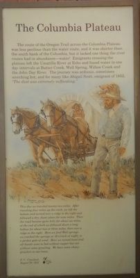
The route of the Oregon Trail across the Columbia Plateau was less perilous than the water route, and it was shorter than the south bank of the Columbia, but it lacked one thing the river routes had in abundance--water! Emigrants crossing the plateau left the Umatilla River at Echo and found water in one day intervals at Butter Creek, Well Spring, Willow Creek and the John Day River. The journey was arduous, sometimes scorching hot, and for many like Abigail Scott, emigrant of 1852, "The dust was extremely suffocating."
This day we traveled twenty-two miles. After traveling four miles up the creek, we left the bottom and turned over a ridge to the right and followed a dry, dusty plain for nine miles. Then the road became quite hilly for about six miles, at the end of which we followed down a long hollow for about two or three miles, then over a ridge to the right. Here we find Well springs. we reached the springs at 10 0'clock at night, in a perfect gale of wind. Here we turned loose and all hands went to bed without supper but not without some growling. We have some choice growlers in our train. -- P. V. Crawford, August 29, 1851
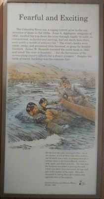
The Columbia River was a raging torrent prior to the construction of dams in the 1930s. Jesse A. Appleggate, emigrant of 1843, recalled his trip down the river through rapids "so wild, so commotional, so fearful and exciting, had not death been there , were worth a month of ordinary life." The river's banks were sandy, rocky, and presented little firewood, or grass for hungry livestock. James W. Nesmith traveled the south bank in 1843 and noted "the river is beautiful ... but the barrenness of the surrounding country affords but a dreary prospect." Despite the mode of travel, hardship was the common fare.
On the first day after leaving the Fort, one of our canoes, in which there were three persons, one of whom was a lady, in passing through a narrow shoot in the Grand Rapids, struck a rock, upset, and filled instantly. The lady and her husband succeeded in gaining the rock; which was about three feet across the top, and just under the surface of the water. Our pilot succeeded in taking them off in safety, and regained most of the property. -- Overton Johnson and William Winter, October 1843
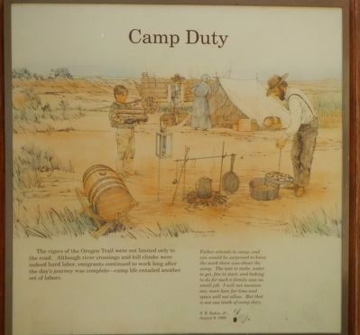
The rigors of the Oregon Trail were not limited only to the road. Although river crossings and hill climbs were indeed hard labor, emigrants continued to work long after the day's journey was complete -- camp life entailed another set of labors.
Father attends to camp, and you would be surprised to know the work there was about the camp. The tent to stake, water to get, fire to start, and baking to do for such a family was no small job. I will not mention any more here for time and space will not allow. But that is not one tenth of camp duty. -- S. B. Eakin, Jr.; August 9, 1866
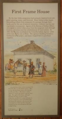
By the late 1840s emigration had seriously depleted trail-side game, grazing, water, and firewood. Many Indians tribes began demanding tribute from emigrants for passage through their lands and for the use of natural resources -- violence was but one regrettable consequence. Agents of the Bureau of Indian Affairs attempted to entice the tribes away from the emigrant routes through treaties, annuities and the establishment of reservations. In 1851 the Bureau established the Umatilla Indian Agency a few miles east of this site at Echo. The agency's building became a landmark for travelers, and many stopped here to purchase supplies.
... traveled three miles, to the crossing of the Umatilla River, at the Indian agency. Here we saw the first frame house since leaving the Missouri River. This house is about eighteen or twenty feet square, and one story high. The sight of this house, although standing alone out here in this wilderness, proved to be a great stimulus to the poor emigrants, worn out by there (sic) long trip across the continent, who received new encouragement, believing their long and tiresome journey was nearing its end, and trudged along. -- E. W. Conyers; September 4, 1852
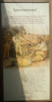
The majority of Oregon Trail emigrants relied upon published guidebooks for route and travel information. There was no substitute for firsthand information; however, emigrants were always eager to query anyone they met from the Willamette Valley -- sometimes answers to their questions were more than enlightening.
We met some men this afternoon who were from The Dalles. ... Nearly every person they met had a lot of questions to ask in regard to Oregon. Of course we were no exception, and when we met them many questions were asked. Finally someone in our party asked about the size of Oregon City, and how far it was to that place. This question about Oregon City seemed to ruffle his feelings somewhat, and he answered. "You emigrants seem to think that Oregon City is the only town in Oregon. Why there is Portland, that is about twelve miles below, which is twice the size of Oregon City and does ten times the business. You fellers must be a set of damned ignoramuses to think that Oregon City is the only town that is in Oregon." We readily came to the conclusion that we were somewhat ignorant concerning the geography of the great Northwest, and asked no more questions. -- E. W. Conyers, September 4, 1852
Erected by Oregon Trail Coordinating Council (OTCC).
Topics and series. This historical marker is listed in these topic lists: Roads & Vehicles • Settlements & Settlers. In addition, it is included in the Oregon Trail series list.
Location. 45° 46.308′ N, 119° 15.06′ W. Marker is near Stanfield, Oregon, in Umatilla County. Marker is on Interstate 84 at milepost 185 near Umatilla-Stanfield Highway (U.S. 395), on the right when traveling west. Touch for map. Marker is in this post office area: Stanfield OR 97875, United States of America. Touch for directions.
Other nearby markers. At least 8 other markers are within 11 miles of this marker, measured as the crow flies. Covered Wagon Museum (approx. 3.3 miles away); Jack Dempsey (approx. 3.3 miles away); Umatilla County Jail (approx. 3.3 miles away); The Blockhouse (approx. 3.3 miles away); The Lower Crossing (approx. 3.3 miles away); Charlie Berry Stadium (approx. 3.7 miles away); David R. Koontz (approx. 3.9 miles away); The Lewis and Clark Expedition (approx. 10.6 miles away).
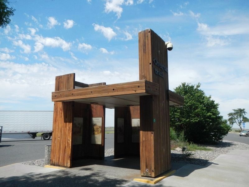
More about this marker. This Oregon Trail Kiosk is located at the westbound Stanfield Rest Area.
Credits. This page was last revised on December 27, 2017. It was originally submitted on December 27, 2017, by Barry Swackhamer of Brentwood, California. This page has been viewed 269 times since then and 10 times this year. Photos: 1, 2, 3, 4, 5, 6, 7. submitted on December 27, 2017, by Barry Swackhamer of Brentwood, California.
