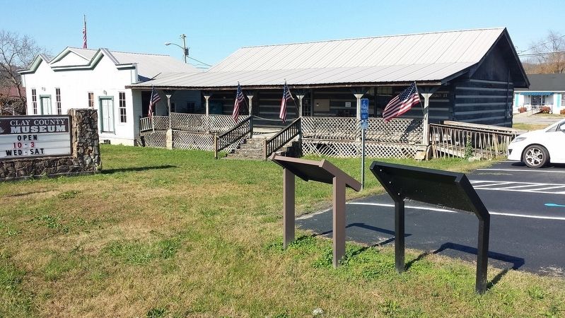
Celina in Clay County, Tennessee — The American South (East South Central)
History of the Webb Cemetery
1830-1942
Mary Ann and her three sons, Hudspeth, Giles, and Daniel, made their home along the banks of the Obed River. Upon her death in 1842, her sons buried her in the garden adjacent to her house. The 200 acres were then divided among her three sons. Huspeth received 120 acres, and Giles W. received 80 acres on the southwest corner adjoining the Obed River. Daniel Webb, who was still not married at the time, took cash for this part. Later on August 7, 1845, Daniel bought 100 acres for $600 from his older brother Hudspeth and established the Webb Homeplace.
Daniel Webb Homeplace
Daniel Webb (1802-1864) was the youngest son of Caleb Webb and Mary Ann (Hudspeth) Webb. Daniel was born in Iredell County North Carolina. Daniel married Mary Jane Gammon (1832-1873) on November 11, 1852. Mary Jane was the only daughter of John and Rebecca “Becky” (Whitworth) Gammon.
Daniel and Mary Jane lived at what was first known as the “Old Webb Homeplace.” Their first son, William Caleb “Bee” Webb, was born there on January 14, 1855. Their second son, Albert Kitchell Webb, was born in June of 1863.
Daniel’s oldest son, William Caleb “Bee” Webb (1855-1924), married Susan “Suffie” Bow (1858-1913) on February 24, 1876. Suffie was the daughter of Jesse Bow (1827-1870) and Judith (Arms) Bow (1828-1916). They were married for 37 years and had 9 children.
With the construction of Dale Hollow Dam, a number of family cemeteries, including the Webb Cemetery, were relocated out of the future pool waters of Dale Hollow Lake. On November 20, 1942, the War Department, U.S. Army Corps of Engineers, Ohio River Division issued a contract for cemetery removals. The Webb Cemetery was identified as Tract A-16, Cemetery 27 and was slated for removal to this location within the Donaldson Cemetery. In total, 34 graves location within the Donaldson Cemetery. In total, 34 graves were removed from the Webb Cemetery, which included 7 of Daniel’s slaves and 2 unidentified confederate soldiers who had been killed in a skirmish at the Webb Homeplace.
(Inset top center under house)
Caleb and Suffie’s house stood at the former Webb Homeplace site of his father Daniel. The original slave quarters and kitchen had remained on the property and in later years was converted to storage.
Gray John Webb
The large triangular-shaped headstone and footstone is the grave of Daniel Webb. These two stones were made by Daniel’s most trusted slave, Gray John Webb (1814-1891). Gray John was a man of many talents and served as a handyman, trader, farmer, carpenter, blacksmith, river man, and wagoner.
After the Civil War, the Webb family gave Gray several acres of land which overlooked the Webb Homeplace, and this property became known locally as Gray John Hill.
The Donaldson Cemetery
The Donaldson Cemetery, which was also known as the Donaldson Government Cemetery, was one of eight reinterment sites identified by the U.S.Army Corps of Engineers. Eventually over 2,200 graves were removed from the pool area of Dale Hollow Lake. No doubt, many early pioneers to this region still rest beneath the waters of Dale Hollow Lake.
Topics. This historical marker is listed in this topic list: Cemeteries & Burial Sites. A significant historical year for this entry is 1942.
Location. 36° 32.643′ N, 85° 30.232′ W. Marker is in Celina, Tennessee, in Clay County. Marker is on Brown St. Touch for map. Marker is in this post office area: Celina TN 38551, United States of America. Touch for directions.
Other nearby markers. At least 8 other markers are within walking distance of this marker. Donaldson Cemetery (a few steps from this marker); Hugh Roberts (within shouting distance of this marker); William Hull Building (approx. 0.4 miles away); Clay County Veterans Memorial (approx. half a mile away); Clay County Veterans Monument (approx. half a mile away); Celina During the Civil War (approx. half a mile away); The Clay County Courthouse (approx. half a mile away); Dumas Walker's Store (approx. half a mile away). Touch for a list and map of all markers in Celina.
More about this marker. Clay County Museum
Credits. This page was last revised on January 5, 2018. It was originally submitted on January 2, 2018, by Karen Emerson-McPeak of Triune, Tennessee. This page has been viewed 573 times since then and 208 times this year. Photos: 1, 2. submitted on January 2, 2018, by Karen Emerson-McPeak of Triune, Tennessee. • Bill Pfingsten was the editor who published this page.

