Near Locust Grove in Spotsylvania County, Virginia — The American South (Mid-Atlantic)
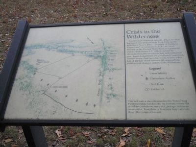
Crisis in the Wilderness
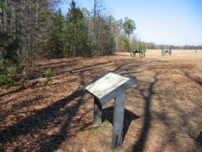
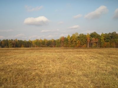
This trail leads a short distance into the Widow Tapp Field to exhibits that describe the dramatic events that saved the Confederate army, and perhaps its famous commander. From there, a 30-minute loop trail visits three other points of interest.
Topics. This historical marker is listed in this topic list: War, US Civil. A significant historical date for this entry is May 6, 1884.
Location. Marker has been reported missing. It was located near 38° 17.365′ N, 77° 43.617′ W. Marker was near Locust Grove, Virginia, in Spotsylvania County. Marker could be reached from Orange Plank Road (County Route 621), on the right when traveling west. Marker is the first of a walking trail in the Tapp Field. The trail head is accessible from a parking lot off the Orange Plank Road. Touch for map. Marker was at or near this postal address: 11325 Orange Plank Rd, Locust Grove VA 22508, United States of America. Touch for directions.
Other nearby markers. At least 8 other markers are within walking distance of this location. Wilderness Campaign (within shouting distance of this marker); In the Nick of Time (about 300 feet away, measured in a direct line); Lee-to-the-Rear (about 300 feet away); In The Nick of Time (about 300 feet away); The Home of Widow Tapp (approx. 0.2 miles away); The Widow Tapp House (approx. 0.2 miles away); Brink of Victory (approx. ¼ mile away); Lee to the rear! (approx. ¼ mile away). Touch for a list and map of all markers in Locust Grove.
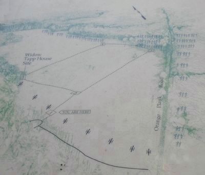
More about this marker. On the left side of the marker is a trail map indicating positions of the units, the tree lines, and stops along the trail.
Also see . . . Battle of the Wilderness. (Submitted on March 9, 2008, by Bill Coughlin of Woodland Park, New Jersey.)
Photographed By Craig Swain, February 16, 2008
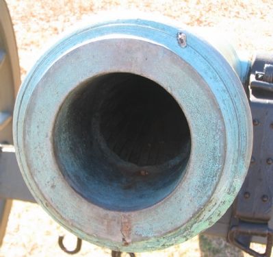
7. A "False Napoleon"
In the 1890s a commission placing cannon at Gettysburg was short of real 12-pdr Napoleon guns to depict all the important artillery locations on the field. The commission had several 6-pdr Field Guns altered to look similar to the larger guns. The process required removal of some bands and rings, generally smoothing of the barrel, and the bore enlarged to 4 and a half inches to a depth of about six inches. While resembling the larger guns from a distance, the smaller cannon are easy to identify up close, as seen here. This particular piece was originally altered with rifling during the war. The lands and grooves of which are seen where the bore enlargement ends.
Credits. This page was last revised on July 9, 2021. It was originally submitted on March 9, 2008, by Bill Coughlin of Woodland Park, New Jersey. This page has been viewed 1,205 times since then and 7 times this year. Last updated on January 5, 2018, by Shane Oliver of Richmond, Virginia. Photos: 1. submitted on March 9, 2008, by Bill Coughlin of Woodland Park, New Jersey. 2. submitted on January 5, 2018, by Shane Oliver of Richmond, Virginia. 3. submitted on March 10, 2008, by Craig Swain of Leesburg, Virginia. 4, 5, 6. submitted on March 9, 2008, by Bill Coughlin of Woodland Park, New Jersey. 7. submitted on March 10, 2008, by Craig Swain of Leesburg, Virginia. • J. J. Prats was the editor who published this page.
