West End in Northwest Washington in Washington, District of Columbia — The American Northeast (Mid-Atlantic)
During the years following the Civil War
Dupont Circle
— Diverse Visions | One Neighborhood —

Photographed By Devry Becker Jones (CC0), January 13, 2018
1. During the years following the Civil War Marker
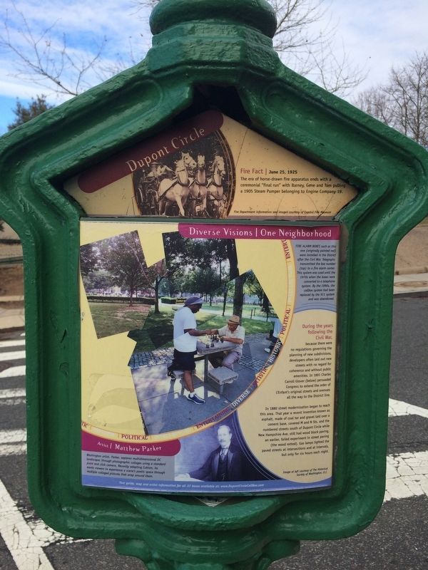
Fire Fact, June 25, 1925
The era of horse-drawn fire apparatus ends with a ceremonial "final run" with Barney, Gene and Tom pulling a 1905 Steam Pumper belonging to Engine Company 19.
Fire Department information and images courtesy of Capitol Fire Museum
Fire alarm boxes such as this one (originally painted red) were installed in the District after the Civil War. Telegraphs transmitted the box number (top) to a fire alarm center. This system was used until the 1970s when the boxes were converted to a telephone system. By the 1990s, the callbox system had been replaced by the 911 system and was abandoned.
During the years following the Civil War, because there were no regulations governing the planning of new subdivisions, developers often laid out new streets with no regard for coherence and without public amenities. In 1891 Charles Carroll Glover (below) persuaded Congress to extend the order of L'Enfant's original streets and avenues all the way to the District line.
In 1880 street modernization began to reach this area. That year a recent invention known as asphalt, made of coal tar and gravel laid over a cement base, covered M and N Sts. and the numbered streets south of Dupont Circle while New Hampshire Ave. still had wood block paving, an earlier, failed experiment in street paving (the wood rotted). Gas lamps lighted the paved streets at intersections and at intervals, but only for six hours each night.
Image at left courtesy of The Historical society of Washington, D.C.
Artist, Matthew Parker
Washington artist, Parker, explores multidimensional DC landscapes through photographic collages using a standard point and click camera. Recently adapting Cubism, he wants viewers to experience a scene's poetic space through multiple collaged pictures that wrap around them.
Erected by Cultural Tourism DC.
Topics and series. This historical marker is listed in these topic lists: Architecture • Roads & Vehicles. In addition, it is included in the DC, Art on Call series list. A significant historical year for this entry is 1880.
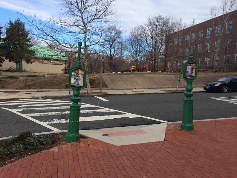
Location. 38° 54.428′ N, 77° 3.192′ W. Marker is in Northwest Washington in Washington, District of Columbia. It is in West End. Marker is at the intersection of N Street Northwest and 25th Street Northwest on N Street Northwest. Touch for map. Marker is at or near this postal address: 1275 25th Street Northwest, Washington DC 20037, United States of America. Touch for directions.
Other nearby markers. At least 8 other markers are within walking distance of this marker. Before the 1800s (here, next to this marker); Rose Park Recreation Center (about 600 feet away, measured in a direct line); Margaret Peters and Roumania Peters Walker Rose Park Tennis Courts

Photographed By Devry Becker Jones (CC0), January 13, 2018
2. During the years following the Civil War Marker

Photographed By Devry Becker Jones (CC0), January 13, 2018
3. During the years following the Civil War Marker
Credits. This page was last revised on January 30, 2023. It was originally submitted on January 14, 2018, by Devry Becker Jones of Washington, District of Columbia. This page has been viewed 213 times since then and 5 times this year. Photos: 1, 2, 3. submitted on January 14, 2018, by Devry Becker Jones of Washington, District of Columbia. • Bill Pfingsten was the editor who published this page.