Near Gold Hill in Jackson County, Oregon — The American West (Northwest)
Valley of the Rogue Applegate Trail Kiosk
Inscription.
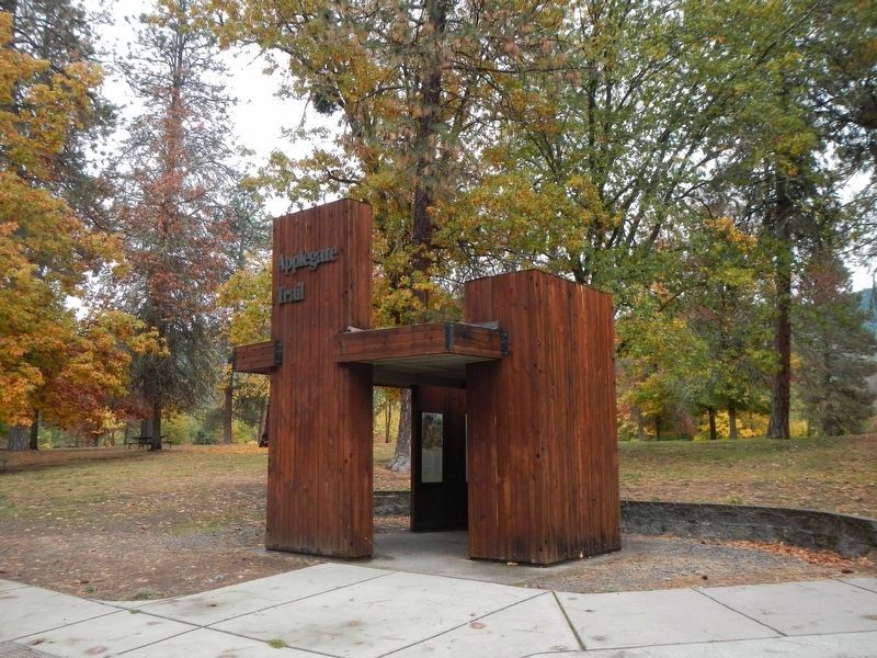
(Seven panels dealing with topics related to the Applegate Trail are found at this kiosk.)
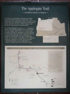
Southern Route to Oregon
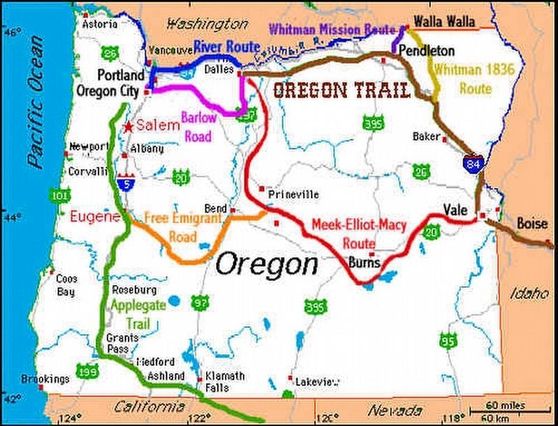
In 1846, Jesse Applegate and fourteen others from near Dallas, Oregon, established a trail south from the Willamette Valley and east to Fort Hall. This route offered emigrants an alternative to the perilous "last leg" of the Oregon Trail down the treacherous Columbia River.
The first emigrants to trek the new "Southern Road" left with the trailblazers from Fort Hall in early August 1846. With Levi Scott acting as guide, while Jesse Applegate traveled ahead to mark the route, the hardy emigrants blazed a wagon trail through nearly 500 miles of wilderness arriving in the upper Willamette Valley in November. Emigrant travel continued along the Applegate Trail in later years and contributed greatly to the settlement of southern Oregon and the Willamette Valley.
thay followed the Trail untill thay come to the Sisksue Montaiens there thay had to worke there way through the mountiens thay toiled through untill thay came to the Roge River Valey there thay meet with the Indiens had some Truble thay did not do Eney Fighting but thay Stald and Runaway stock mostley horses there it was gene laite in the Fall Rany Season was setting in and there cattle was poore and gave out with sore feet and provisions almost gone thay wore in bad condition to trail thay thoaught thay could get through to settlement be fore winter and thay strougled on... -- Angeline Smith C?, Recollection of 1846
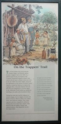
The ancient Indian trail connecting the Umpqua, Rogue, and Klamath regions became a trapper's trail in the 1820s. In a spirited quest for furs, the Hudson's Bay Company dispatched brigades to barter with natives and set traps in distant creeks and rivers. In the late 1820s Peter Skene Ogden, famed for his explorations of the interior of western North America, crossed the Siskiyous to explore the Applegate River. Alexander Roderick McLeod drew the next assignment to visit the region. In the 1830s John Work headed up expeditions traveling as far south as the Sacramento River.
Testing the route later used by emigrants in western Oregon, the fur trappers traveled with dozens of horses, fifteen to thirty men, Indian wives, and numerous children. They risked exposure and were compelled to subsist by finding their food where they camped. They bartered with the Indians, hunted, and endured sickness. They blazed the way for the wagon trains.
Our trappers were on the run for Beaver not Suspecting the Natives would carry away their traps, in which, however, we were sadly disappointed as Several traps were taken by them and we only recovered the Pieces. Annoyed in this manner, we could no longer trust them as it was evident they were on the alert to give us every trouble, so much so ended that we had to resort to arms. -- Alexander Roderick McLeod, Hudson's Bay Company, February 25, 1830
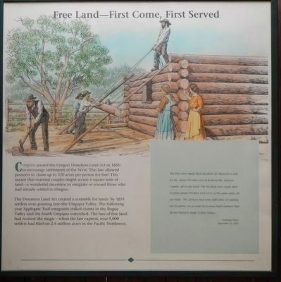
Congress passed the Oregon Donation Land Act in 1850 to encourage settlement of the West. This law allowed pioneers to claim up to 320 acres per person for free! This meant that a married couple might secure a square mile of land - a wonderful incentive to emigrate or reward those who had already settled in Oregon.
The Donation Land Act created a scramble for lands. By 1851 settlers were pouring into the Umpqua Valley. The following year Applegate Trail emigrants staked claims to the Rouge Valley and the South Umpqua watershed. The lure of free land has worked like magic - when the law expired, over 9,000 settlers had filed on 2.6 million acres in the Pacific Northwest.
The boys have made their locations for themselves and for me, about 12 miles east of Jacksonville, Jackson County, all in one track. The Walkers have made their location about 10 miles west of us in the same valey, in one body. We all have had some difficulties in making our locations, on account of so many land-claimers that do not intend to make it their homes. -- Nathaniel Myer, September 25, 1853
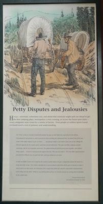
Hungry, uncertain, sometimes sick, and afraid that someone might pull out ahead to get the best camping place, monopolize a river crossing, or secure the finest land claims - weary emigrants were vexed by a variety of factors. Even people of noblest spirits found overland travel a test of patience and understanding.
Dr. Owen, seeing us, became hysterically profane because we had taken the road ahead of his droves. Determined to out-general us, and to prevent us from reaching the settlements first, he started two of his best teams with empty wagons to give us chase. ... ...my pursuer made a rash dash to pass me on the sidling hill. But just opposite me his wagon was upset, and team and all rolled over. This gave our little company another advantage. But he was desperate and heroic. He gathered himself and his possessions together, and righted things again. ... At last he had passed all wagons but one. This was my father's. The wiry little superannuated preacher from Illinois was to quick for him, and kept ahead at every turn.
At last my father's team was occupying the road at a point where it made a sharp turn around the head of a steep and rocky ravine. One reckless attempt here to get in ahead cooled him off for good. In trying to make a short (cut) across the ravine, the hind-gate of his wagon was jolted out, and his camp kettle and provisions went rolling into the ditch. While he was packing them all up, we leisurely passed on, leaving him to meditate on his selfish folly. -- Thomas Fletcher Royal, Recollection on October 26, 1853
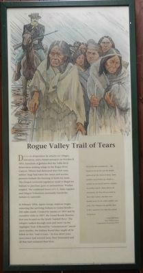
Driven to desperation by attacks on villages, starvation, and a brutal massacre on October 8, 1855, hundreds of Indians fled the Table Rock Reservation seeking refuge in the Rogue River Canyon. Miners had destroyed their fish runs; settler's hogs had eaten the camas and acorns; pioneers forbade the burning of fields for seeds. The Oregon territorial legislature made it illegal for Indians to purchase guns or ammunition. Warfare erupted. The combined forces of U.S. Army regulars and Oregon Volunteers eventually forced the Indians to surrender.
In February 1856, Agent George Ambrose began removing the surviving Indians to Grand Ronde - 250 miles north. Created by treaties in 1855 and by executive order in 1857, the Grand Ronde Reservation was located on the South Yamhill River. The refugees walked through mud and snow via the Applegate Trail. Followed by "exterminators" intent upon murder, the Indians feared they might be killed on this "trail of tears." In four short years newcomers had wrested away their homeland and all that has sustained their lives.
Ni-Ya-Na-Ha remembered.... She began to cry for she saw her people gathered up like herds of sheep. Some families were broken up, maybe a mother in one bunch and her children in another bunch. Many fled to the mountains, for they did not want leave their homes. But they were hunted down by the white soldiers and shot. They learned very quickly, that if they wanted to live they dared not protest. -- Pauline Bell Ricks, Siletz Tribal Council, Congressional Testimony (1977)
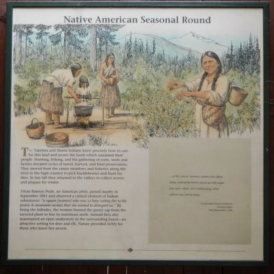
The Takelma and Shasta Indians knew precisely how to care for this land and secure the food which sustained their people. Hunting, fishing, and the gathering of roots, seeds and berries dictated cycles of travel, harvest, and food preservation. They moved from the camas meadows and fisheries along the river to the high country to pick huckleberries and hunt for deer. The late fall they returned to the valleys to collect acorns and prepare for winter.
Titan Ramsey Peale, an American artist, passed nearby in September 1841 and observed a critical element of Indian subsistence: "a squaw (woman) who was so busy setting fire to the prairie & mountain ravines that she seemed to disregard us." By firing the hillside, the women burned the gooey sap from the tarred plant to free it nutritious seeds. Annual fires also maintained an open understory in the surrounding forest - an attractive setting for deer and elk. Nature provided richly for those who knew her secrets.
...at this season, summer, camass was taken along, manzanita berries mixed up with sugar-pine nuts - those were carried along, dried salmon was carried along. -- Gwisgwashan (Frances Johnson), Takelma Indian, Siletz Reservation, 1906
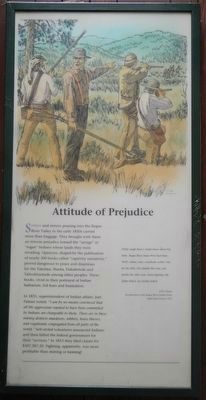
Settlers and miners pouring into the Rose River Valley in the early 1850s carried more than baggage. They brought with them an intense prejudice toward the "savage" or "rogue" Indians whose lands they were invading. Opinions, shaped by the publication of nearly 300 books called "captivity narratives," proved dangerous to peace and disastrous for the Takelma, Shasta, Dakubetede and Taltushtuntude among other peoples. These books, vivid in their portrayal of Indian barbarism, fed fears and frustrations.
In 1855, superintendent of Indians affairs, Joel Palmer noted: "I am by no means convinced that all the aggressions reputed to have been committed by Indians are chargeable to them. They are in these mining districts murderers, robbers, horse thieves, and vagabonds congregated from all parts of the world." Self-styled volunteers massacred Indians and they billed the federal government for their "services." In 1853 they filed claims for $107,287.20. Fighting, apparently, was more profitable than mining or farming!
Pretty rough times! Awful times, when I'm baby. Rogue River Injun War that time. Well, soldiers come, everybody scatter, run for the hills. One family this way, one family the other way. Some fighting. My father killed, my mother killed. -- John Adams, Recollections of the Rogue River Indian Wars. Siletz Reservation, 1911
Erected by Applegate Trail Coalition.
Topics and series. This historical marker is listed in these topic lists: Native Americans • Roads & Vehicles • Settlements & Settlers. In addition, it is included in the Applegate Trail series list.
Location. 42° 24.702′ N, 123° 7.704′ W. Marker is near Gold Hill, Oregon, in Jackson County. Marker can be reached from Interstate 5 at milepost 458, on the right when traveling north. Touch for map. Marker is in this post office area: Gold Hill OR 97525, United States of America. Touch for directions.
Other nearby markers. At least 8 other markers are within 3 miles of this marker, measured as the crow flies. Fort Birdseye (approx. 1.2 miles away); Applegate Trail - Fort Birdseye (approx. 1.2 miles away); Rock Point, Oregon (approx. 2.4 miles away); Rock Point Bridge (approx. 2.4 miles away); Rock Point Hotel (approx. 2.4 miles away); The City of Rogue River (approx. 2.6 miles away); Rising above the Rogue (approx. 2.6 miles away); A Bridge for a New Century (approx. 2.6 miles away). Touch for a list and map of all markers in Gold Hill.
More about this marker. The Applegate Trail Kiosk is located at the Valley of the Rogue State Park Rest Area.
Credits. This page was last revised on October 19, 2020. It was originally submitted on January 14, 2018, by Barry Swackhamer of Brentwood, California. This page has been viewed 337 times since then and 14 times this year. Photos: 1, 2, 3, 4, 5, 6, 7, 8, 9. submitted on January 14, 2018, by Barry Swackhamer of Brentwood, California.
