Rogue River in Jackson County, Oregon — The American West (Northwest)
Crossing the Rogue

Photographed By Barry Swackhamer, September 21, 2017
1. Crossing the Rogue Marker
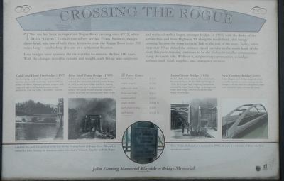
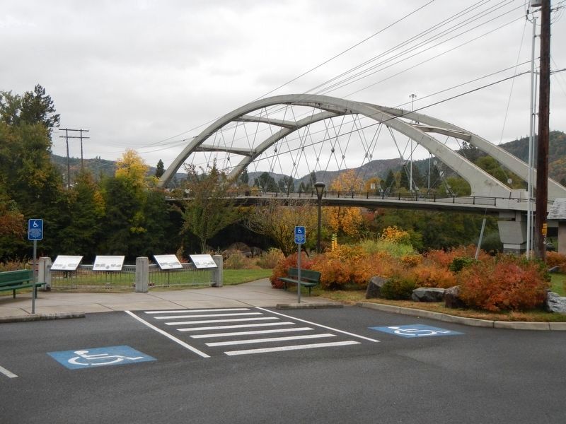
Captions: (center, far left) Cable and Plank Footbridge (1897): The first bridge to span the Rogue River at this location was a cable footbridge, built in 1897 by settler Ad Helms. Although animals, wagons, and cargo still had to be floated or swam across, pedestrians now has a dry - if wobbly - traverse.; (center, near left) First Steel Truss Bridge (1909): In the early 1900s, with the arrival of the railroad, the community needed a better bridge. In 1909, a steel trues bridge was built, making the town center and its depot more accessible to settlers. This plank-floored structure originally carried a $25 fine for crossing faster than a walk.; (middle) Ferry Rates: loaded wagon - $1.50, empty wagon - $1.00, yoke with oxen - $0.25, horse and rider - $0.25, loaded animal - $0.25, single animal - $0.12 1/2, each sheep or dog - $0.05, each person - $0.12 1/2; (center, near right) Depot Street Bridge (1950): By the 1940s, the increasing automobile traffic became too heavy for the 1909 steel bridge. In 1950, the Oregon State Highway Commission erected the Depot Street Bridge - a stronger and wider steel bridge, which replaced the older Rogue River bridge.; (center, far right) New Century Bridge (2005): Today's Rogue River Bridge (began in 2003) is another update to a river crossing that has changed with the times. It is designed to meet traffic demands today and into the future.; (bottom) John Fleming Memorial Wayside - Bridge Memorial: Land for this park was donated to the City by the Fleming family of Rogue River. The park is named for John Fleming, an American soldier who died in Vietnam. Together with the Rogue River Bridge (dedicated as a memorial in 1950), the park is a reminder of those who have seraed our county.
Four bridges have spanned the river at this location in the last 100 years. With the changes in traffic volume and weight, each bridge was outgrown and replaced with a larger, stronger bridge. In 1910, with the dawn of the automobile and State Highway 99 along the south bank, this bridge crossing became the town's crucial link to the rest of the state. Today, while Interstate 5 has shifted the primary travel corridor to the north bank of the river, this river crossing continues to be the lifeline to smaller communities along the south side. Without it, neighboring communities would go without mail, food, supplies, and emergency services.
Erected by City of Rogue River.
Topics. This historical marker is listed in these topic lists: Bridges & Viaducts • Settlements & Settlers.
Location. 42° 25.862′ N, 123° 10.314′ W. Marker is in Rogue River, Oregon, in Jackson County. Marker is on Rogue River Highway (Oregon Route 99) near North Star Lane, on the right when traveling west. Touch for map. Marker is at or near this postal address: 8898 Rogue River Highway, Rogue River OR 97537, United States of America. Touch for directions.
Other nearby markers. At least 8 other markers are within 4 miles of this marker, measured as the crow flies. A Bridge for a New Century (here, next to this marker); Rising above the Rogue (here, next to this marker); The City of Rogue River (here, next to this marker); Evan's Ferry (a few steps from this marker); Applegate Trail - Fort Birdseye (approx. 2 miles away); Fort Birdseye (approx. 2 miles away); Valley of the Rogue Applegate Trail Kiosk (approx. 2.6 miles away); Rock Point, Oregon (approx. 4.1 miles away). Touch for a list and map of all markers in Rogue River.
More about this marker. The marker is near the Rogue River Chamber of Commerce.
Credits. This page was last revised on January 26, 2018. It was originally submitted on January 15, 2018, by Barry Swackhamer of Brentwood, California. This page has been viewed 257 times since then and 17 times this year. Photos: 1, 2. submitted on January 15, 2018, by Barry Swackhamer of Brentwood, California.
