Keno in Klamath County, Oregon — The American West (Northwest)
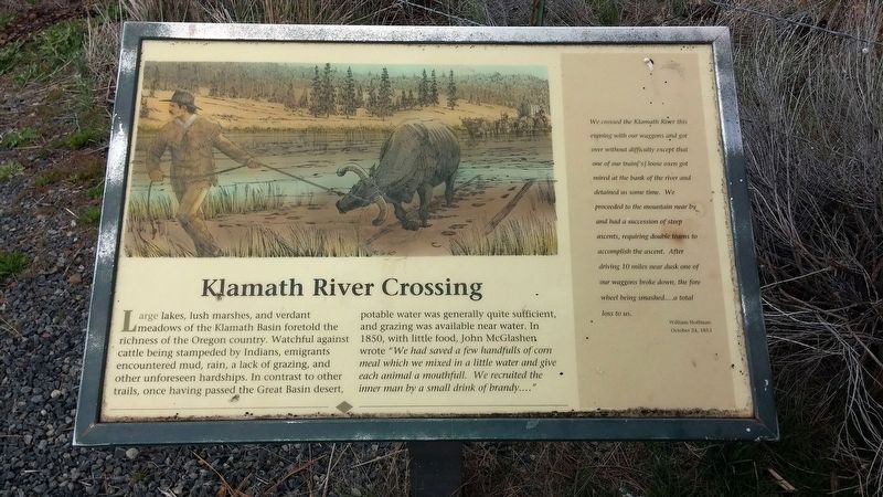
Klamath River Crossing
We crossed the Klamath River this evening with our waggons and got over without difficulty except that one of our train['s] loose oxen got mired at the bank of the river and detained us some time. We proceeded to the mountain near by and had a succession of steep ascents, requiring double teams to accomplish the ascent. After driving 10 miles near dusk one of our waggons broke down, the fore wheel being smashed....a total loss to us.
William Hoffman
October 24, 1853
Erected by Bureau of Land Management.
Topics and series. This historical marker is listed in this topic list: Exploration. In addition, it is included in the Applegate Trail series list. A significant historical date for this entry is October 24, 1853.
Location. 42° 8.217′ N, 122° 1.81′ W. Marker is in Keno, Oregon, in Klamath County. Marker is on Green Springs Highway (Oregon Route 66), on the left when traveling west. Touch for map. Marker is in this post office area: Keno OR 97627, United States of America. Touch for directions.
Other nearby markers. At least 8 other markers are within 4 miles of this marker, measured as the crow flies. The Applegate Trail (here, next to this marker); a different marker also named Applegate Trail (about 400 feet away, measured in a direct line); Topsy Grade (about 500 feet away); Chase Stage Station (approx. 0.9 miles away); Second Klamath River Ford (approx. one mile away); Spencer Creek Crossing / Camp Day (approx. 1.1 miles away); Cooper Stage - Station Site (approx. 3.1 miles away); Bear Valley (approx. 3.3 miles away). Touch for a list and map of all markers in Keno.
More about this marker. One of two interpretive displays facing the Klamath River at Topsy Reservoir
Regarding Klamath River Crossing. The Klamath River is much deeper now than it was in the mid-1850s, due to the dams along Klamath River that have created Topsy Reservoir at this location.
Credits. This page was last revised on January 19, 2018. It was originally submitted on January 17, 2018, by Douglass Halvorsen of Klamath Falls, Oregon. This page has been viewed 273 times since then and 30 times this year. Photos: 1, 2. submitted on January 17, 2018, by Douglass Halvorsen of Klamath Falls, Oregon. • Bill Pfingsten was the editor who published this page.

