Ridgefield in Clark County, Washington — The American West (Northwest)
Early Highway of the West
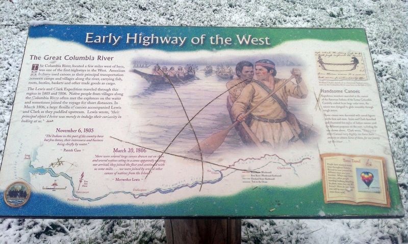
The Great Columbia River
The Lewis and Clark Expedition traveled through this region in 1805 and 1806. Native people from villages along the Columbia River often met the explorers on the water and sometimes joined the voyage for short distances. In March 1806, a large flotilla of canoes accompanied Lewis and Clark as they paddled upstream. Lewis wrote, "their principal object I believe was merely to indulge their curiosity in looking at us."
..............................................
November 6, 1805
"The Indians in this part of the country have but few horses, their intercourse and business being chiefly by water." ~ Patrick Gass
..............................................
March 30, 1806
"there were several large canoes drawn out on shore and several natives seting in a canoe apparently waiting our arrival; they joined the fleet and continues with us some miles.... we were joined by several other canoes of natives from the Island." ~ Meriweather Lewis
..............................................
Handsome Canoes
Expedition members marveled at the canoes of the American Indians of the Lower Columbia. Carefully crafted from large cedar trees, the canoes were designed to glide smoothly through rough waters.
Some canoes were decorated with carved figures on the bow and stern. Lewis and Clark described and illustrated five styles of Indian canoes used for different purposes on the river, including the one shown above. Clark wrote, "They prize their Canoes very highly: we have been anxious to obtains Some of them, for our journey up the river...."
Erected by Washington State Parks.
Topics and series. This historical marker is listed in these topic lists: Exploration • Native Americans • Roads & Vehicles. In addition, it is included in the Lewis & Clark Expedition series list. A significant historical month for this entry is March 1806.
Location. 45° 47.957′ N, 122° 40.817′ W. Marker is in Ridgefield, Washington, in Clark County. Marker can be reached from Interstate 5. Touch for map. Marker is in this post office area: Ridgefield WA 98642, United States of America. Touch for directions.
Other nearby markers. At least 8 other markers are within 11 miles of this marker, measured as the crow flies. Fort Vancouver (a few steps from this marker); down the trodden path... (approx. 7.2 miles away in Oregon); Lewis & Clark Discovery Trail (approx. 7.2 miles away in Oregon); Warrior Rock Fog Bell (approx. 7.2 miles away in Oregon); Woodland Community Veterans Memorial (approx. 7.7 miles away); The Finn Hall (approx. 10 miles away); Thomas McKay (approx. 10.1 miles away in Oregon); Lewis and Clark on the Columbia (approx. 10.1 miles away in Oregon).
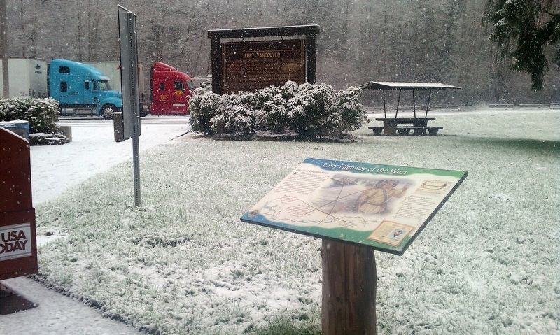
More about this marker. Marker is located within the Fort Gee Rest Area (southbound)
Credits. This page was last revised on January 21, 2018. It was originally submitted on January 18, 2018, by Douglass Halvorsen of Klamath Falls, Oregon. This page has been viewed 235 times since then and 12 times this year. Photos: 1, 2. submitted on January 18, 2018, by Douglass Halvorsen of Klamath Falls, Oregon. • Bill Pfingsten was the editor who published this page.

