South Lake Tahoe in El Dorado County, California — The American West (Pacific Coastal)
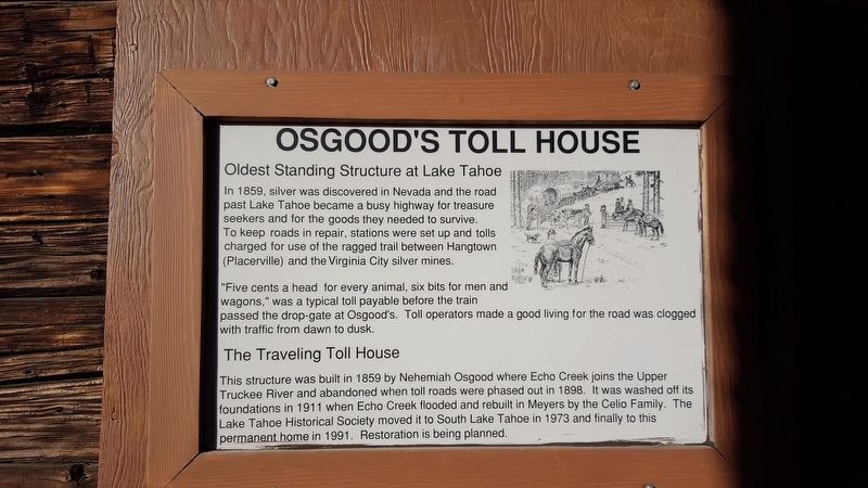
Osgood's Toll House
In 1859, silver was discovered in Nevada and the road past Lake Tahoe became a busy highway for treasure seekers and for the goods they needed to survive. To keep roads in repair, stations were set up and tolls charged for use of the ragged trail between Hangtown (Placerville) and the Virginia City silver mines.
“Five cents a head for every animal, six bits for men and wagons,” was a typical toll payable before the train passed the drop-gate at Osgood's Toll operators made a good living for the road was clogged with traffic from dawn to dusk.
The Traveling Toll House
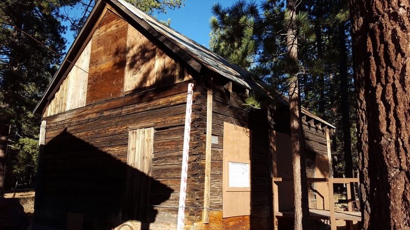
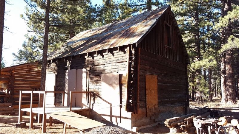
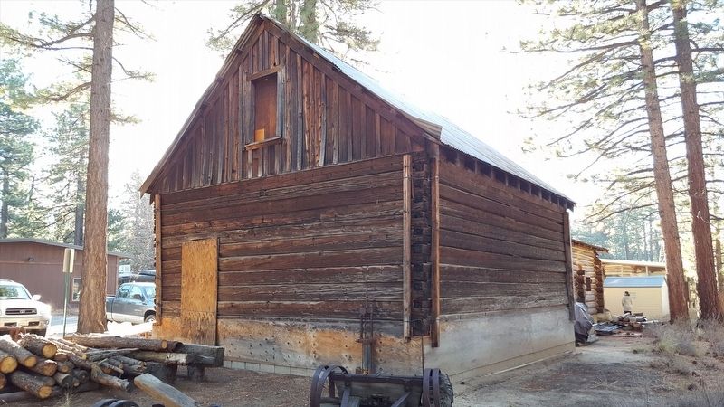
This structure was built in 1859 by Nehemiah Osgood where Echo Creek joins the Upper Truckee River and abandoned when the toll roads were phased out in 1898. It was washed off its foundations in 1911 when Echo Creek flooded and rebuilt in Meyers by the Celio Family. The Lake Tahoe Historical Society moved it to South Lake Tahoe in 1973 and finally to this permanent home in 1991. Restoration is being planned.
Erected by Lake Tahoe Historical Society.
Topics. This historical marker is listed in this topic list: Roads & Vehicles. A significant historical year for this entry is 1859.
Location. 38° 56.398′ N, 119° 58.582′ W. Marker is in South Lake Tahoe, California, in El Dorado County. Marker can be reached from Lake Tahoe Blvd (U.S. 50) north of Lyons Avenue. Touch for map. Marker is at or near this postal address: 3058 Lake Tahoe Blvd, South Lake Tahoe CA 96150, United States of America. Touch for directions.
Other nearby markers. At least 8 other markers are within 3 miles of this marker, measured as the crow flies. The Log Cabin (a few steps from this marker); South Lake Tahoe Library Veterans Memorial (approx. 0.3 miles away); Veterans Memorial (approx. 1½ miles away); Lakeside Beach History (approx. 2 miles away); Henry Van Sickle (approx. 2.2 miles away); Jack’s Ranch (approx. 2.2 miles away); Pony Express State Line Crossing (approx. 2.3 miles away in Nevada); The Pony Express (approx. 2.4 miles away in Nevada). Touch for a list and map of all markers in South Lake Tahoe.
More about this marker. Marker is located at Lake Tahoe Historical Society
Regarding Osgood's Toll House. A newspaper article from the Lake Tahoe News provides additional history: The oldest building still standing in the Tahoe basin is now boarded up and waiting for disposition. It is a sturdy, hand-hewn blockhouse which served as a toll station and landmark on the road into Lake Valley. It was built in the summer of 1859 by Nehemiah Osgood and established at the foot of the Meyers Grade where Echo Lake Creek flows into the Upper Truckee River. Osgood’s shortcut was one thousand feet long from the summit to the toll house and reduced the distance form the summit to the floor of Lake Valley. It stood on the left side of the road as one travelled toward the lake. Osgood established his family’s home just across the road from the toll station.
Toll houses dotted the valley in the 1860 and 1870s, especially at the south end of the lake. The operators charged for passage and took the responsibility of keeping their section of the road in good condition as the state had failed to provide adequate funds for building or maintaining the roads. During the Comstock Lode’s highest activity, traffic was heavy as these roads carried all of the supplies and material from California that were needed for mines and miners around Virginia City, Nevada.
Osgood expanded his holdings around the station in 1871 and employed at least three toll keepers to handle the traffic. The 1867 capture of outlaws by a posse from Placerville was only another part of the passing parade for Osgood’s. No longer in use after the 1880s, it stood empty for three decades. In 1911, the spring thaw broke the dam on Echo Lake Creek and sent tons of water down upon the station washing it form its foundation. It was rescued by the Celio family and placed on a foundation in Meyers near the old golf course.
Local citizens and the Historical Society helped to move the building in 1974 to the site of a proposed museum adjacent to the new county library. Funds for the new museums were never raised and Osgood’s stands today at the corner of Highway 50 and Rufus Allen, a vision and a relic of the past. It is in good condition for its age and the Historical Society is investigating the feasibility of moving that venerable building closer to the museum. Discussions and investigations are under way on its ultimate fate.
Credits. This page was last revised on September 29, 2020. It was originally submitted on January 22, 2018, by Douglass Halvorsen of Klamath Falls, Oregon. This page has been viewed 321 times since then and 17 times this year. Photos: 1, 2, 3, 4. submitted on January 22, 2018, by Douglass Halvorsen of Klamath Falls, Oregon. • Andrew Ruppenstein was the editor who published this page.


