Astoria in Clatsop County, Oregon — The American West (Northwest)
Columbia River Tugs And Towboats
High Efficiency Transportation System with a Low Profile
Towboats began working on the Columbia in the mid 19th century. Powerful steam tugs towed sailing vessels over the Columbia River bar. Sternwheel steamboats, many of which operated as tugs, plied the entire Columbia River system. During this period, river navigation was divided into upper, middle, and lower sections, due to the many rapids and falls on the Columbia River.
As the age of sail faded and steamships took over the high seas, tug and barge traffic rose to prominence on the river. Navigation improvements, including locks and canals, combined with the development of more efficient gas and diesel propeller boats to produce an extensive inland water transportation system during the 20th century. The biggest changes took place because of lock and dam-building beginning in the 1930s. Today, the Columbia – Snake River system affords slackwater navigation 465 miles inland to Lewiston, Idaho, on the Clearwater River, a major tributary of the Snake.
Wheat and forest products are the major commodities moving down the combined Columbia – Snake River system. Petroleum products are an important part of the traffic moving upriver. In addition to primary cargo handling capabilities, ship assist tugs attend large vessels at deep water ports up and down the river. Despite their low profile, Columbia River tugs and towboats have played a big role in the development of the region's economy.
The 14th Street Pier
The Brix Maritime pier at the foot of 14th Street was built for towboat moorage by Callender Navigation Co. around 1910. By 1920, Callender Navigation had merged with the Knappton Towboat Co.
The pier was abandoned during the 1940s and fell into disrepair. Around 1950 it was acquired by Arrow Tug and Barge. Arrow’s fleet was later purchased by Knappton Towboat Co. in 1961, and the pier became the site of Knappton's Astoria offices.
Knappton's towboat operations began as a means of supplying the Knappton lumber mill across the river in Knappton, Washington. After the Knappton mill burned in 1941, the company turned entirely to water transportation. The Knappton Corporation, founded by mill owner and towboat pioneer Peter John Brix, was reorganized as Brix Maritime Co. in 1990, reflecting continuing family management of the firm.
Erected by City of Astoria.
Topics. This historical marker is listed in these topic lists: Industry & Commerce • Waterways & Vessels.
Location. 46° 11.425′ N, 123° 49.734′ W. Marker is in Astoria, Oregon, in Clatsop County. Marker

Photographed By Cosmos Mariner, July 8, 2015
2. Marker detail: Push Tug
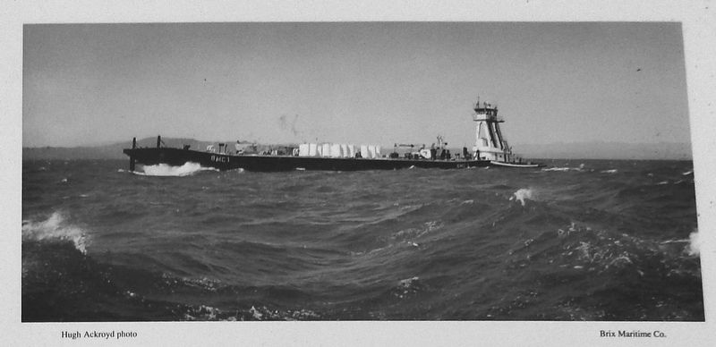
A push tug and barge buck a strong chop on the lower Columbia River. Push tugs, easily recognized by their high towers to see over the "tow" in front of them, are among the most commonly seen varieties of towboats along the Astoria waterfront.
Other nearby markers. At least 8 other markers are within walking distance of this marker. Pilots on the Columbia River (here, next to this marker); 14th Street Ferry Slip (within shouting distance of this marker); Gimre's Shoe Store (about 400 feet away, measured in a direct line); At Play on the River (about 500 feet away); Harvesting River & Sea (about 500 feet away); Into the Unknown (about 600 feet away); A Waterfront at Work (about 700 feet away); Fort Astoria (approx. 0.2 miles away). Touch for a list and map of all markers in Astoria.
Related markers. Click here for a list of markers that are related to this marker.
Also see . . . Columbia River.
Since the late 19th century, public and private sectors have heavily developed the river. To aid ship and barge navigation, locks have been built along the lower Columbia and its tributaries, and dredging has opened, maintained, and enlarged shipping channels. Since the early 20th century, dams have been built across the river for power generation, navigation, irrigation, and flood control. (Submitted on January 24, 2018, by Cosmos Mariner of Cape Canaveral, Florida.)

Photographed By Cosmos Mariner, July 8, 2015
3. Marker detail: Astoria Tug
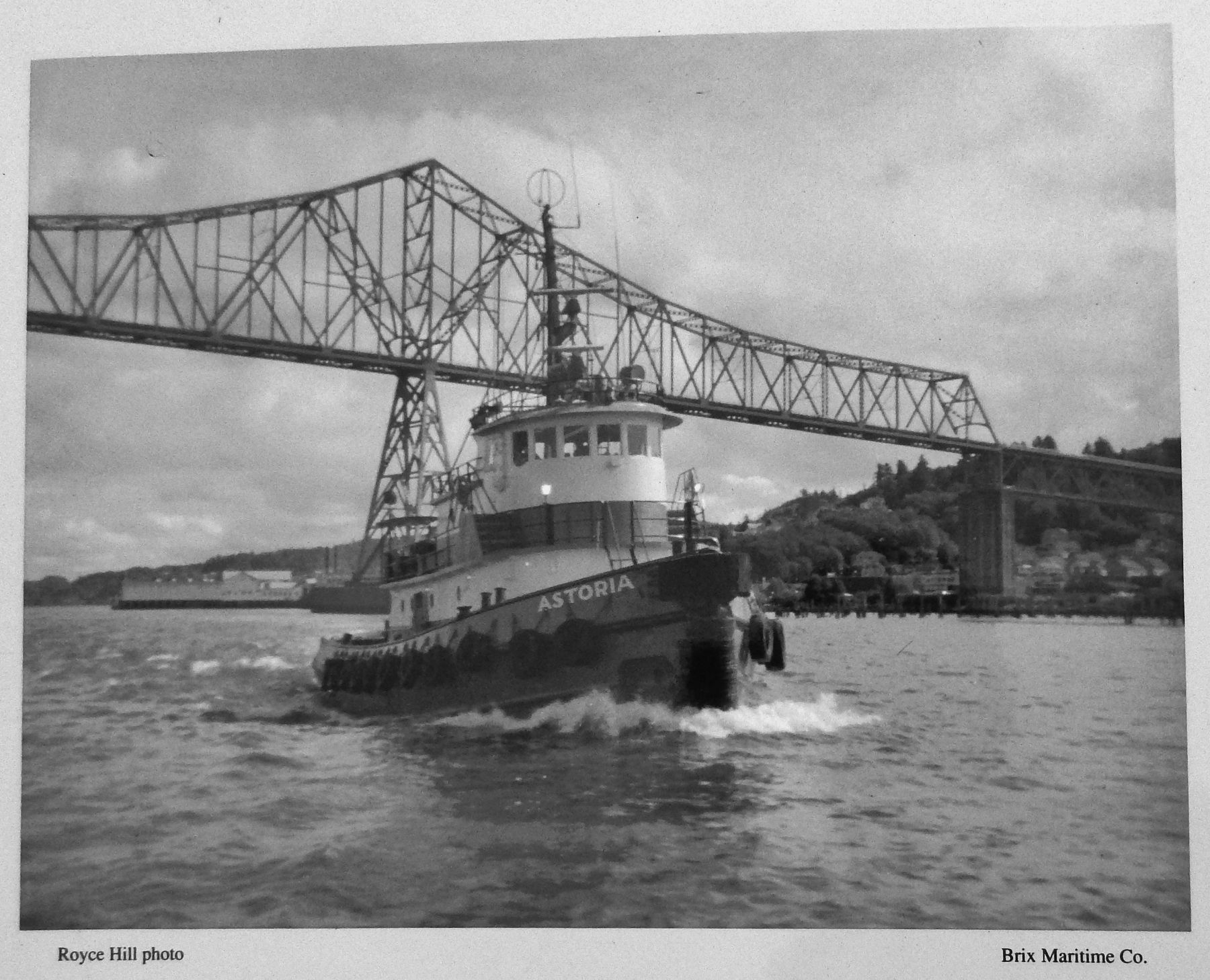
The seagoing tug Astoria heads downriver past the Astoria bridge. Seagoing tugs and barges connect the Columbia River with points up and down the West Coast and distant locations around the Pacific Ocean. With ocean going capabilities, tugs and barges form a vital link in the economy of the maritime West.

Photographed By Cosmos Mariner, July 8, 2015
4. Marker detail: Mystic and John A. Shaw with a log raft
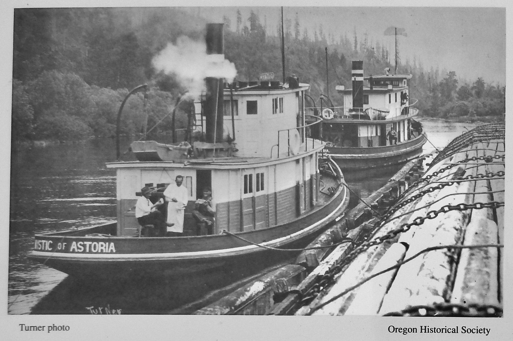
The steam tugs Mystic and John A. Shaw with a log "cigar" raft at Coal Creek Slough near Stella, Washington, circa 1917.
Such seagoing cigar rafts were conceived as a means of transporting Northwest timber to sawmills distant from a reliable source of raw materials.
Many of the towboat companies on the Columbia River got their start booming and towing logs for timber companies and lumber mills along the river, once so numerous that it was said one never lost sight of a sawmill on the Columbia. This photo was taken when Capt. Nathan Burkholder was master of the Shaw, and his wife and family lived on board. Mrs. Burkholder's planter box with potted flowers can be seen on the side of the living quarters abaft the pilot house. For many families along the river, working the towboats has long been a way of life.
Credits. This page was last revised on October 14, 2020. It was originally submitted on January 24, 2018, by Cosmos Mariner of Cape Canaveral, Florida. This page has been viewed 883 times since then and 83 times this year. Photos: 1, 2, 3, 4. submitted on January 24, 2018, by Cosmos Mariner of Cape Canaveral, Florida. • Bill Pfingsten was the editor who published this page.
