Near San Joaquín in Cadereyta de Montes, Querétaro, Mexico — The Central Highlands (North America)
Place of the Magueyes
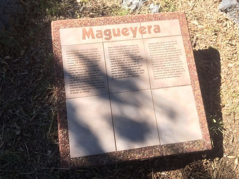
Magueyera
Este sector del sitio tenía conjuntos habitacionales alrededor de patios mismos que estaban separados por callejones y distribuidos a lo largo de las avenidas. Sin embargo, durante los ultimos 100 años los edificios fueron destruidos y reutilizados sus materiales para la construcción de viviendas modernas.
Desde este lugar, que es el más alto del sitio, puede Ud. observar el macizo de El Doctor a la izquierda y a la derecha, la parte más alta del macizo de San Nicolás; este último que parece un cerro aislado, tiene en realidad una enorme amplitud en parte baja y llega hasta los límites con el Estado de Hidalgo.
Magueyera
Núnä nthéke rä hyódi mí peétsi na juti yä nthoe ngu núu mära, geä, yä ngumui mí téni yä nxingä nyoóñuú nzóho, mí thétsi yä tsintä ñuú ha xki ntui há yä tsánä bátha. Híngo rä ngeéä, yä gäxä nthebe njeya däángä nguú bi ñhote. Ha núnä nthéke, gehnä ndodo rä Doktor rí nja há nge rä ngäáhä; ha unumäna xá ñheétsi há rä ndodo Nsánikula rí nge rä ñei geä, mäske ñénä gehni na rä toho di seéhé, há nge ngáti xi rá nxidi ha mä rí tsóni há yá hyódi Ñhunthe (Hidalgo).
Place of the Magueyes
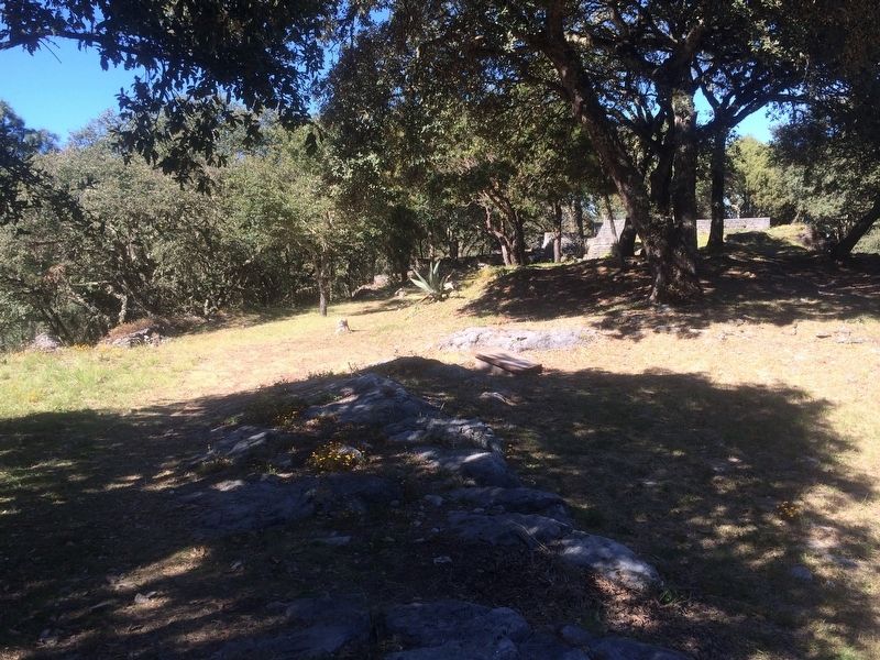
Found in this section of the site are groups of dwellings placed around courtyards while separated by alleyways and distributed along avenues. However, the buildings were dismantled over the course of the last 100 years and their materials used for the construction of modern houses.
From this point (the highest within the site), one can see to the left the mountain known as El Doctor, and to the right, the highest part known as San Nicolás. Though it appears to be an isolated peak, its great width at its base connects it to the mountains bordering the state of Hidalgo.
Erected by Instituto Nacional de Antropología e Historia (INAH).
Topics. This historical marker is listed in these topic lists: Anthropology & Archaeology • Colonial Era • Man-Made Features • Native Americans.
Location. 20° 52.975′ N, 99° 31.839′ W. Marker is near San Joaquín, Querétaro, in Cadereyta de Montes. Marker can be reached from Unnamed road just west of Carretera San Joaquín-Querétaro. The marker is at Toluquilla Archaeological Site, turning on to an unnamed road some few kilometers from the town of San Joaquín on Route 120 towards Querétaro. Touch for map. Marker is in this post office area: San Joaquín QUE 76529, Mexico. Touch for directions.
Other nearby markers. At
least 8 other markers are within 6 kilometers of this marker, measured as the crow flies. Ball Court Two (within shouting distance of this marker); Ball Court One (about 150 meters away, measured in a direct line); Archaeological Work at Toluquilla (about 180 meters away); The History and Natural Environment of Toluquilla (about 180 meters away); Observation Post "La Crucita" (approx. 4.8 kilometers away); Historic Tree (approx. 4.8 kilometers away); Monument to the Miner (approx. 4.9 kilometers away); Los Herrera Caves (approx. 5 kilometers away). Touch for a list and map of all markers in San Joaquín.
Credits. This page was last revised on January 30, 2018. It was originally submitted on January 30, 2018, by J. Makali Bruton of Accra, Ghana. This page has been viewed 112 times since then and 4 times this year. Photos: 1, 2. submitted on January 30, 2018, by J. Makali Bruton of Accra, Ghana.

