Seaside in Clatsop County, Oregon — The American West (Northwest)
A Convenient Place for Making Salt
Inscription.
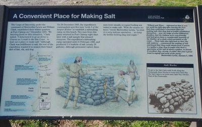
The Corps of Discovery, under the command of Meriwether Lewis and William Clark, established their winter quarters at Fort Clatsop on 7 December 1805. “We haveing fixed on this situation,” Clark noted, “I deturmin’d to go as direct a Course as I could to the Sea Coast. . .to look out a place to make salt.” Although Clark was indifferent to salt, the rest of the expedition wanted it to season their bland diet of fish, elk, and dog.
On 28 December 1805, the expedition’s commanders sent five men “with 5 of the largest Kittles” to establish a salt making camp on this beach. Two men from this party returned to Fort Clatsop eight days later with a salt sample that pleased everyone. The expedition’s saltmaking camp operated until 21 February 1806, and produced 3 1/2 bushels of salt (nearly 28 gallons). Although personnel varied, three men were usually occupied boiling sea water to make salt. “With the means we have,” wrote Meriwether Lewis, “we find it a very tedious operation. . .we keep the kettles boiling day and night.”
”Willard and Wiser. . . .informed us that it was not untill the fifth day after leaving the Fort that they could find a convenient place for making salt; that they had at length established themselves... near the lodge of some Killamuck families; that the Indians were very friendly and had given them a considerable quantity of the blubber of a whale which perished on the coast... These lads also informed us that (the salt makers)... commenced the making of salt and found that they could obtain from 3 quarts to a gallon a day; they brought with they a specemine of the salt of about a gallon, we found it excellent, fine, strong, & white; this was a great treat to myself and most of the party.” - Meriwether Lewis, January 5, 1806
To get to the Salt Cairn walk North along the Promenade three blocks to Lewis and Clark Way. The Salt Cairn is on Lewis and Clark Way 100 feet east of the Promenade.
Erected by National Park Service.
Topics and series. This historical marker is listed in this topic list: Exploration. In addition, it is included in the Lewis & Clark Expedition series list. A significant historical date for this entry is December 28, 1805.
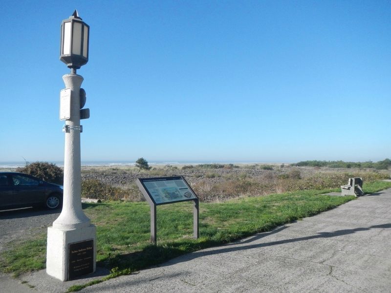
Location. 45° 58.842′ N, 123° 56.037′ W. Marker is in Seaside, Oregon, in Clatsop County. Marker can be reached from South Promenade near Avenue U. Touch for map. Marker is at or near this postal address: 2275 South Promenade, Seaside OR 97138, United States of America. Touch for directions.
Other nearby markers. At least 8 other markers are within 5 miles of this marker, measured as the crow flies. Lewis & Clark Salt Cairn (approx. ¼ mile away); The Saltworks (approx. ¼ mile away); Site of the Lewis and Clark Salt Camp (approx. ¼ mile away); Tsunami (approx. 0.8 miles away); Gilbert Inn - 1892 (approx. 0.8 miles away); Ekkoli: A Whale of a Tale (approx. 4 miles away); Ecola (approx. 4.8 miles away); "Cannon Beach" (approx. 4.8 miles away). Touch for a list and map of all markers in Seaside.
More about this marker. This marker is at beach at the west end of Avenue U. Promenade is a pedestrian pathway.
Credits. This page was last revised on February 2, 2018. It was originally submitted on February 2, 2018, by Barry Swackhamer of Brentwood, California. This page has been viewed 207 times since then and 17 times this year. Photos: 1, 2. submitted on February 2, 2018, by Barry Swackhamer of Brentwood, California.

