Meridian in McIntosh County, Georgia — The American South (South Atlantic)
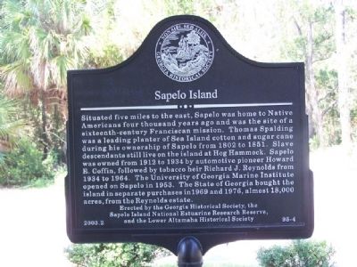
Sapelo Island
Situated five miles to the east, Sapelo was home to Native Americans four thousand years ago and was the site of a sixteenth-century Franciscan mission. Thomas Spalding was a leading planter of Sea Island cotton and sugar cane during his ownership of Sapelo from 1802 to 1851. Slave descendants still live on the island at Hog Hammock. Sapelo was owned from 1912 to 1934 by automotive pioneer Howard E. Coffin, followed by tobacco heir Richard J. Reynolds from 1934 to 1964. The University of Georgia Marine institute opened on Sapelo is 1953. The State of Georgia bought the island in separate purchases in 1969 and 1976, almost 18,000 acres, from the Reynolds estate.
Erected 2003 by The Georgia Historical Society, the Sapelo Island National Estuarine Research Reserve, and the Lower Altamaha Historical Society. (Marker Number 95-4.)
Topics and series. This historical marker is listed in these topic lists: Colonial Era • Industry & Commerce • Notable Places • Settlements & Settlers. In addition, it is included in the Georgia Historical Society series list. A significant historical year for this entry is 1802.
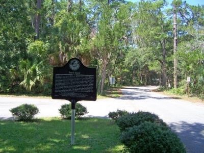
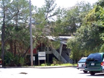
Location. 31° 27.299′ N, 81° 21.91′ W. Marker is in Meridian, Georgia, in McIntosh County. Marker is on Landing Road/Sapelo Dock Road, on the right. At the Sapelo Island Visitor Center. Touch for map. Marker is in this post office area: Crescent GA 31304, United States of America. Touch for directions.
Other nearby markers. At least 8 other markers are within 7 miles of this marker, measured as the crow flies. “The Thicket” (approx. 2.4 miles away); Baisden's Bluff Academy (approx. 3.8 miles away); Ardoch (approx. 4.4 miles away); Capture of 26 Men in 1864 (approx. 5.4 miles away); Old Belleville or Troup Cemetery (approx. 5˝ miles away); Ashantilly (approx. 5.8 miles away); St. Andrew's Cemetery (approx. 6.1 miles away); Captain William McIntosh (approx. 6.3 miles away).
Also see . . . Sapelo Island. New Georgia Encyclopedia website entry:
Situated about sixty miles south of Savannah, the island lies in the center of coastal Georgia's well-defined chain of barrier islands. (Submitted on September 11, 2008, by Mike Stroud of Bluffton, South Carolina.)
Credits. This page was last revised on October 13, 2021. It was originally submitted on September 11, 2008, by Mike Stroud of Bluffton, South Carolina. This page has been viewed 1,018 times since then and 14 times this year. Photos: 1. submitted on September 11, 2008, by Mike Stroud of Bluffton, South Carolina. 2. submitted on February 27, 2013, by Mike Stroud of Bluffton, South Carolina. 3. submitted on September 11, 2008, by Mike Stroud of Bluffton, South Carolina. • Kevin W. was the editor who published this page.


