Cumberland Township near Gettysburg in Adams County, Pennsylvania — The American Northeast (Mid-Atlantic)
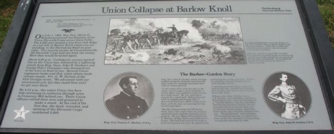
Union Collapse at Barlow Knoll
July 1, 1863 - First Day
"P.S. Tell them I was hit face toward them - no Reb saw my back."
Pvt. J. Henry Blakeman, U.S.A.
17th Connecticut Infantry, Eleventh Corps
Battlefield letter to his mother
On July 1, 1863, Maj. Gen. Oliver O. Howard positioned two divisions of his Union Eleventh Corps across these fields. The 5,200 men formed a line from Oak Ridge on your left, to Barlow Knoll where you are standing, to the Harrisburg Road on your right. Two months earlier at Chancellorsville the Eleventh Corps had run from the enemy. Hence they would be tested again.
About 3:00 p.m., Confederate cannon opened fire on the Union line, followed by a lightning attack from Brig. Gen. John B. Gordon's and George Dole's Georgians who streamed out of the trees in front of you. Several Union regiments broke and fled, while others made valiant stands. Pvt. G. W. Nichols of the 61st Georgia wrote, "We advanced with our accustomed yell, but they stood firm until we got near them."
By 4:15 p.m., the entire Union line here was retreating in confusion through town to Cemetery Hill behind you. There Union officers rallied their men and prepared to make a stand. At the end of the first day, the dead, wounded, and missing of the Eleventh Corps numbered 3,000.
The Barlow-Gordon Story
Brig. Gen. John B. Gordon, whose Georgia soldiers swept the Federals from this hill, later wrote of a personal encounter here with an enemy general:
"In the midst of the wild disorder in the ranks, and through a storm of bullets, a Union officers was seeking to rally his men for a final stand. He, too, went down, pierced by a minie ball. Riding forward with my rapidly advancing lines, I discovered that brave officer lying on his back, with the July sun pouring its rays into his pale face....
"Quickly dismounting and lifting his head, I gave him water from my canteen, asked his name and the character of his wounds. He was Major-General Fancis C. Barlow, of New York, and of Howard's Corps. The ball had entered his body in front and passed out near the spinal cord, paralizing him in legs and arms. Neither of us had the remotest though that he could possibly survive....
"I summoned several soldiers who were looking after the wounded, and directed them to place him upon a litter and carry him to the shade."
Fifteen years later, Gordon, now a U.S. Senator, was attending a dinner in Washington, D.C., when he learned that a "General Barlow" was also attending. Introducing himself to Barlow, he was stunned to learn it ws the same one he had met at Gettysburg. Each man believed the other had been killed in the war. "Thenceforward," wrote Gordon, "the friendship between us, which was born amidst the thunders of Gettysburg, was greatly cherished by both."
Erected by National Park Service, U.S. Department of the Interior.
Topics. This historical marker is listed in this topic list: War, US Civil. A significant historical month for this entry is July 1607.
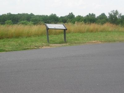
Location. This marker has been replaced by another marker nearby. It was located near 39° 50.735′ N, 77° 13.586′ W. Marker was near Gettysburg, Pennsylvania, in Adams County. It was in Cumberland Township. Marker was on Howard Avenue, ¼ mile north of Old Harrisburg Road (Business U.S. 15), on the left when traveling east. Located in Gettysburg National Military Park at the Barlow Knoll stop. Touch for map. Marker was in this post office area: Gettysburg PA 17325, United States of America. Touch for directions.
Other nearby markers. At least 8 other markers are within walking distance of this location. A Father's Loss (here, next to this marker); Francis Channing Barlow (a few steps from this marker); Battery G Fourth U.S. Artillery (within shouting distance of this marker); Driven Back (within shouting distance of this marker); 17th Connecticut Volunteers (within shouting distance of this marker); 153d Pennsylvania Infantry (within shouting distance of this marker); 25th and 75th Ohio Infantry

Photographed By Craig Swain, June 28, 2008
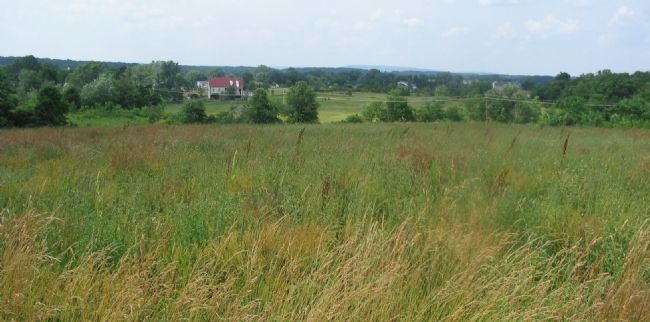
3. Doles' Brigade Advance
Looking north from Barlow Knoll. Doles' Brigade advanced forward from Blocher's Run. The Confederates moved at somewhat an oblique to the Federal lines, centering the advance between the Carlisle Road and Barlow Knoll. The advance met with fierce resistance from both Barlow's and Schurz's Divisions.
More about this marker. At the bottom of the marker are portraits of Generals Barlow and Gordon. In the upper right is a drawing of Battery G, 4th U.S. in action, captioned:
Lt. Bayard Wilkeson commands Battery G, 4th U.S. Artillery, here on Barlow Knoll on the afternoon of July 1. When the Confederates routed the Union infantry, the cannoneers were forced to withdraw.
Wilkeson, age 19, was mortally wounded here when a cannonball nearly severed his leg. Carried to a nearby almshouse, he amputated the leg with a pocketknife. As his dying act, he gave his last canteen of water to a thirsty comrade.
Related markers. Click here for a list of markers that are related to this marker. Barlow's Knoll Virtual Tour by Markers

Photographed By Craig Swain, June 28, 2008
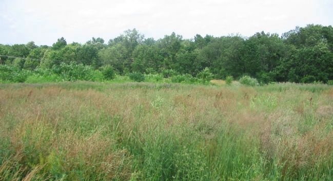
4. Looking East from Barlow Knoll
Gordon's Georgians advanced toward the camera's position from the low ground in front. Their advance had been screened by the trees along Rock Creek. Doles' and Gordon's Brigades hit the Federal lines between 3 and 4 p.m. on July 1st. Their combined efforts drove the Federals off the high ground here, and turned the entire Federal right flank.
Credits. This page was last revised on February 7, 2023. It was originally submitted on September 11, 2008, by Craig Swain of Leesburg, Virginia. This page has been viewed 1,692 times since then and 22 times this year. Last updated on September 23, 2021, by Cameron Brandon of Fredericksburg, Virginia. Photos: 1, 2, 3, 4. submitted on September 11, 2008, by Craig Swain of Leesburg, Virginia. • Devry Becker Jones was the editor who published this page.

