Oregon City in Clackamas County, Oregon — The American West (Northwest)
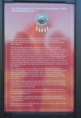
The Confederate Tribes of Grande Ronde Today
Honoring Our Ancestors
Inscription.
The Clowewalla (also known as the Willamette Tumwater) and Clackamas Chinooks were relocated to the Grand Ronde Reservation under the Treaty with the Kalapuya, Etc. 1855 (also known as the Willamette Valley Treaty).
The Clowewalla joined other tribes and bands at the reservation, including the Kalapuya, Molalla, Umpqua, Rogue River (Takelama and Athapaskan), Shasta, Tillamook, and other tribes of the Lower Columbia River peoples. The Lower Columbia River Chinookan tribes, those in the Portland Area, included the Multnomah on both sides of the river at Sauvie Island, and the Watlala (Cascades) on both sides of the river at Cascade rapids, the area now flooded by Bonneville Dam. The "down river people" were called the Kigwalat by the Multnomah, and were those tribes and bands between Sauvie Island and the great bend of the river at Oak Point. The major Kigwalat tribes were the Kathlamet, Clatskanie, and the Skilloot.
The original reservation was approximately 69,000 acres, but was reduced by the Dawes Allotment Act in the early 1900's and Termination (lost of Federal recognition) in 1954. All service were withdrawn by 1956 and the reservation was closed. All remaining reservation lands were sold, except 2.5 acres - the tribal cometery that remained in Tribal possession.
In the 1970's tribal members began efforts to regain Federal recognition. The efforts succeeded in 1983 with Federal recognition and restoration of the Tribal government. In 1988, part of the original reservation 9.811 acres, was returned to the Tribe.
Since restoration, the Tribe has worked to rebuild its tribal community, providing important health, housing, education, and social services and economic self-sufficiency.
Today, the Tribe is working to retain cultural traditions and remains connected to its traditional homeland areas, including Willamette Falls and Oregon City.
The Tribe continues to honor the legacy of their ancestors who have lived here since time immemorial.
Erected by End of the Oregon Trail Interpretive Center.
Topics. This historical marker is listed in this topic list: Native Americans.
Location. 45° 21.864′ N, 122° 35.701′ W. Marker is in Oregon City, Oregon, in Clackamas County. Marker can be reached from Washington Street near Abernethy Road, on the right when traveling north. Touch for map. Marker is at or near this postal address: 1726 Washington Street, Oregon City OR 97045, United States of America. Touch for directions.
Other nearby markers. At least 8 other markers are within walking distance of this marker. Oregon (here, next to this marker); Dr. John McLoughlin (here, next to this marker); Coyote Creates Willamette Falls (here, next to
this marker); To The Banks Of The Willamette (a few steps from this marker); a different marker also named Coyote Creates Willamette Falls (a few steps from this marker); The Trail of Tears (a few steps from this marker); Wagons (a few steps from this marker); Clackamas Chinook (within shouting distance of this marker). Touch for a list and map of all markers in Oregon City.
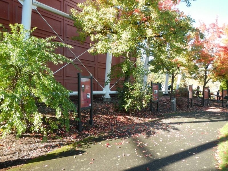
More about this marker. This marker is located next to the End Of Oregon Trail Interpretive Center facing outward towards Abernethy Green.
Credits. This page was last revised on February 13, 2018. It was originally submitted on February 13, 2018, by Barry Swackhamer of Brentwood, California. This page has been viewed 402 times since then and 20 times this year. Photos: 1, 2. submitted on February 13, 2018, by Barry Swackhamer of Brentwood, California.

