Near Fredericksburg in Spotsylvania County, Virginia — The American South (Mid-Atlantic)
Chancellorsville Campaign
Hooker vs. Lee
-Gen. Joseph Hooker, U.S. Army
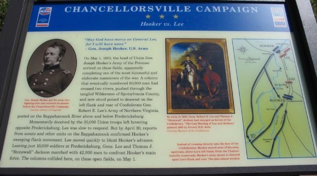
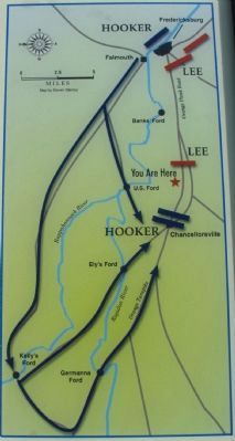
On May 1, 1863, the head of Union Gen. Joseph Hooker's Army of the Potomac arrived on these fields, apparently completing one of the most successful and elaborate maneuvers of the war. A column that eventually numbered 80,000 men had crossed two rivers, pushed through the tangled Wilderness of Spotsylvania County, and now stood poised to descend on the left flank and rear of Confederate Gen. Robert E. Lee's Army of Northern Virginia, posted on the Rappahannock River above and below Fredericksburg.
Momentarily deceived by the 30,000 Union troops left hovering opposite Fredericksburg, Lee was slow to respond. But on April 30, reports from scouts and other units on the Rappahannock confirmed Hooker's sweeping flank movement. Lee moved quickly to blunt Hooker's advance. Leaving just 10,000 soldiers at Fredericksburg, Gens. Lee and Thomas J. "Stonewall" Jackson marched with 42,000 men to confront Hooker's main force. The columns collided here, on these open fields, on May 1.
Erected 2008 by Virginia Civil War Trails.
Topics and series. This historical marker is listed in this topic list: War, US Civil. In addition, it is included in the Virginia Civil War Trails series list. A significant historical year for this entry is 1863.
Location. 38° 17.77′ N, 77° 35.786′ W. Marker is near Fredericksburg, Virginia, in Spotsylvania County. Marker is on Plank Road (Route 3), on the right when traveling east. Located on a 140 acres tract preserved by Central Virginia Battlefields Trust working with Civil War Preservation Trust. Touch for map. Marker is at or near this postal address: 6161 Plank Road, Fredericksburg VA 22407, United States of America. Touch for directions.
Other nearby markers. At least 8 other markers are within walking distance of this marker. A different marker also named Chancellorsville Campaign (here, next to this marker); The First Day at Chancellorsville (here, next to this marker); a different marker also named First Day at Chancellorsville (here, next to this marker); a different marker also named First Day at Chancellorsville (approx. 0.2 miles away); a different marker also named First Day at Chancellorsville (approx. 0.2 miles away); a different marker also named First Day at Chancellorsville (approx. 0.2 miles away); a different marker also named First Day at Chancellorsville (approx. 0.3 miles away); a different marker also named First Day at Chancellorsville (approx. 0.3 miles away). Touch for a list and map of all markers in Fredericksburg.
More about this marker. In the upper left
In the center is a painting of Gens. Lee and Jackson: By early 1863, Gens. Robert E. Lee and Thomas J. "Stonewall" Jackson had emerged as heroes of the Confederacy. "The Last Meeting of Lee and Jackson," painted 1869 by Everett B.D. Julio.
On the right is a campaign map, captioned: Instead of crossing directly into the face of the Confederates, Hooker moved most of his army upstream, above Lee's left flank. From the Chancellorsville crossroads, Hooker's army meant to descend upon Lee's flank and rear. The plan almost worked.
Regarding Chancellorsville Campaign. Additional kiosks and markers nearby detail preservation efforts by local and national organizations which ensured this section of the battlefield, which was not originally included within the National Park Service boundary.
Photographed By Craig Swain, July 25, 2009
4. Waysides at the First Day Battlefield
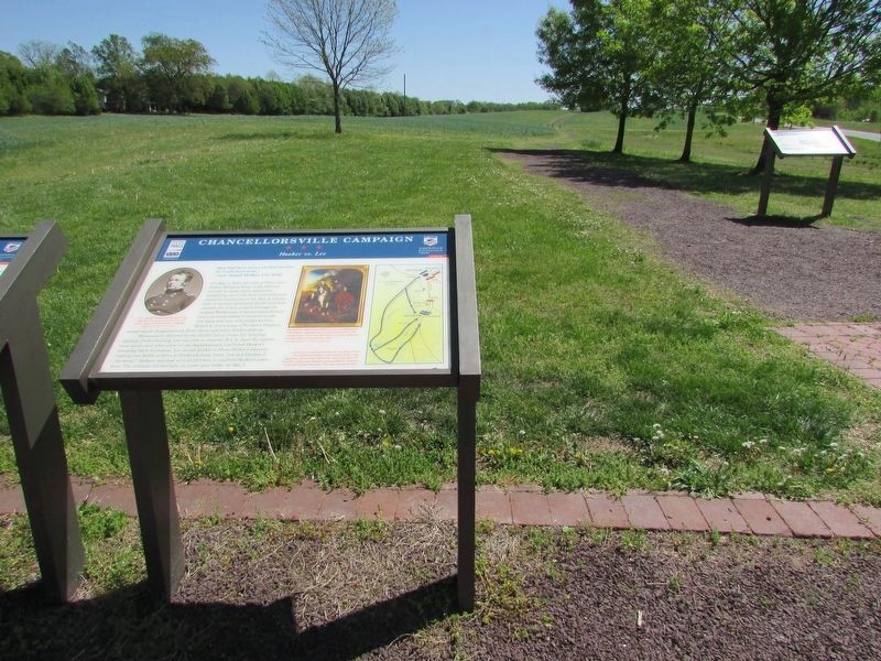
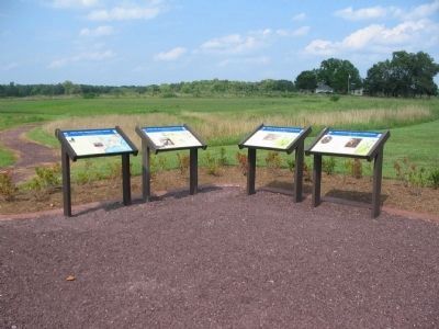
Four Civil War Trails markers stand at the trail head for the First Day of Chancellorsville Battlefield site. On the left is an informational marker detailing the efforts of Civil War Preservation Trust. To it's right is a marker detailing the Area Civil War sites. In the center is the First Day at Chancellorsville - Pivot Point of a Campaign marker. And on the right is the Chancellorsville Campaign - Hooker vs. Lee marker.
Photographed By Craig Swain, August 24, 2008
6. Civil War Preservation Trust
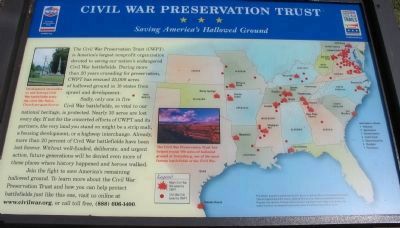
Saving America's Hallowed Ground
Saving America's Hallowed Ground
Double click the photo above for a better view of the map.
The Civil War Preservation Trust (CWPT) is America's largest nonprofit organization devoted to saving our nation's endangered Civil War battlefields. During more than 20 years crusading for preservation, CWPT has rescued 25,000 acres of hallowed ground in 18 states from sprawl and development.
Sadly, only one in five Civil War battlefields, so vital to our national heritage, is protected. Nearly 30 acres are lost every day. If not for the concerted efforts of CWPT and its partners, the very land you stand on might be a strip mall, a housing development, or a highway interchange. Already more than 20 percent of Civil War battlefields have been lost forever. Without well-funded, deliberate, and urgent action, future generations will be denied even more of those places where history happened and heroes walked.
Join the fight to save America's remaining hallowed ground. To learn more about the Civil War Preservation Trust and how you can help protect battlefields just like this one, visit us online at www.civilwar.org, or call toll free, (888) 606-1400.
Photographed By Craig Swain
7. First Day at Chancellorsville
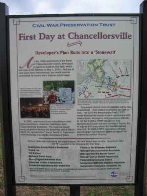
Developer's Plan Runs into a "Stonewall"
Developer's Plan Runs into a "Stonewall"
Included as a history of the marking and preserving of historical sites note of interest.
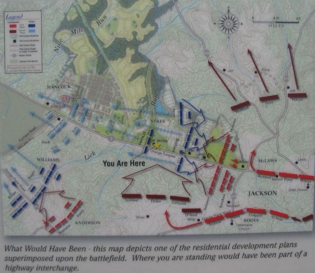
As the 140th anniversary of the Battle of Chancellorsville neared, developers prepared to build on this land, which saw most of the fighting on May 1, 1863. Had any of their plans been implemented, you would now be surrounded by houses and a highway interchange.
In 2002, concerned citizens joined forces with preservationists to create the Coalition to Save Chancellorsville Battlefield. The Coalition fought every proposal to destroy this battlefield, and in March 2003 the Spotsylvania County Board of Supervisors overwhelmingly rejected the development plans.
Concerned citizens were not satisfied just to stop development - they wanted to preserve the land as well. The Civil War Preservation Trust (CWPT) worked behind the scenes to reach agreements with local activists, developers, and government officials. In the fall of 2004, CWPT teamed up with Spotsylvania County and local developer Tricord, Inc., to acquire 140 acres where the heaviest fighting occurred. In 2006, CWPT, Spotsylvania County, and developer Toll Brothers agreed to expand the property by another 74 acres.
Photographed By Craig Swain, July 25, 2009
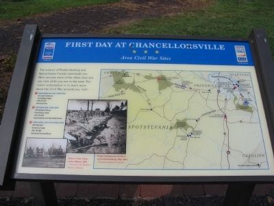
9. Area Civil War Sites
The history of Fredericksburg and Spotsylvania County surrounds you. Here are just some of the other sites you can visit while you are in the area. For visitor information or to learn more about the Civil War around you, visit:
(1) Fredericksburg Battlefield Visitor Center
1013 Lafayette Boulevard,
Fredericksburg, Virginia
(540) 373-6122
(2) Spotsylvania County Visitor Center
4704 Southpoint Parkway,
Fredericksburg, Virginia
(540) 507-7090
(3) Chancellorsville Battlefield Visitor Center
9001 Plank Road,
Spotsylvania, Virginia
(540) 786-2880
Photos depict the Ruins of the Chancellor House, 1865 and Dead Confederate Soldiers at Fredericksburg, May 1863.
Credits. This page was last revised on April 25, 2023. It was originally submitted on September 13, 2008, by Craig Swain of Leesburg, Virginia. This page has been viewed 1,935 times since then and 14 times this year. Last updated on September 10, 2021, by Bradley Owen of Morgantown, West Virginia. Photos: 1. submitted on September 13, 2008, by Craig Swain of Leesburg, Virginia. 2. submitted on March 13, 2009, by Craig Swain of Leesburg, Virginia. 3. submitted on September 13, 2008, by Craig Swain of Leesburg, Virginia. 4. submitted on August 24, 2009, by Craig Swain of Leesburg, Virginia. 5. submitted on April 22, 2023, by Bill Coughlin of Woodland Park, New Jersey. 6. submitted on September 13, 2008, by Craig Swain of Leesburg, Virginia. 7, 8. submitted on November 18, 2007, by Craig Swain of Leesburg, Virginia. 9. submitted on August 24, 2009, by Craig Swain of Leesburg, Virginia. • J. Makali Bruton was the editor who published this page.
