Oregon City in Clackamas County, Oregon — The American West (Northwest)
Gardens
Living History of the Oregon Trail
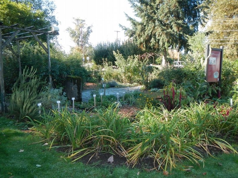
Land brought the settlers west. These gardens demonstrate the critical role growing things played in emigrant life. From practical to nostalgic, these plantings unite many different traditions. Any one pioneer garden would not have had such variety. Settlers in those early year were too busy.
It was a rare woman who didn't bring at least one favorite flower from home. A stranger in a strange land, the pioneer woman determined to preserve beauty and hope - founding new Territorial traditions on memories of home.
Like gardeners to today, emigrants tastes varied. Some brought "romantic" plants like ivy and roses. Others chose ice plant and Christmas cactus. First plantings were usually a single flower protected by a packing crate next to the kitchen door where it could be easily soaked with wash water.
Erected by End of the Oregon Trail Interpretive Center.
Topics and series. This historical marker is listed in these topic lists: Agriculture • Horticulture & Forestry • Settlements & Settlers. In addition, it is included in the Oregon Trail series list.
Location. 45° 21.864′ N, 122° 35.755′ W. Marker is in Oregon City, Oregon, in Clackamas County. Marker can be reached from Washington Street near Abernethy Road, on the right when traveling north. Touch for map. Marker is at or near this postal address: 1726 Washington Street, Oregon City OR 97045, United States of America. Touch for directions.
Other nearby markers. At least 8 other markers are within walking distance of this marker. Old Oregon Trail (here, next to this marker); End of the Oregon Trail (here, next to this marker); Coyote Creates Willamette Falls (within shouting distance of this marker); a different marker also named Coyote Creates Willamette Falls (within shouting distance of this marker); The Confederate Tribes of Grande Ronde Today (within shouting distance of this marker); Oregon (within shouting distance of this marker); Dr. John McLoughlin (within shouting distance of this marker); To The Banks Of The Willamette (within shouting distance of this marker). Touch for a list and map of all markers in Oregon City.
More about this marker. The marker is located in the garden at the western corner of the End of the Oregon Trail Interpretive Center.
Credits. This page was last revised on February 18, 2018. It was originally submitted on February 18, 2018, by Barry Swackhamer of Brentwood, California. This page has been viewed 185 times since then and 8 times this year. Photos: 1, 2. submitted on February 18, 2018, by Barry Swackhamer of Brentwood, California.

