Rock Creek Park in Northwest Washington in Washington, District of Columbia — The American Northeast (Mid-Atlantic)
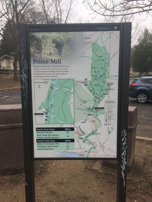
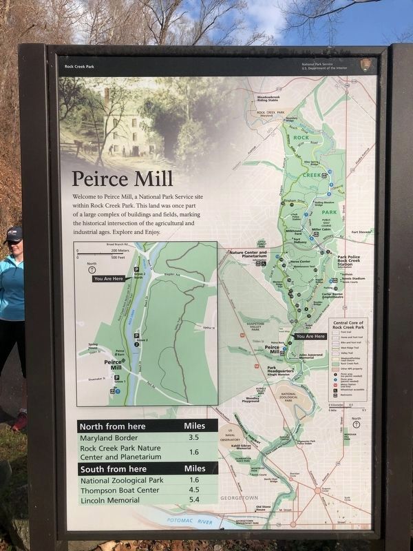
Peirce Mill
Rock Creek Park
— National Park Service, U.S. Department of the Interior —
North from here:
Maryland Border: 3.8 miles
Rock Creek Park Nature Center and Planetarium: 1.9 miles
South from here:
National Zoological Park: 1.3 miles
Thompson Boat Center: 4.2 miles
Lincoln Memorial: 5.1 miles
Erected by National Park Service, U.S. Department of the Interior.
Topics. This historical marker is listed in these topic lists: Agriculture • Industry & Commerce • Parks & Recreational Areas. A significant historical month for this entry is June 1848.
Location. 38° 56.361′ N, 77° 3.149′ W. Marker is in Northwest Washington in Washington, District of Columbia. It is in Rock Creek Park. Marker is on Spring of Freedom Street Northwest east of Shoemaker Street Northwest, on the left when traveling south. Touch for map. Marker is at or near this postal address: 3998 Spring of Freedom Street Northwest, Washington DC 20008, United States of America. Touch for directions.
Other nearby markers. At least 8 other markers are within walking distance of this marker. Michael Kovats de Fabricy (about 300 feet away, measured in a direct line); Peirce Still House (about 400 feet away); The Peirce Family Estate (about 400 feet away); Machine in a Stone Box (about 400 feet away); Pierce Plantation (about 500 feet away); Orchards, Fields, Gardens, Pastures (about 600 feet away); Springhouse (about 600 feet away); Herring Highway (about 600 feet away). Touch for a list and map of all markers in Northwest Washington.
Credits. This page was last revised on January 30, 2023. It was originally submitted on February 24, 2018, by Devry Becker Jones of Washington, District of Columbia. This page has been viewed 223 times since then and 9 times this year. Photos: 1, 2, 3. submitted on February 24, 2018, by Devry Becker Jones of Washington, District of Columbia. 4. submitted on January 6, 2019, by Devry Becker Jones of Washington, District of Columbia. • Bill Pfingsten was the editor who published this page.


