Pleasant Grove West in Chesapeake, Virginia — The American South (Mid-Atlantic)
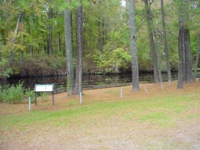
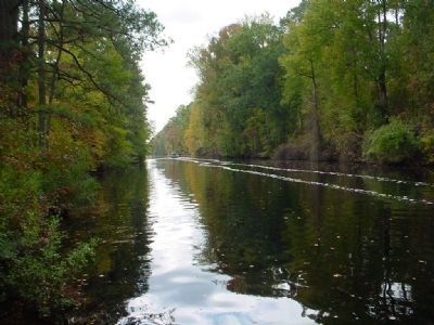
Dismal Swamp Canal
The Battle of South Mills
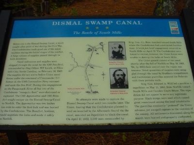
Naval ordinances and supplies were shipped through the canal for the CSS Sea Bird, commanded by Flag Officer W.F. Lynch, at Elizabeth City, North Carolina, on February 10, 1862. The supplies did not arrive before Union naval forces under the command of Commander S.C. Rowan in the USS Commodore Perry rammed and sank the Sea Bird. During this engagement in the Pasquotank River all but two of the Confederate “mosquito fleet” were destroyed or captured. The CSS Appomattox and CSS Beaufort sought escape via the Dismal Swamp Canal to Norfolk. The Appomattox was two inches too wide to enter the first lock and was burned by the Confederates. The Beaufort, however, could negotiate the locks and made it safely to Norfolk.
No attempts were made to capture the Dismal Swamp Canal until two months later. The Union, fearing that the Confederates planned to send an ironclad to the Albermarle Sound via the canal, mounted and expedition to block the canal. On April 17, 1862, 3,000 men commanded by Brig. Gen. J.L. Reno marched toward South Mills where the Confederates had constructed fortifications. A brisk but brief engagement occurred at South Mills on April 19. The Confederates were forced to retreat, however, the Union forces were unable to destroy the locks at South Mills.
The Union gained control of the canal shortly after the fall of Norfolk on May 10, 1862. Yet, by 1863 their control over the region was tenuous. Great quantities of supplies were smuggled through the canal by Southern sympathizers and Confederate guerrillas annoyed the Federals with their periodic raids.
Brig. Gen. Edward A. Wild led a punitive expedition on May 15, 1863, from Norfolk toward South Mills and Camden Court House. The expedition did not appear to serve any legitimate purpose. Black troops were used which caused great resentment among the local inhabitants. The guerrillas constantly “pestered” the Union advance, yet escaped capture in the vastness of the swamp. All settlements discovered along the march were burned and property confiscated.
Erected by Virginia Civil War Trails.
Topics and series. This historical marker is listed in these topic lists: War, US Civil • Waterways & Vessels. In addition, it is included in the Virginia Civil War Trails series list. A significant historical date for this entry is February 10, 1862.
Location. 36° 38.277′ N, 76° 22.373′ W. Marker is in Chesapeake, Virginia. It is in Pleasant Grove West. Marker can be reached from the intersection of Douglas Road (Old U.S. 17) and George Washington Highway (Old U.S. 17), on the right when traveling south. From new US-17S/George Washington Hwy, travel west down Douglas Road 0.6mi to a dead end and the marker located on the west side of Old US-17 which is now the Dismal Swamp Canal Trail. The marker may also be reached by parking at the north or south trailhead and following the DSCT to the marker. Touch for map. Marker is in this post office area: Chesapeake VA 23322, United States of America. Touch for directions.
Other nearby markers. At least 8 other markers are within 4 miles of this marker, measured as the crow flies. Outliers (approx. 0.3 miles away); Stone Mileposts along the Dismal Swamp Canal (approx. 0.6 miles away); The Superintendent's House... from Tolls to Tea (approx. 1.7 miles away); From Towpath...to Highway...to "Toe" path (approx. 1.7 miles away); Glencoe (approx. 2.3 miles away); North West Canal (approx. 2.3 miles away); Herring (Heron) Ditch (approx. 3.1 miles away); Dismal Swamp Canal Trail (approx. 3.3 miles away). Touch for a list and map of all markers in Chesapeake.
Regarding Dismal Swamp Canal. The word "ordinances" appears; should be "ordnances" (no "i").
Related markers. Click here for a list of markers that are related to this marker. Dismal Swamp Canal Trail
Credits. This page was last revised on May 28, 2023. It was originally submitted on November 10, 2010, by Chris Bieber of Chesapeake, Virginia. This page has been viewed 1,992 times since then and 22 times this year. Last updated on November 25, 2022, by Carl Gordon Moore Jr. of North East, Maryland. Photos: 1, 2, 3. submitted on November 10, 2010, by Chris Bieber of Chesapeake, Virginia. • Bernard Fisher was the editor who published this page.


