Pleasant Grove West in Chesapeake, Virginia — The American South (Mid-Atlantic)
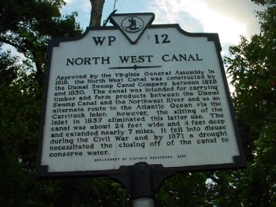
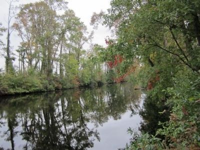
North West Canal
Erected 2003 by Department of Historic Resources. (Marker Number WP-12.)
Topics and series. This historical marker is listed in these topic lists: Man-Made Features • Waterways & Vessels. In addition, it is included in the Virginia Department of Historic Resources (DHR) series list. A significant historical year for this entry is 1818.
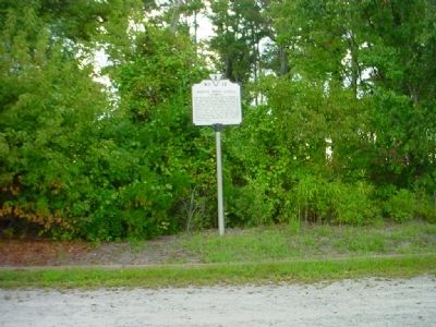
Location. 36° 36.313′ N, 76° 22.883′ W. Marker is in Chesapeake, Virginia. It is in Pleasant Grove West. Marker is on Old U.S. 17, on the right when traveling south. Travel south from Chesapeake to Ballahack Road, then turn north on the Dismal Swamp Canal Trail to the marker near the south trailhead for the DSCT. Touch for map. Marker is in this post office area: Chesapeake VA 23322, United States of America. Touch for directions.
Other nearby markers. At least 8 other markers are within 6 miles of this marker, measured as the crow flies. Glencoe (within shouting distance of this marker); The Superintendent's House... from Tolls to Tea (approx. 0.6 miles away); Dismal Swamp Canal (approx. 2.3 miles away); Outliers (approx. 2.6 miles away); Stone Mileposts along the Dismal Swamp Canal (approx. 2.9 miles away); From Towpath...to Highway...to "Toe" path (approx. 4.1 miles away); Herring (Heron) Ditch (approx. 5.4 miles away); Dismal Swamp Canal Trail (approx. 5.6 miles away). Touch for a list and map of all markers in Chesapeake.
Related markers. Click here for a list of markers that are related to this marker. Dismal Swamp Canal Trail
Credits. This page was last revised on May 28, 2023. It was originally submitted on November 10, 2010, by Chris Bieber of Chesapeake, Virginia. This page has been viewed 1,047 times since then and 35 times this year. Last updated on March 1, 2018, by Cosmos Mariner of Cape Canaveral, Florida. Photos: 1, 2. submitted on November 10, 2010, by Chris Bieber of Chesapeake, Virginia. 3. submitted on October 30, 2011, by Bernard Fisher of Richmond, Virginia. • Bernard Fisher was the editor who published this page.


