Pleasant Grove West in Chesapeake, Virginia — The American South (Mid-Atlantic)
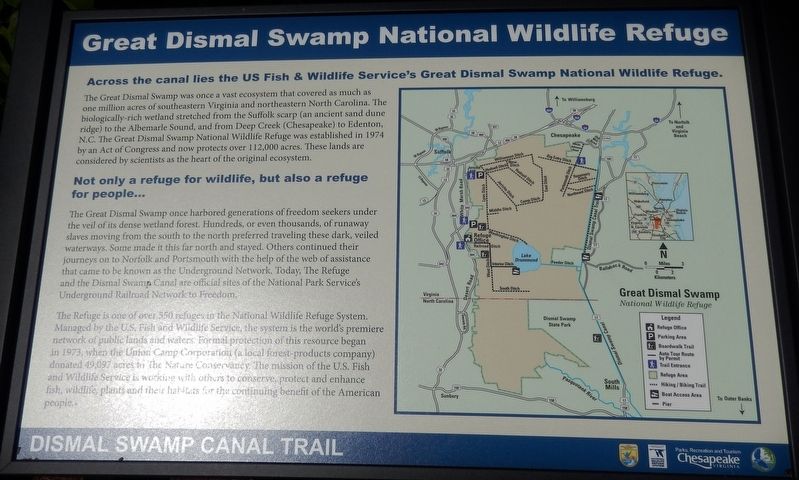
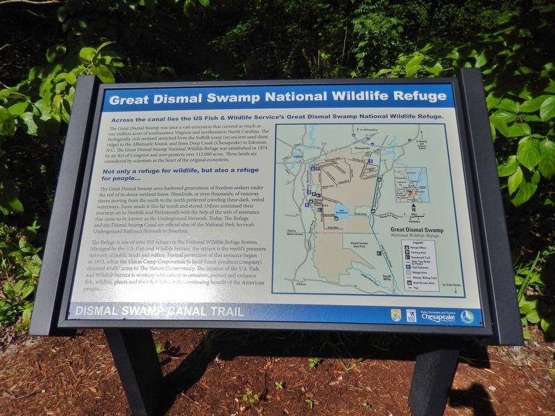
Great Dismal Swamp National Wildlife Refuge
— Dismal Swamp Canal Trail —
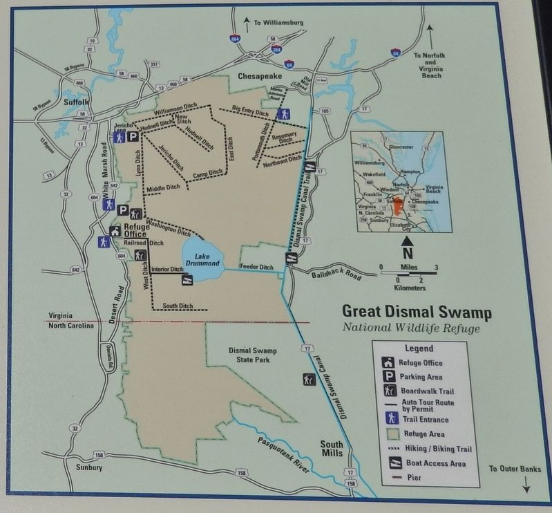
Across the canal lies the US Fish & Wildlife Service's Great Dismal Swamp National Wildlife Refuge.
The Great Dismal Swamp was once a vast ecosystem that covered as much as one million acres of southeastern Virginia and northeastern North Carolina. The biologically-rich wetland stretched from the Suffolk scarp (an ancient sand dune ridge) to the Albemarle Sound, and from Deep Creek (Chesapeake) to Edenton, N.C. The Great Dismal Swamp National Wildlife Refuge was established in 1974 by an Act of Congress and now protects over 112,000 acres. These lands are considered by scientists as the heart of the original ecosystem.
Not only a refuge for wildlife, but also a refuge for people...
The Great Dismal Swamp once harbored generations of freedom seekers under the veil of its dense wetland forest. Hundreds, or even thousands, of runaway slaves moving from the south to the north preferred traveling these dark, veiled waterways. Some made it this far north and stayed. Others continued their journeys on to Norfolk and Portsmouth with the help of the web of assistance that came to be known as the Underground Network. Today, The Refuge and the Dismal Swamp Canal are official sites of the National Park Service's Underground Railroad Network to Freedom.
The Refuge is one of over 550 refuges in the National Wildlife Refuge System. Managed by the U.S. Fish and Wildlife Service, the system is the world's premiere network of public lands and waters. Formal protection of this resource began 1973 when the Union Camp Corporation (a local forest products company) donated 49,097 acres to The Nature Conservancy. The mission of the U.S. Fish and Wildlife Service is working with others to conserve, protect and enhance fish, wildlife, plants and their habitats for the continuing benefit of the American people.
Erected by Parks, Recreation and Tourism, Chesapeake, Virginia.
Topics and series. This historical marker is listed in these topic lists: Abolition & Underground RR • African Americans • Environment • Waterways & Vessels. In addition, it is included in the National Underground Railroad Network to Freedom series list.
Location. 36° 41.237′ N, 76° 21.59′ W. Marker is in Chesapeake, Virginia. It is in Pleasant Grove West. Marker can be reached from Dismal Swamp Canal Trail, 0.4 miles south of George Washington Highway South (Business U.S. 17), on the right when traveling south. Marker is located on the Dismal Swamp Canal Trail, at the North Trailhead. Touch for map. Marker is in this post office area: Chesapeake VA 23323, United States of America. Touch for directions.
Other nearby markers. At least 8 other markers are within
5 miles of this marker, measured as the crow flies. Dismal Swamp Canal Trail (approx. 0.2 miles away); Herring (Heron) Ditch (approx. 0.4 miles away); From Towpath...to Highway...to "Toe" path (approx. 1.7 miles away); Stone Mileposts along the Dismal Swamp Canal (approx. 2.9 miles away); Cody S. Childers (approx. 2.9 miles away); Outliers (approx. 3.2 miles away); Dismal Swamp Canal (approx. 3˝ miles away); Village of Deep Creek (approx. 4.2 miles away). Touch for a list and map of all markers in Chesapeake.
Related markers. Click here for a list of markers that are related to this marker. Dismal Swamp Canal Trail
Also see . . .
1. Great Dismal Swamp History. Beginning in the 1660s, an established community of escaped slaves known as the Great Dismal Swamp maroons lived freely within the Great Dismal Swamp. Most maroons settled in mesic islands, the high and dry parts of the swamp. Maroons were not the only people who lived inside the swamp — some residents had bought their freedom, others were still slaves who lived semi-independently. In addition, some escaped slaves used the swamp as a stop on the Underground Railroad as they made their way further north. Nearby whites often left the maroons alone so long as they paid a quota in logs or shingles. (Submitted on March 1, 2018, by Cosmos Mariner of Cape Canaveral, Florida.)
2. History of the Dismal Swamp
. The Dismal Swamp Canal, hand dug by hired enslaved labor, opened to navigation in 1805 after twelve years of backbreaking work under highly unfavorable conditions. This 22 mile long canal allowed trade between the Chesapeake Bay in Virginia and the Albemarle Sound in North Carolina. African Americans made up thirty percent of the waterman in Camden County in the 1790s and were common sights on local waterways. (Submitted on March 1, 2018, by Cosmos Mariner of Cape Canaveral, Florida.)
3. Moses Grandy. Moses Grandy was an African-American author, abolitionist, and, for more than the first four decades of his life, an enslaved person Grandy helped build the Great Dismal Swamp Canal and learned how to navigate boats. It was that skill that led him to be made commander of several boats that traveled the canal and Pasquotank River, transporting merchandise from Elizabeth City, North Carolina to Norfolk, Virginia. Able to keep a portion of his earnings, Grandy arranged to buy his freedom twice and twice his owners kept the money and held him in slavery. Grandy earned the money to buy his freedom a third time, this time successfully. (Submitted on March 1, 2018, by Cosmos Mariner of Cape Canaveral, Florida.)
Credits. This page was last revised on May 28, 2023. It was originally submitted on March 1, 2018, by Cosmos Mariner of Cape Canaveral, Florida. This page has been viewed 613 times since then and 58 times this year. Photos: 1, 2, 3. submitted on March 1, 2018, by Cosmos Mariner of Cape Canaveral, Florida. • Bernard Fisher was the editor who published this page.


