Memphis in Shelby County, Tennessee — The American South (East South Central)
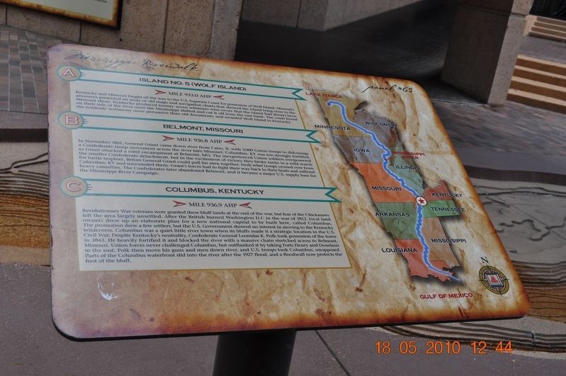
Island No. 5 (Wolf Island)/Belmont, Missouri/Columbus, Kentucky
Panel #63 Mississippi Riverwalk
Inscription.
A) Island No. 5 (Wolf Island)
Mile 933.0 AHP
Kentucky and Missouri fought all the way to the U. S. Supreme Court for possession of Wolf Island. Missouriís attorneys presented an array of old maps and navigation charts that showed the island lying close to the Missouri shore. Kentucky produced twenty-seven witnesses who swore that the island had always been on their side of the river until the Mississippi shifted and cut it off from the east bank. The court found the residents' testimony more persuasive that old documents, and awarded Wolf Island to Kentucky.
B) Belmont, Missouri
Mile 936.8 AHP
In November 1861, General Grant came down river from Cairo, IL with 3,000 Union troops to discourage a Confederate troop movement across the river to Missouri. Columbus, KY was too strongly fortified, so Grant attacked a rebel encampment at Belmont, MO. The inexperienced Union soldiers overpowered the smaller Confederate detachment but in the excitement of victory, they broke ranks in a wild search for trophies. Before General Grant could pull his men together, fresh rebel troops crossed over from Columbus, KY and surrounded them. Grantís forces had to fight their way back to their boats and suffer heavy casualties. The Confederates later abandoned Belmont, and it became a major U.S. Supply base for the Mississippi River Campaign.
C) Columbus, Kentucky
Mile 936.9AHP
Revolutionary War veterans were granted theses bluff lands at the end of the war, but fear of the Chickasaws left the area largely unsettled. After the British burned Washington D.C. in the war of 1812, local landowners drew up an elaborate plan for a new national capital to be built here called Columbus. The promotion drew a few settlers, but the U.S. Government showed no interest in moving to the Kentucky wilderness. Columbus was a quiet little river town when its bluffs made it a strategic location in the U.S. Civil War. Despite Kentuckyís neutrality, Confederate General Leonidas K. Polk took possession of the town in 1861. He headily fortified it and blocked the river with a massive chain stretched across to Belmont, Missouri. Union forces never challenged Columbus but outflanked it by taking Fort Henry and Donelson to the east. Polk then moved his guns and men down the river, and U.S. troops took Columbus, unopposed. Parts of the Columbus waterfront slid into the river after the 1927 flood, and a flood wall now protects the foot of the bluff.
Erected by Mississippi Riverwalk. (Marker Number 63.)
Topics. This historical marker is listed in these topic lists: War, US Civil • War, US Revolutionary • Waterways & Vessels. A significant historical month for this entry is November 1861.
Location. 35° 8.968′ N, 90° 3.507′ W. Marker is in Memphis, Tennessee, in Shelby County. Marker can be reached from Island Drive, 0.8 miles south of West A.W. Willis Avenue when traveling south. Located in Mud Island River Park. Touch for map. Marker is at or near this postal address: 125 N Front Street, Memphis TN 38103, United States of America. Touch for directions.
Other nearby markers. At least 8 other markers are within walking distance of this marker. The Mississippi Riverwalk (here, next to this marker); Island No. 20/Cottonwood Point/Booth Point, Tennessee/Linwood Bend (here, next to this marker); Head of Passes/Pilottown, Louisiana (here, next to this marker); Venice Louisiana/Fort Jackson, Louisiana/Fort St. Phillip (here, next to this marker); Ostrica Lock/Buras, Louisiana/Empire Lock/Nairn, Louisiana (here, next to this marker); Point a La Hache, Louisiana/Magnolia Plantation, Louisiana (here, next to this marker); Junior Crevasse/Poverty Point, Louisiana/Jesuits Bend (here, next to this marker); Belle Chasse, Louisiana/English Turn Bend/Caernarvon Crevasse/Poydras Crevasse (here, next to this marker). Touch for a list and map of all markers in Memphis.
Credits. This page was last revised on March 8, 2018. It was originally submitted on March 8, 2018, by Sandra Hughes Tidwell of Killen, Alabama, USA. This page has been viewed 745 times since then and 67 times this year. Photo 1. submitted on March 8, 2018, by Sandra Hughes Tidwell of Killen, Alabama, USA. • Bernard Fisher was the editor who published this page.
Editor’s want-list for this marker. Wide shot of marker and its surroundings. • Can you help?
