Cumberland Township near Gettysburg in Adams County, Pennsylvania — The American Northeast (Mid-Atlantic)
Pegram's Battalion
Artillery Reserve - Hill's Corps
— Army of Northern Virginia —
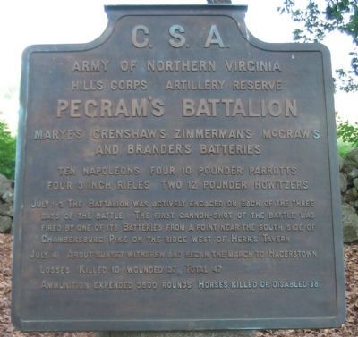
Army of Northern Virginia
Hill's Corps Artillery Reserve
Pegram's Battalion
Marye's, Crenshaw's, Zimmerman's, McGraw's
and Brander's Batteries
Ten Napoleons, Four 10 pounder Parrotts
Four 3 inch Rifles, Two 12 pounder Howizters
July 1-3 The Battalion was actively engaged on each of the three days of the battle. The first from a point near the south side of Chambersburg Pike on the ridge west of Herr's Tavern.
July 4 About sunset withdrew and began the march to Hagerstown.
Losses Killed 10, wounded 37, Total 47.
Ammunition expended 3800 rounds. Horses killed or disabled 38.
Erected 1910 by Gettysburg National Military Park Commission.
Topics. This historical marker is listed in this topic list: War, US Civil. A significant historical month for this entry is July 1775.
Location. 39° 49.227′ N, 77° 14.783′ W. Marker is near Gettysburg, Pennsylvania, in Adams County. It is in Cumberland Township. Marker is on West Confederate Avenue, on the right when traveling south. Located on the McMillan Woods section of Confederate Avenue, just south of the McMillan Woods Youth Campground, in Gettysburg National Military Park. Touch for map. Marker is in this post office area: Gettysburg PA 17325, United States of America. Touch for directions.
Other nearby markers. At least 8 other markers are within walking distance of this marker. Zimmerman's Battery - Pegram's Battalion (within shouting distance of this marker); Crenshaw's Battery - Pegram's Battalion (within shouting distance of this marker); Lane's Brigade (within shouting distance of this marker); Scales's Brigade (within shouting distance of this marker); Marye's Battery - Pegram's Battalion (within shouting distance of this marker); McGraw's Battery - Pegram's Battalion (about 300 feet away, measured in a direct line); Thomas's Brigade (about 300 feet away); Third Army Corps (about 300 feet away). Touch for a list and map of all markers in Gettysburg.
Also see . . . William Pegram. Wikipedia entry (Submitted on December 8, 2022, by Larry Gertner of New York, New York.)

Photographed By Craig Swain, June 28, 2008
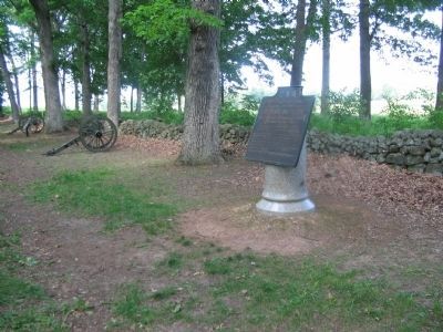
2. Pegram's Battalion Tablet
The tree beside the tablet is a "witness tree" which dates to the time of the battle. Three other trees nearby also date to 1863. Small tags on the trees provide a reference number by which the park service catalogs these living artifacts of the battle.

Photographed By Craig Swain
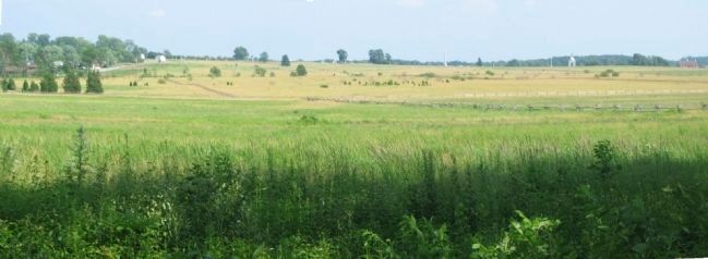
3. Pegram's Battalion Field of Fire
Through most of July 2 and 3, the five batteries of Pegram's Battalion stood on the edge of McMillan Woods looking to the east at Cemetery Ridge. In this view, from left to right, the key points are the white buildings of the Brian Farm, General Meade's equestrian statue, the "Copse of Trees," the spire of the U.S. Regulars Monument, the domed Pennsylvania Monument, and the the red Codori Farm house. Federal batteries at a stone wall, the section known as "the Angle," between the Meade statue and the Copse of Trees received considerable attention from the Confederate gunners on July 3.
Credits. This page was last revised on February 7, 2023. It was originally submitted on September 15, 2008, by Craig Swain of Leesburg, Virginia. This page has been viewed 1,048 times since then and 41 times this year. Photos: 1, 2. submitted on September 15, 2008, by Craig Swain of Leesburg, Virginia. 3. submitted on September 16, 2008, by Craig Swain of Leesburg, Virginia.
