Bayou Teche
Bayou Teche National Wildlife Refuge
— Atchafalaya Water Heritage Trail —
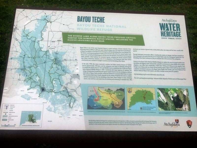
The diverse land along the Bayou Teche provides critical habitat for numerous native species, including the elusive Louisiana black bear.
Bayou Teche is one of the most important bayous in south Louisiana. A former channel of the Mississippi River (3,800 to 5,500 years ago), today the bayou runs 125 miles from its headwaters at Bayou Courtableau in Port Barre to its convergence with the Atchafalaya River near Morgan City.
The Teche’s multi-layered geological history can be found in the soils of its natural levees, from heavy sands carried by the Mississippi to red clay from the Red River. The diverse land along the bayou provides critical habitats for numerous species, including the elusive Louisiana black bear (Ursus americanus luteolus), one of 16 subspecies of the American black bear (Ursus americanus) and a resident of southern Louisiana and the Atchafalaya River Basin.
In the early 1990s this native mammal’s numbers had fallen (mainly because of habitat loss) to approximately 100 bears, and the subspecies was listed as federally endangered. To combat this decline the U.S. Fish and Wildlife Service established the 9,028-acre Bayou Teche National Wildlife Refuge in 2001. Combined with large expanses of swamps, this refuge of bottomland hardwoods and cypress-tupelo forests in six non-contiguous units on
both sides of Bayou Teche provides conducive habitats for Louisiana black bears to roam. The Louisiana black bear’s health depends on the variety of habitats that exist in a deltaic wetland environment like the Atchafalaya River Basin. Bears forage on mast, including acorns, nuts and fruit, and create dens for birthing and wintering in secluded sites. Den structures can consist of ground nests, woody debris piles, tree snags and live trees—usually bald cypress.Through dedicated conservation efforts, including the creation of refuges, local bear populations have recovered to the point that they are no longer listed under the Endangered Species Act. The Atchafalaya River Basin continues to play an essential role in the survival of this subspecies.
Visitors to the Bayou Teche National Wildlife Refuge can explore the area via several paddle trails that follow old logging canals and provide a peaceful environment to view wildlife such as birds, alligators, river otters and, occasionally, a black bear. Fishing and hiking are also popular here, though most hiking trails are closed during hunting season. Bayou Teche itself has also become a popular recreational avenue as the Bayou Teche Paddle Trail Corridor, part of the National Park Service’s National Water Trails System, and offers multiple access points for paddlers.
Visit Atchafalaya.org for more information about
this site.This site’s geology/geomorphology: Holocene deltaic deposits of Teche course of Mississippi River
Erected by State of Louisiana and National Park Service.
Topics and series. This historical marker is listed in these topic lists: Environment • Waterways & Vessels. In addition, it is included in the Atchafalaya Water Heritage Trail series list.
Location. 29° 44.411′ N, 91° 27.186′ W. Marker is in Franklin, Louisiana, in St. Mary Parish. Marker is at the intersection of Levee Road and Alice C Road (Parish Road 16), on the left when traveling north on Levee Road. Touch for map. Marker is in this post office area: Franklin LA 70538, United States of America. Touch for directions.
Other nearby markers. At least 8 other markers are within 5 miles of this marker, measured as the crow flies. A different marker also named Bayou Teche (here, next to this marker); Swamps on the Cusp of Change (about 500 feet away, measured in a direct line); Cypress Trees (about 700 feet away); Murphy James Foster (approx. 3.2 miles away); Franklin's Historic Lampposts (approx. 4.1 miles away); Edward V. Loustalot (approx. 4½ miles away); St. Mary Parish Courthouse War Memorial (approx. 4½ miles away); St. Mary Parish Confederate Soldiers Monument (approx. 4½ miles away). Touch for a list and map of all markers in Franklin.
More about
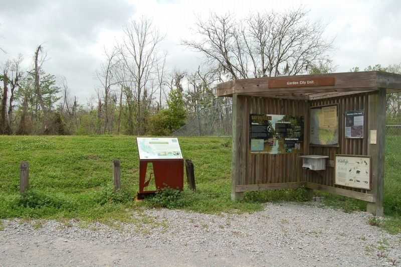
this marker. Located at the trail head for the Bayou Teche National Wildlife Refuge - Garden City Unit walking trail.
Credits. This page was last revised on August 18, 2023. It was originally submitted on March 19, 2018, by Cajun Scrambler of Assumption, Louisiana. This page has been viewed 246 times since then and 13 times this year. Photos: 1, 2. submitted on March 19, 2018.

