Charlestown in Boston in Suffolk County, Massachusetts — The American Northeast (New England)
The Training Field's Struggle for Survival
Charlestown Training Field / Winthrop Square
Road projects in two centuries endangered the “communitie’s meeting place.”
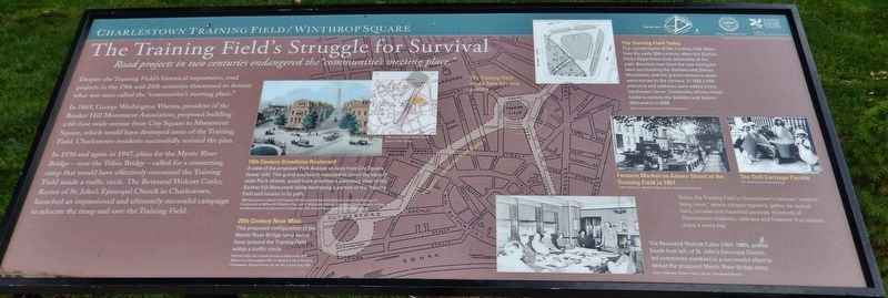
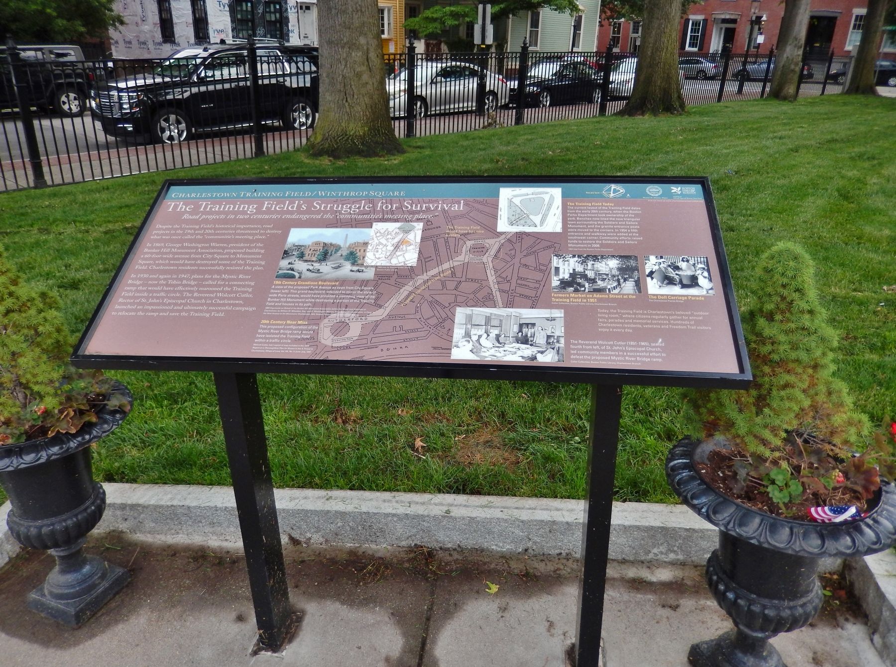
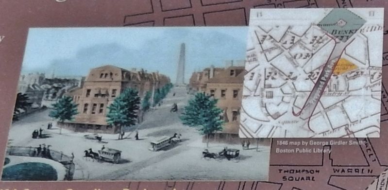
Despite the Training Field's historical importance, road projects in the 19th and 20th centuries threatened to destroy what was once called the “communitie's meeting place." In 1869, George Washington Warren, president of the Bunker Hill Monument Association, proposed building 60-foot-wide avenue from City Square to Monument Square, which would have destroyed some of the Training Field. Charlestown residents successfully resisted the plan.
In 1930 and again in 1947, plans for the Mystic River Bridge — now the Tobin Bridge — called for a connecting ramp that would have effectively marooned the Training Field inside a traffic circle. The Reverend Wolcott Curler, Rector of St. John's Episcopal Church in Charlestown, launched an impassioned and ultimately successful campaign to relocate the ramp and save the Training Field.
Erected by Boston Parks & Recreation.
Topics. This historical marker is listed in these topic lists: Bridges & Viaducts • Parks & Recreational Areas • Roads & Vehicles.
Location. 42° 22.444′ N, 71° 3.62′ W. Marker is in Boston, Massachusetts, in Suffolk County. It is in Charlestown. Marker can be reached from Common Street south of Winthrop Street, on the left when traveling south. Marker is located on the Freedom Trail walkway, within the Training Field, a block away from the Bunker Hill Monument. Touch for map. Marker is at or near this postal address: 74 Park St, Charlestown MA 02129, United States of America. Touch for directions.
Other nearby markers. At least 8 other markers are within walking distance of this marker. Three Centuries of Use & Transformation (within shouting distance of this marker); American Soldiers Killed June 17, 1775 (within shouting distance of this marker); Deacon Larkin House (about 600 feet away, measured in a direct line); John Hurd House (about 600 feet away); Massachusetts Gate (about 600 feet away); The Freedom Trail (about 700 feet away); Connecticut Gate (about 700 feet away); Vietnam/Korean Conflict Memorial (about 700 feet away). Touch for a list and map of all markers in Boston.
Related markers. Click here for a list of markers that are related to this marker. Charlestown Training Field
Also see . . .
1. Charlestown's "Outdoor Room" has an important history as a memorial to fallen soldiers.
The Training Field started life in the 1640s as a training ground for colonial militia. On the field, which also was used for farm land, soldiers gathered for military exercises. On their march into Charlestown in 1775, colonials mustered in the field before meeting the British advance at Breed's Hill. Along with most of the town the
Photographed By Cosmos Mariner, June 19, 2017
2. Marker detail: 19th Century Grandiose Boulevard
A view of the proposed Park Avenue, as seen from City Square (lower left). This grand boulevard, intended to mirror the style wide Paris streets, would have provided a sweeping view of the Bunker Hill Monument while destroying a portion of the Training Field and houses in its path.
2. Tobin Bridge / Mystic River Bridge.
The Maurice J. Tobin Memorial Bridge (formerly and still sometimes referred to as the Mystic River Bridge or less often the Mystic/Tobin Bridge) is a cantilever truss bridge that spans more than two miles from Boston to Chelsea over the Mystic River in Massachusetts. The bridge is the largest in New England. (Submitted on March 21, 2018, by Cosmos Mariner of Cape Canaveral, Florida.)

Photographed By Cosmos Mariner, June 19, 2017
3. Marker detail: 20th Century Near Miss
This proposed configuration of the Mystic River Bridge ramp would have isolated the Training Field within a traffic circle.
The Reverend Wolcott Cutler seated fourth from left, of St. John's Episcopal Church, led community members in a successful effort to defeat the proposed Mystic River Bridge ramp.
The Reverend Wolcott Cutler seated fourth from left, of St. John's Episcopal Church, led community members in a successful effort to defeat the proposed Mystic River Bridge ramp.
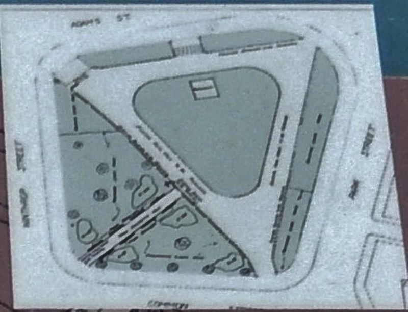
4. Marker detail: The Training Field Today
The current layout of the Training field dates from the early 20th century, when the Boston Parks Department took ownership of the park. Benches now lined the new triangular lawn surrounding the Soldiers and Sailors Monument, and the granite entrance posts were moved to the corners. In 1954 a fifth entrance and walkway were added at the southwest corner. Community efforts raised funds to restore the Soldiers and Sailors Monument in 2008.
Photographed By Cosmos Mariner, June 19, 2017
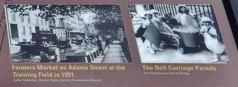
5. Marker detail: Farmer's Market & Doll Carriage Parade
Today, the Training Field is Charlestown's beloved "outdoor living room," where citizens regularly gather for annual fairs, parades and memorial services. Hundreds of Charlestown residents, veterans and Freedom Trail visitors enjoy it every day.
Credits. This page was last revised on January 30, 2023. It was originally submitted on March 21, 2018, by Cosmos Mariner of Cape Canaveral, Florida. This page has been viewed 238 times since then and 21 times this year. Photos: 1, 2, 3, 4, 5, 6. submitted on March 21, 2018, by Cosmos Mariner of Cape Canaveral, Florida. • Andrew Ruppenstein was the editor who published this page.
