Columbia Heights in Northwest Washington in Washington, District of Columbia — The American Northeast (Mid-Atlantic)
Main Street
Cultural Convergence
— Columbia Heights Heritage Trail —
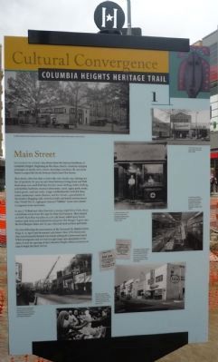
Fourteenth Street has always been the business backbone of Columbia Heights. Beginning in the 1890s, electric streetcars dropped passengers at nearly every corner, attracting commerce. By 1925 storefronts occupied the blocks between Euclid and Otis Streets.
Most stores, often less than 20 feet wide, were family run and offered one line of products. In 192 on 14th Street between Irving Street and Park Road alone, you could find hats, bicycles, men's clothing, ladies’ clothing, automobiles, hardware, musical instruments, candy, cigars, paint, meats, baked goods, and real estate. Larger establishments included drug stores, restaurants, movie theaters, and the Arcade, a granddaddy to the modern shopping mall, with food stalls and family entertainment. After World War II, nightspots featured “hillbilly” music and catered to migrants from rural states.
In 1927 J. Willard and Alice Marriott, a young couple from Utah, chose a storefront on the west side of 14th Street for their first business. The opened an A&W Root Beer franchise at 3128 14th Street, added spicy Southwestern style food, and dubbed the enterprise Hot Shoppe. It grew into the Hot Shoppes chain, and by 1957, Marriott food services and hotels.
The riots following the assassination of the Reverend Dr. Martin Luther King, Jr., in April 1968 devastated 14th Street. Most of the businesses that weren’t actually burned out closed, setting off a downward spiral. While immigrants and activists brought some new enterprises in the 1980s, it took the opening of the Columbia Heights Metrorail station in 1999 to begin the latest revival.
Erected by Cultural Tourism DC. (Marker Number 1.)
Topics and series. This historical marker is listed in these topic lists: African Americans • Government & Politics • Industry & Commerce • Settlements & Settlers. In addition, it is included in the Columbia Heights Heritage Trail series list. A significant historical month for this entry is April 1968.
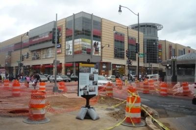
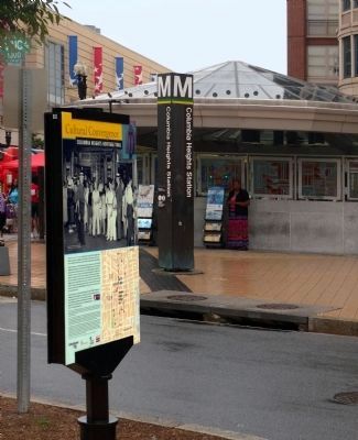
Location. 38° 55.718′ N, 77° 1.944′ W. Marker is in Northwest Washington in Washington, District of Columbia. It is in Columbia Heights. Marker is at the intersection of Irving Street Northwest and 14th Street Northwest, on the right when traveling east on Irving Street Northwest. Touch for map. Marker is in this post office area: Washington DC 20009, United States of America. Touch for directions.
Other nearby markers. At least 8 other markers are within walking distance of this marker. The Latino Intelligence Center (about 500 feet away, measured in a direct line); Amusement Palace (about 500 feet away); A City in Itself (about 700 feet away); Literary Lights (approx. 0.2 miles away); The Wilson Center (approx. 0.2 miles away); Turbulence and Change (approx. 0.2 miles away); After the Hard Times (approx. 0.2 miles away); Everyday People (approx. 0.2 miles away). Touch for a list and map of all markers in Northwest Washington.
More about this marker. [Caption, photo in upper left of marker:]
In 1926, the Barker Motor Company and Gude’s Flowers occupied the site of today’s Metro Station, across Irving Street. (Library of Congress.)
[Caption, photo in upper right of marker:]
These businesses stood across 14th Street from this sign in 1960. (Collection of Ann Graham.)
[Caption, photo in upper center of marker:]
J. Willard Marriott, in the doorway, and his first employee, Robert Smice, pose at the first Hot Shoppe, 1927. (Marriott Corporation.)
[Caption, photo in center left of marker:]
In 1946, these ladies in starched withe uniforms and signature pocket hankies served scratch baked pies at Sholl’s Georgian Cafeteria, 3027 14th St. (Library of Congress.)
[Caption, photos in lower right of marker:]
The Ding How (later Starlight) restaurant and night club
once occupied the block of Irving St. to your left. A section of the Pontiac dealership facade can be seen today. (Collection of Harold Silver.)
[Caption, photo in lower left of marker:]
Federal troops in gas masks approached from Hiatt Pl. as fire fighters set up to battle a blaze on Irving St. during the 1968 disturbances. (Washington Post.)
[Caption, photo in lower center of marker:]
After the riots closed many businesses, Nation of Islam members opened Shabazz Restaurant at 14th and Irving Sts., seen in 1973. (Washington Post.)
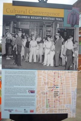
[Caption for picture on the marker's reverse:]
Saturday regulars line up at Harry Crandall’s Savoy Theater to see Custer’s Last Stand in 1936. (Collection of Payette Family.)
Also see . . . Columbia Heights, Washington, D.C. (Submitted on October 27, 2009, by Richard E. Miller of Oxon Hill, Maryland.)
Credits. This page was last revised on January 30, 2023. It was originally submitted on October 27, 2009, by Richard E. Miller of Oxon Hill, Maryland. This page has been viewed 1,869 times since then and 18 times this year. Last updated on March 7, 2019, by Devry Becker Jones of Washington, District of Columbia. Photos: 1, 2, 3. submitted on October 27, 2009, by Richard E. Miller of Oxon Hill, Maryland. 4, 5, 6. submitted on July 19, 2015, by Allen C. Browne of Silver Spring, Maryland. • Bill Pfingsten was the editor who published this page.
