Near Sylvania in Screven County, Georgia — The American South (South Atlantic)
General Samuel Elbert
Inscription.
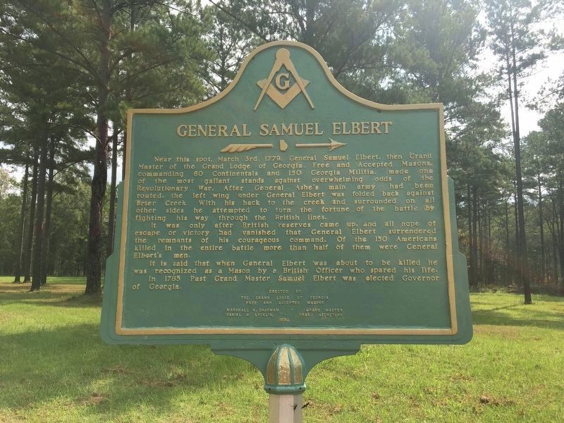
Near this spot, March 3rd, 1779, General Samuel Elbert, then Grand Master of the Grand Lodge of Georgia, Free and Accepted Masons, commanding 60 Continentals and 150 Georgia Militia, made one of the most gallant stands against overwhelming odds of the Revolutionary War. After General Ashe`s main army had been routed, the left wing under General Elbert was folded back against Brier Creek. With his back to the creek and surrounded on all other sides he attempted to turn the fortune of the battle by fighting his way through the British lines.
It was only after British reserves came up, and all hope of escape or victory had vanished that General Elbert surrendered the remnants of his courageous command. Of the 150 Americans killed in the entire battle more than half of them were General Elbert`s men.
It is said that when General Elbert was about to be killed he was recognized as a Mason by a British Officer who spared his life. In 1785 Past Grand Master Samuel Elbert was elected Governor of Georgia.
Erected 1954 by The Grand Lodge of Georgia Free and Accepted Masons Marshall A. Chapman - Grand Master Daniel W. Locklin - Grand Secretary.
Topics. This historical marker is listed in these topic lists: Fraternal or Sororal Organizations • Patriots & Patriotism • War, US Revolutionary. A significant historical month for this entry is March 1779.
Location. 32° 48.336′ N, 81° 28.274′ W. Marker is near Sylvania, Georgia, in Screven County. Marker is on an unnamed gravel road, 0.1 miles south of Brannen's Bridge Road, on the right when traveling south. It is at the Battle of Brier Creek Revolutionary War Memorial. From the intersection of Old River Road and Pine Grove Inn Road, go southeast one mile. During this mile the name of the road changes to Brannens Bridge Road. Turn left onto a gravel road at the sign reading “Tuckahoe Wildlife Management Area — Battle of Brier Creek Revolutionary War Memorial.” The memorial will be one tenth of a mile down the gravel road at the fork. Touch for map. Marker is in this post office area: Sylvania GA 30467, United States of America. Touch for directions.
Other nearby markers. At least 8 other markers are within 9 miles of this marker, measured as the crow flies. Battle of Brier Creek - Mar. 3, 1779 (a few steps from this marker); Washington Slept Here (approx. 6 miles away); Wesleyanna Memorial Church (approx. 6.4 miles away); John Abbot (approx. 8.9 miles away); The Goodall House (approx. 8.9 miles away); The 14th Corps (approx. 8.9 miles away); Washington's Route (approx. 8.9 miles away); Jacksonboro (approx. 8.9 miles away). Touch for a list and map of all markers in Sylvania.
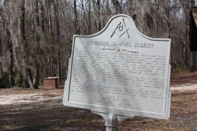
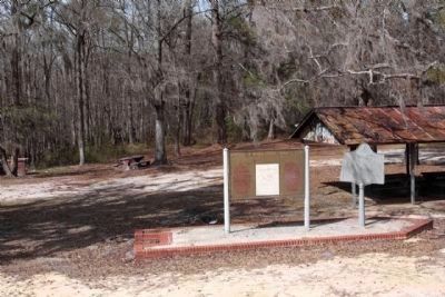
More about this marker. Marker was originally located at approximately 32° 48.651′ N, 81° 29.035′ W. Marker was near Sylvania, Georgia, in Screven County. It was on Brannen's Bridge Road, 1.1 miles south of Old River Road, on the left. The marker adjoined the Georgia marker “Battle of Brier Creek - Mar. 3, 1779” in a small park with a picnic pavilion at Brier Creek.
Also see . . . Samuel Elbert (1740-1788). New Georgia Encyclopedia website entry (Submitted on September 21, 2008, by Bill Pfingsten of Bel Air, Maryland.)
Photographed By Mike Stroud, 2009
5. Previous location of this and the adjacent marker
General Samuel Elbert Marker (r) shared location with Battle of Brier Creek Marker (l) at the picnic area on Brannens Bridge Road at today's bridge over Brier Creek, two tenths of a mile by road from its current location.
Credits. This page was last revised on September 2, 2023. It was originally submitted on September 20, 2008, by David Seibert of Sandy Springs, Georgia. This page has been viewed 2,064 times since then and 44 times this year. Last updated on September 2, 2023, by Barry Snyder of Melbourne, Florida. Photos: 1. submitted on September 2, 2023, by Barry Snyder of Melbourne, Florida. 2. submitted on January 17, 2021, by Larry Gertner of New York, New York. 3. submitted on September 20, 2008, by David Seibert of Sandy Springs, Georgia. 4, 5. submitted on February 22, 2009, by Mike Stroud of Bluffton, South Carolina. • J. J. Prats was the editor who published this page.
