Cotton Plant in Woodruff County, Arkansas — The American South (West South Central)
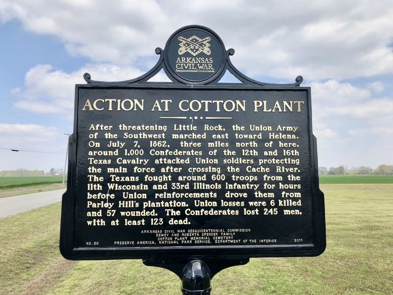
Action at Cotton Plant
Erected 2011 by Arkansas Civil War Sesquicentennial Commission, Dewey and Roberta Spencer Family, Cotton Plant Memorial Cemetery, Preserve America, National Park Service, Department of the Interior. (Marker Number 20.)
Topics and series. This historical marker is listed in this topic list: War, US Civil. In addition, it is included in the Arkansas Civil War Sesquicentennial Commission series list. A significant historical date for this entry is July 7, 1862.
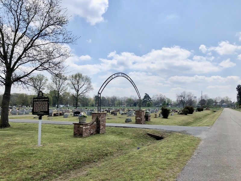
Location. 35° 0.495′ N, 91° 15.493′ W. Marker is in Cotton Plant, Arkansas, in Woodruff County. Marker is on Arkansas Route 306 north of Cemetery Road, on the right when traveling north. Located at Cotton Plant Memorial Cemetery. Touch for map. Marker is in this post office area: Cotton Plant AR 72036, United States of America. Touch for directions.
Other nearby markers. At least 8 other markers are within 10 miles of this marker, measured as the crow flies. Woodruff County Courthouse (approx. 0.3 miles away); The Battle of Cache River or Cotton Plant (approx. 0.4 miles away); Sister Rosetta Tharpe (approx. half a mile away); American Legion Memorial (approx. 9.1 miles away); 100 West Cyprus Street (approx. 9.1 miles away); 1921 Brass Bell (approx. 9.1 miles away); Louis Jordan (approx. 9.1 miles away); Willie Cobbs (approx. 9.2 miles away). Touch for a list and map of all markers in Cotton Plant.
Also see . . . Wikipedia article on the Battle of Cotton Plant. (Submitted on April 13, 2018, by Mark Hilton of Montgomery, Alabama.)
Credits. This page was last revised on April 13, 2018. It was originally submitted on April 13, 2018, by Mark Hilton of Montgomery, Alabama. This page has been viewed 448 times since then and 38 times this year. Photos: 1, 2. submitted on April 13, 2018, by Mark Hilton of Montgomery, Alabama.

