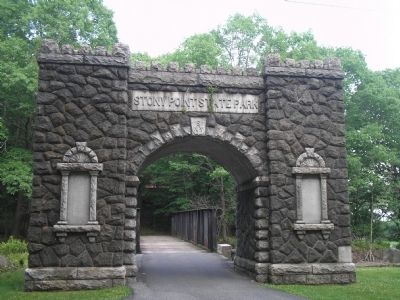
Stony Point in Rockland County, New York — The American Northeast (Mid-Atlantic)
British Defenses: The Outer Works
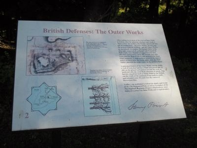
After cutting down most of the trees at Stony Point to reduce cover for potential attackers and create a “field of fire” for artillery, the British constructed two sets of fortifications – the Outer Works, located near the present museum building – and the Upper Works, an unenclosed, incomplete fort located closer to the river and comprised of earth and rock formations. Both works were situated on rugged terrain that afforded commanding views. The British navy also controlled the Hudson River, and protected the Stony Point peninsula. A small gunboat guarded the shallow waters of Haverstraw Bay in the south, while the HMS Vulture patrolled the deeper water on the northern flank.
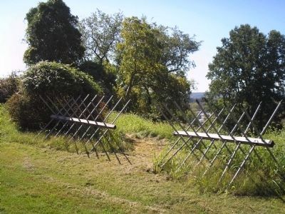
A principal feature of the Outer Works was an abatis, a wall of trees that had been felled and placed side by side on the ground and pointed toward the west, or landward side, the most likely direction of attack. This barrier, one of two built at Stony Point by the British, ran the width of the peninsula from north to south, and extended some 50 yards into the waters of Haverstraw Bay.
Artillery was positioned to defend the abatis, and troops of the 17th Regiment of Foot, as well as Grenadiers of the 71st Highland Regiment (Fraser’s Highlanders), were deployed to protect the Outer Works and to repel invaders.
Erected by Stony Point Battlefield State Historic Site.
Topics. This historical marker is listed in these topic lists: Notable Events • Notable Places • War, US Revolutionary.
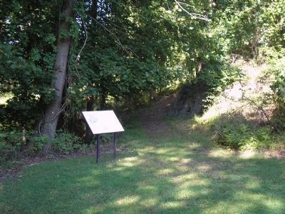
Location. 41° 14.497′ N, 73° 58.511′ W. Marker is in Stony Point, New York, in Rockland County. Marker can be reached from Stony Point Park Road, on the left when traveling east. The marker is found in the British camp located near the Stony Point Museum. Touch for map. Marker is in this post office area: Stony Point NY 10980, United States of America. Touch for directions.
Other nearby markers. At least 8 other markers are within walking distance of this marker. The American Strategy (a few steps from this marker); 17th British Regiment of Foot (a few steps from this marker); Stony Point Battlefield (within shouting distance of this marker); "I … imagined them to be British Troops, but found my mistake by being wounded and taken prisoner." (within shouting distance of this marker); The British Occupy Stony Point (within shouting distance of this marker); Capture of Stony Point (within shouting distance of this marker); Fraser’s Highlanders (about 300 feet away, measured in a direct line); “By the light occasioned by the flash of the gun I could perceive a body of them...” (about 300 feet away). Touch for a list and map of all markers in Stony Point.
More about this marker.
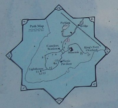
The upper left of the marker features an 18th-century map of Stony Point Battlefield by British Lt. William Marshall, 63rd Regiment of Foot showing the outer abatis. Map is reproduced courtesy of The Historical Society of Pennsylvania. Below this is a “Drawing of an abatis, from A Complete Treatise on Field Fortification, by Dennis Hart Mahan.” The lower left of the marker contains a map of the walking tour of the Stony Point Battlefield.
Related markers. Click here for a list of markers that are related to this marker. This series of markers follow the walking tour of the Stony Point Battlefield.
Also see . . .
1. Stony Point Battlefield State Historic Site. New York State Parks, Recreation and Historic Preservation website entry (Submitted on September 20, 2008, by Bill Coughlin of Woodland Park, New Jersey.)
2. The Battle of Stoney (sic) Point. American Revolution War website entry (Submitted on September 20, 2008, by Bill Coughlin of Woodland Park, New Jersey.)
Credits. This page was last revised on August 24, 2021. It was originally submitted on September 20, 2008, by Bill Coughlin of Woodland Park, New Jersey. This page has been viewed 1,111 times since then and 25 times this year. Photos: 1, 2, 3, 4, 5. submitted on September 20, 2008, by Bill Coughlin of Woodland Park, New Jersey.
