Erie in Erie County, Pennsylvania — The American Northeast (Mid-Atlantic)
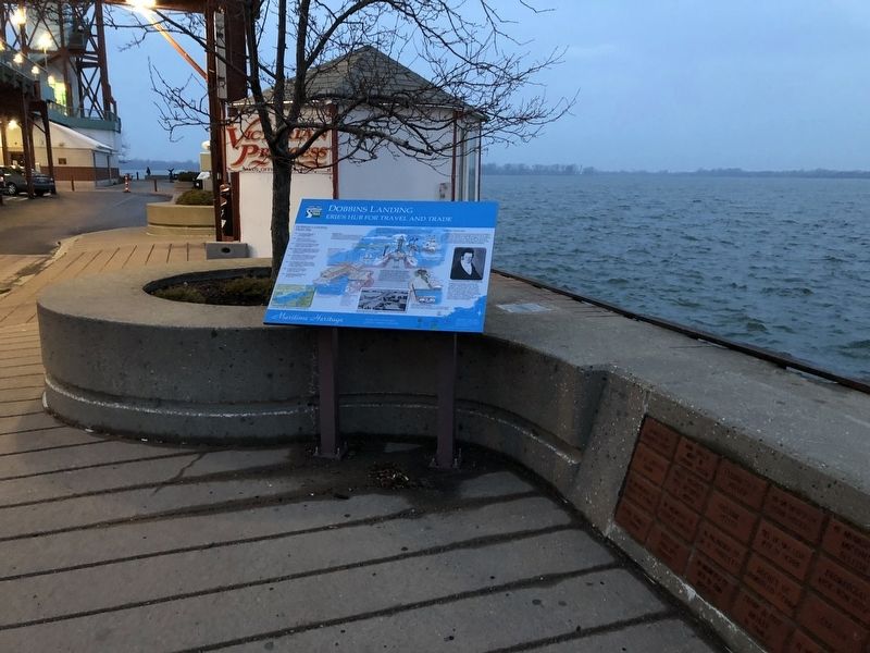
Dobbins Landing
Erie's Hub for Travel and Trade
— Great Lakes Seaway Trail —
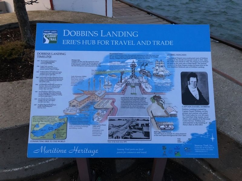
Dobbins Landing Timeline
1995
Bicentennial Tower built to commemorate the 200th anniversary of Erie.
1986
Public Dock renamed Dobbins Landing in honor of pioneer mariner Daniel Dobbins.
1926
Nicholson Ferry to Port Dover begins operation from the public dock and provides service until 1931.
1909
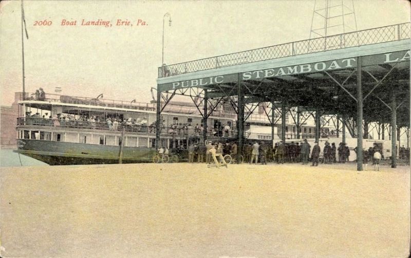
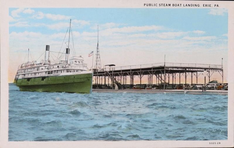
City of Erie assumes possession of State Street dock and builds public steamboat landing on the northern end. Structure still visible today.
1844
USS Michigan (Wolverine) assembled in Erie and stationed in the East Basin where it serves as a U.S. naval and reserve ship until 1923.
1843
Erie's Extension Canal opens, linking city to Allegheny River and Pittsburgh using the East Basin as staging, loading, and canal origin point.
1833
City extends State Street into Presque Isle Bay and creates east and west slips.
1807
Shipping magnate Rufus Reed builds wharfs along the Erie bay front.
Since its construction in 1815, the pier has been a connecting point for people and goods traveling across Presque Isle Bay, on the Great Lakes, and to the interior U.S.
Presque Isle
Presque Isle Bay and the peninsula which protects it was created by the last glacier and is the primary reason native Americans and the first Europeans were attracted to the area.
Bicentennial Tower
Built to commemorate Erie's Bicentennial celebration in 1995, the tower rises 187 feet above Dobbins Landing affording spectacular views of the Presque Isle Bay, Presque Isle State Park, Lake Erie, and the city of Erie.
Lake Schooner (1800s)
Before the railroads, these large sailing vessels carried bulk materials such as lumber, coal, ore, and grain.
Erie Boat (1870 - 1910)
A unique style of sail powered fishing vessel developed in Erie.
Ferry Boat (1926 - 1931)
Passengers traveled between Port Dover, Ontario and Erie on the Nicholson Line ferries. Smaller boats carried tourists across and around the Bay.
Victorian Princess
Cruise the bay aboard a replica of a 19th century river dreamboat.
USS Wolverine (1844-1923)
Originally named the USS Michigan, the first iron-hulled ship in the US Navy was stationed at Erie where it was a familiar sight at the pier.
Public Dock (Now Dobbins Landing)
The structure was originally built as a public steamboat landing in 1909 and has remained almost the same since then. It was built off the end of the State Street extension by the city of Erie and it created more space for ship landings.
Fish
The center of Erie's commercial fishing industry for decades, the waterfront was dominated by fish drying racks, processing buildings, and fishing vessels.
Canal Packet Boats (1844-1871)
Goods and passengers were transferred to and from lake vessels here.
Fish Tugs (1930-Present)
This fish tug is an example of a style pioneered in Erie and copied throughout the Great Lakes.
US Brig Niagara
The original Niagara was constructed west of Dobbins Landing at the mouth of Cascade Creek in 1813. After the vessel was rebuilt in 1913, the Niagara was berthed on land on the west side of State Street. The present version of the Brig Niagara makes its home port at the Erie Maritime Museum east of Dobbins Landing.
Captain Daniel Dobbins
Dobbins Landing is named for Captain Daniel Dobbins, an Erie pioneer and mariner who sailed the Great Lakes for over 40 years as a merchant ship master, naval officer, and captain of the Revenue Cutter Service. Dobbins was instrumental in the building of Perry's fleet in 1812-1813.
Topics and series. This historical marker is listed in this topic list: Waterways & Vessels. In addition, it is included in the Great Lakes Seaway Trail National Scenic Byway series list. A significant historical year for this entry is 1995.
Location. 42° 8.29′ N, 80° 5.454′ W. Marker is in Erie, Pennsylvania, in Erie County. Marker is on Dobbins Landing north of East Dobbins Landing. Touch for map. Marker is at or near this postal address: 1 State Street, Erie PA 16507, United States of America. Touch for directions.
Other nearby markers. At least 8 other markers are within walking distance of this marker. Fort de la Presqu'ile (within shouting distance of this marker); Captain Daniel Dobbins (within shouting distance of this marker); Alexis de Tocqueville (within shouting distance of this marker); U.S. Brig Niagara (about 300 feet away, measured in a direct line); Perry 200 Commemoration (about 300 feet away); Freshwater Fishing Capital (about 500 feet away); Canal Basin (approx. 0.2 miles away); Making of the Flag "Don't Give Up The Ship" (approx. 0.2 miles away). Touch for a list and map of all markers in Erie.
Credits. This page was last revised on September 20, 2023. It was originally submitted on April 16, 2018, by Devry Becker Jones of Washington, District of Columbia. This page has been viewed 630 times since then and 70 times this year. Photos: 1, 2. submitted on April 16, 2018, by Devry Becker Jones of Washington, District of Columbia. 3, 4. submitted on April 17, 2018. • Andrew Ruppenstein was the editor who published this page.


