Somerset Township in Somerset County, Pennsylvania — The American Northeast (Mid-Atlantic)
Wind Power
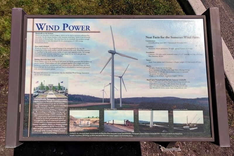
Windmills on the horizon
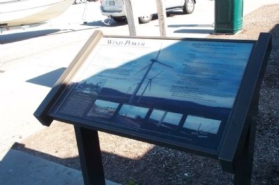
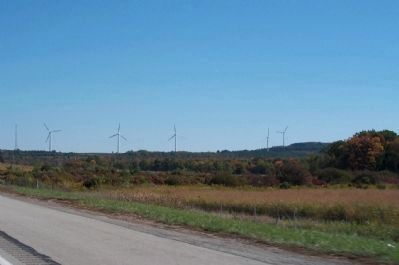
Wind is an abundant resource, which can be used to generate pollution-free electricity. On the distant horizon is the Somerset wind farm which is one of several wind farms of Pennsylvania. This wind farm has six windmills that produce enough clean energy to meet the annual electric consumption of 2,500 average Pennsylvanian homes.
How wind is formed
Winds are formed by the unequal heating of the atmosphere by the sun, the irregularities of the earth's surface, and the rotation of the earth. Wind flow patterns are modified by the earth's terrain, bodies of water, and vegetative cover. The average wind speed at the Somerset wind farm ranges from 15.7 to 16.8 mile per hour measured 160-feet above the earth's surface.
Making electricity from wind
Wind turbines turn in the moving air and power an electric generator that produces an electric current. Wind turbines are often grouped together into a single wind plant, known as a wind farm, and generate bulk electrical power. Electricity from the wind farm is fed into the local electric grid and then is distributed to customers just as it is with conventional power plants.
For more information on wind power, visit the American Wind Energy Association web site (www.awea.org).
Pennyslvania Turnpike Commission
Many people, businesses, organizations, federal and state agencies, and educational institutions chose to purchase wind-generated electricity. The Pennsylvania Turnpike Commission (PTC) is purchasing the electricity used in their Harrisburg administrative office from Pennsylvania wind farms. The PTC's commitment of purchasing 2,700 megawatt-hours/year (almost 100% of the electricity generated from one of the Somerset windmills) is helping to support to the Somerset wind farm.
Neat facts for the Somerset Wind Farm
Construction:Goundbreaking: June 2001 • Operational: November 2001
Foundation: Concrete: 156 cubic yeards/ Windmill (makes a 3' x 3' sidewalk over one mile long) Base diameter: 38 feet
Tower: Made from tubular steel (3 sections) • Height/ weight: 213 feet (total) / 89 tons
Blades: Fiberglass blades are 112 feet long
Rotor diameter is 231 feet (10% larger than a Boeing 747 jet)
Revolutions: 11-20 rpm (one revolution every 2-3 seconds)
Tip Speed: 155 miles/ hour
Height to top of blade (maximum height): 330 feet
Based upon Pennsylvania's fuel mix Somerset windmills:
Save 15,825 tones of carbon dioxide from being emitted/ year (equivalent to removing 2,400 vehicles from the road)
Save 110 tons of sulfur dioxide from being emitted/ year
Save
40 tons of nitrous oxides from being emitted/ year
Supporting Wind Power
Like the Pennsylvania Turnpike Commission, homes and busiesses can support power. For more information on how to support sustainable energy resources such as wind power, visit the following web sites:
Clean Your Air (www.cleanyourair.org)
West Penn Power Sustainable Energy Fund (www.wppsef.org)
Funding for this educational display was provided by the West Penn Power Sustainable Energy Fund (WPPSEF). Photographs courtesy of Robert and Tomalee Will. Assistance provided by the Pennsylvania Turnpike Commission, FPL Energy, GE Wind, Mid-Atlantic Renewable Energy Coalition, and Community Energy.
Erected by West Penn Power Sustainable Energy Fund (WPPSEF).
Topics. This historical marker is listed in these topic lists: Man-Made Features • Natural Resources. A significant historical year for this entry is 2001.
Location. 39° 59.996′ N, 79° 2.672′ W. Marker is near Somerset, Pennsylvania, in Somerset County. It is in Somerset Township. Marker can be reached from Pennsyvania Turnpike (Interstate 76). Marker has been moved from the South Somerset Service Plaza to the North Somerset Service Plaza on the other side of the Pennsylvania Turnpike. Touch for map. Marker is at or
near this postal address: 179 N Plaza Access Rd, Somerset PA 15501, United States of America. Touch for directions.
Other nearby markers. At least 8 other markers are within 2 miles of this marker, measured as the crow flies. Flight 93 National Memorial (a few steps from this marker); The Dwight D. Eisenhower Highway (about 500 feet away, measured in a direct line); Blue Star Memorial Highway (about 600 feet away); Rural Electrification (approx. 0.4 miles away); Coffee Springs Farm (approx. 1.4 miles away); Harmon Husband (approx. 1.4 miles away); George R. Scull House (approx. 1.8 miles away); The G. Henry Cook Enrichment Center (approx. 1.8 miles away). Touch for a list and map of all markers in Somerset.
Credits. This page was last revised on March 27, 2024. It was originally submitted on October 9, 2008, by Kathy Walker of Stafford, Virginia. This page has been viewed 1,509 times since then and 14 times this year. Last updated on April 16, 2018, by Devry Becker Jones of Washington, District of Columbia. Photos: 1, 2, 3. submitted on October 10, 2008, by Kathy Walker of Stafford, Virginia. 4, 5. submitted on July 9, 2019, by Bernard Fisher of Richmond, Virginia. • Bill Pfingsten was the editor who published this page.


