Baucum in Pulaski County, Arkansas — The American South (West South Central)
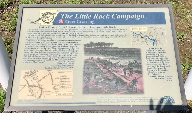
The Little Rock Campaign - River Crossing
Union Troops Cross Arkansas River to Capture Little Rock
"As soon as bridge was done, General Davidson ordered over a brigade of infantry to take possession of a levee in the opposite woods, to cover and protect my brigade while crossing and forming, as the enemy had opened artillery upon us. At about 9 a.m., my brigade began to cross the river. When two squadrons of the First Iowa Cavalry were over, they were ordered to the woods in front, where I found the infantry As soon as my command was fairly over, it moved out to the road running up the river to Little Rock...[M]y brigade had not moved more than 1 1/2 miles on the river road, when the enemy opened a heavy volley of musketry, soon repeated, accompanied with artillery. The firing commenced precisely at 12 m. [noon]."
-Colonel J. M. Glover
3rd Missouri Cavalry
Commanding 2nd Brigade of
Davidson's Cavalry Division, U.S.A.
"At sunrise on the morning of the 10th, the brigade...was ordered to leave the forks of the Brownsville and Shallow Ford roads (at which point we had bivouacked the night previous), cross at the lower pontoon, and move down the river at the double-quick to meet the enemy, who had early in the morning effected a crossing at Terry's Ferry..."
-Colonel William L. Jeffers
8th Missouri Cavalry,
C.S.A.
Erected by the American Battlefield Protection Program, National Park Service, Department of the Interior, the Arkansas Historic Preservation Program, the North Little Rock Volunteers for Improvement and Preservation. (Marker Number 4.)
Topics. This historical marker is listed in these topic lists: War, US Civil • Waterways & Vessels. A significant historical date for this entry is September 10, 1863.
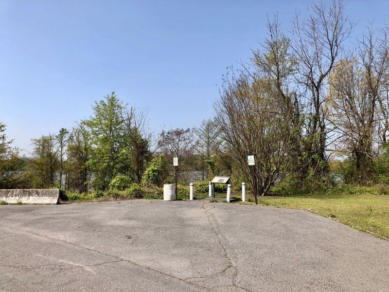
Location. 34° 43.171′ N, 92° 7.25′ W. Marker is in Baucum, Arkansas, in Pulaski County. Marker is on Willow Beach Road west of Colonel Maynard Road (County Road 85), on the left when traveling west. Touch for map. Marker is at or near this postal address: Willow Beach Road, North Little Rock AR 72117, United States of America. Touch for directions.
Other nearby markers. At least 8 other markers are within 7 miles of this marker, measured as the crow flies. The Little Rock Campaign - Ashley's Mills (approx. 1.9 miles away); Harris House (approx. 4.4 miles away); Engagement at Bayou Fourche (approx. 4.6 miles away); Battle of Little Rock (approx. 4.6 miles away); The Little Rock Campaign - Bayou Fourche (approx. 4.9 miles away); Marmaduke-Walker Duel (approx. 6 miles away); Home to Some; Capitol City to All (approx. 6.2 miles away); The Path to Domesticated Plants (approx. 6.2 miles away).
Regarding The Little Rock Campaign - River Crossing. Although today a lake, in 1863 this was the main channel of the Arkansas River. Confederate forces fell back across the Arkansas River, and on September 9 the Union forces reached the river. Steele decided on a strategy to put part of his force under command of Davidson across the river at Terry's Ferry, while Steele proceeded north of the river with the main body to attack the entrenched Confederate defenders. During the night of September 9, Davidson threw a pontoon bridge across the river at Terry's Ferry. Meanwhile Ritter's brigade of Davidson's Division made a demonstration at Bucks' Ford about four miles south of this site, faking a crossing of the Arkansas River to divert Confederate attention from Terry's Ferry. To cover Davidson's crossing, cannon were emplaced north of the river to command all points on the opposite shore from which Confederates might assail the bridgehead. On the morning of September 10, a regiment of infantry crossed first, followed by Davidson's cavalry.
The infantry then returned to the north bank of the River. The purpose in the infantry crossing was twofold; (1) to protect the cavalry's crossing, and (2) to cause the Confederate commander, Maj. Gen. Sterling Price, to think the main body of Steele's army was crossing the river to attack from the south and east. Fearing he would be outflanked and cut off from any retreat, when Price learned of the crossing he ordered a general withdrawal of his men from the fortifications north of the river, which extended along present day Park Hill.
Credits. This page was last revised on April 17, 2018. It was originally submitted on April 17, 2018, by Mark Hilton of Montgomery, Alabama. This page has been viewed 298 times since then and 23 times this year. Photos: 1, 2, 3. submitted on April 17, 2018, by Mark Hilton of Montgomery, Alabama.


