Solvang in Santa Barbara County, California — The American West (Pacific Coastal)
Mission Santa Inéz
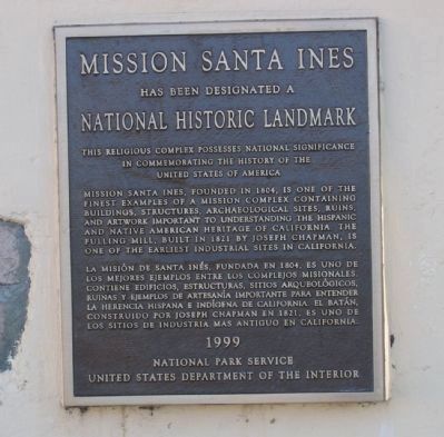
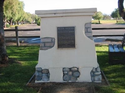
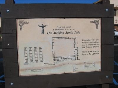
Mission Santa Inéz has been designated a National Historic Landmark. This religious complex possesses national significance in commemorating the history of the United States of America.
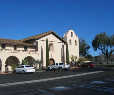
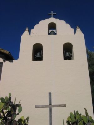
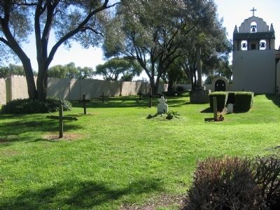
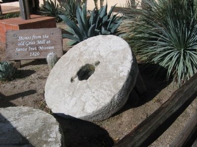
Mission Santa Ines, founded in 1804, is one of the finest examples of a Mission complex containing buildings, structures, archaeological sites, ruins, and artwork important to understanding the Hispanic and Native American heritage of California. The fulling mill, built in 1821 by Joseph Chapman, is one of the earliest industrial sites in California.
Erected 1999 by National Park Service. (Marker Number 305.)
Topics and series. This historical marker is listed in these topic lists: Churches & Religion • Hispanic Americans • Native Americans • Settlements & Settlers. In addition, it is included in the California Historical Landmarks, and the National Historic Landmarks series lists. A significant historical year for this entry is 1804.
Location. 34° 35.683′ N, 120° 8.176′ W. Marker is in Solvang, California, in Santa Barbara County. Marker can be reached from Mission Drive. Touch for map. Marker is at or near this postal address: 1760 Mission Dr, Solvang CA 93464, United States of America. Touch for directions.
Other nearby markers. At least 8 other markers are within 14 miles of this marker, measured as the crow flies. Bit O' Denmark (about 700 feet away, measured in a direct line); Los Olivos 1887 (approx. 5 miles away); Rancho De Los Olivos Farmhouse (approx. 5 miles away); The Past and Future Las Cruces Adobe (approx. 7.9 miles away); Las Cruces • The Crosses (approx. 7.9 miles away); Arroyo Hondo Fish Passage & Upstream Habitat Restoration (approx. 8.4 miles away); Gaviota Pass (approx. 9.2 miles away); The Los Alamos General Store (approx. 13.1 miles away).
Regarding Mission Santa Inéz. This site is California Historical Landmark No. 305.
This mission was founded in 1804 by Father Estévan Tapís to reach the Indians living east of the Coast Range. Construction was completed in 1817. It was through the efforts of Father Alexander Buckler, starting in 1904, that Mission Santa Inés was restored to as much as possible of its old charm and grace.
Also see . . . Mission Santa Ines: History. (Submitted on September 22, 2008, by Syd Whittle of Mesa, Arizona.)
Additional commentary.
1. National Historic Landmark - Statement of Significance (as of designation-January 20, 1999)
Mission Santa Ines is one of the best preserved Spanish mission complexes in the United States, an unrivaled combination of landscape setting, original buildings, extant collections of art and interior furnishings, water-related industrial structures and archaeological remains. The property is also important as the location of the start of the Chumash Revolt of 1824, one of the largest and most successful revolts of Native American Catholic neophytes in the Spanish West, representing indigenous resistance to European colonization. The intact archaeological remains of the two mission wings, a portion of the convento, and the Native American village are rare survivors, and have been demonstrated
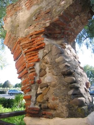
Photographed By Syd Whittle, March 21, 2006
3. The 19th Arch
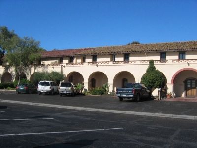
Twenty-two arches formed the front arcade of the mission quadrangle as completed in 1807. This is the original 19th arch. The 10 arches closest to the church are also original. Like most of the adobe quadrangle, some of the arches collapsed. For many years there was a gap between the 10th and 19th arches, but in 1989 the missing arches were reconstructed.
— Submitted September 27, 2008, by Syd Whittle of Mesa, Arizona.
Additional keywords. Missions
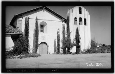
Photographed By Henry F. Withey, Photographer, circa Sept. 1936
10. Mission Santa Ines
Historic American Buildings Survey (LOC)
HABS CAL,42-SOLV,1A-
Building/structure dates: 1814 initial construction.
Building/structure dates: 1904 subsequent work.
See link for additional HABS photos.
Click for more information.
HABS CAL,42-SOLV,1A-
Building/structure dates: 1814 initial construction.
Building/structure dates: 1904 subsequent work.
See link for additional HABS photos.
Click for more information.
Credits. This page was last revised on August 20, 2023. It was originally submitted on September 22, 2008, by Syd Whittle of Mesa, Arizona. This page has been viewed 6,161 times since then and 45 times this year. Last updated on December 12, 2019, by Craig Baker of Sylmar, California. Photos: 1, 2, 3, 4, 5, 6, 7, 8, 9. submitted on September 22, 2008, by Syd Whittle of Mesa, Arizona. 10. submitted on April 16, 2009, by Syd Whittle of Mesa, Arizona. • J. Makali Bruton was the editor who published this page.
