Sharon Springs in Schoharie County, New York — The American Northeast (Mid-Atlantic)
Rockville
Historic Main Street Tour
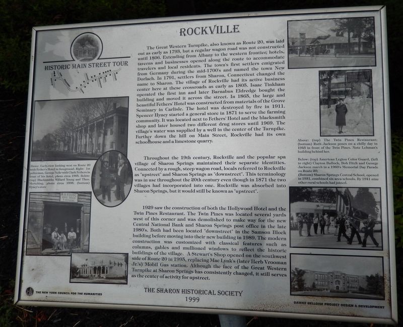
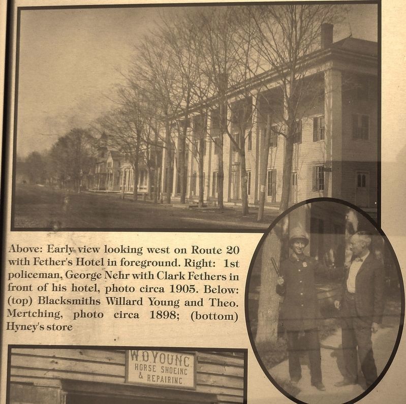
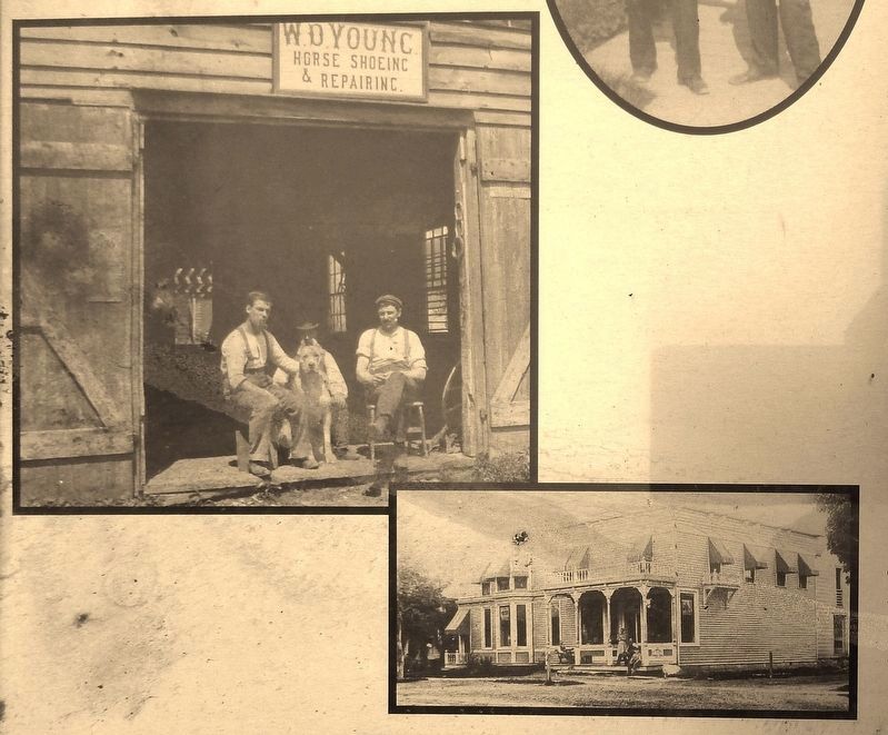
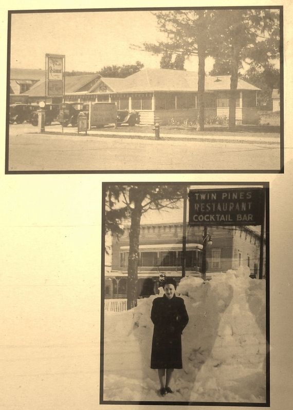
The Great Western Turnpike, also known as Route 20, was laid out as early as 1793, but a regular wagon road was not constructed until 1806. Extending from Albany to the western frontier, hotels, taverns and businesses opened along the route to accommodate travelers and local residents. The town's first settlers emigrated from Germany during, the mid-1700's and named the town New Dorlach. In 1791, settlers from Sharon, Connecticut changed the name to Sharon. The village of Rockville had its active business center here at these crossroads as early as 1805. Isaac Tinkham operated the first inn and later Barnabus Eldredge bought the building and moved it across the street. In 1865, the large and beautiful Fethers' Hotel was constructed from materials of the Grove Seminary in Carlisle. The hotel was destroyed by fire in 1911. Spencer Hyney started a general store in 1871 to serve the farming community. It was located next to Fethers' Hotel and the blacksmith shop and later housed two different drug stores until 1969. The village's water was supplied by a well in the center of the Turnpike. Further down the hill on Main Street, Rockville had its own schoolhouse and a limestone quarry.
Throughout the 19th century, Rockville and the popular spa village of Sharon Springs maintained their separate identities. Connected by a rough, steep wagon road, locals referred to Rockville as "upstreet" and Sharon Springs as "downstreet". This terminology was in use throughout the 20th century even though in 1871 the two villages had incorporated into one. Rockville was absorbed into Sharon Springs, but it would still be known as "upstreet".
Erected 1999 by Sharon Historical Society.
Topics. This historical marker is listed in these topic lists: Notable Places • Roads & Vehicles • Settlements & Settlers.
Location. 42° 47.378′ N, 74° 37.328′ W. Marker is in Sharon Springs, New York, in Schoharie County. Marker is at the intersection of Main Street (New York State Route 10) and U.S. 20, on the right when traveling south on Main Street. Marker is mounted on a waist-high post, and located adjacent to the sidewalk on the west side of Main Street, just north of the intersection. Touch for map. Marker is at or near this postal address: 105 Main Street, Sharon Springs NY 13459, United States of America. Touch for directions.
Other nearby markers. At least 8 other markers are within walking distance of this marker. The Lehman Block (a few steps from this marker); Historic Main Street Tour (approx. 0.3 miles away); a different marker also named Historic Main Street Tour (approx. 0.3 miles away); The American Hotel (approx. 0.4 miles away); Town of Sharon (approx. 0.4 miles away); Battle of Sharon (approx. 0.4 miles away); a different marker also named Historic Main Street Tour (approx. 0.4 miles away); a different marker also named Historic Main Street Tour (approx. 0.4 miles away). Touch for a list and map of all markers in Sharon Springs.
Related markers. Click here for a list of markers that are related to this marker. Rockville, Sharon, and Sharon Springs
Also see . . .
1. About Sharon Springs. Village website entry:
It was not until 1871 that the village was incorporated as its own jurisdictional entity. At that time, the new village combined the Route 20 community of Rockville with the mineral springs resort in the ravine below. The Town of Sharon (originally called New Dorlach) has lived with a dual identity for two centuries, home both to families with agricultural and rural roots, and to visitors and proprietors with visions of resorts and spas. Native Americans were lured here by the healing qualities of the sulphur, magnesia and chalybeate springs. In the 18th century, Yankee settlers, primarily of German and Dutch background, intermingled with Native American tribes. (Submitted on April 24, 2018, by Cosmos Mariner of Cape Canaveral, Florida.)
2. The Demize of the Glory Spa Days. Spas in Sharon Springs, New York website entry:
Then came Prohibition in the 1920 and the Great Depression in the 30’s, and several fires. People could no longer afford to partake in the comfort and luxury of the former spa glory days and several main transportation lifelines through the area ended. In 1954 the New York State Thruway opened its new section from Utica to Newburgh and traffic on Route 20 decreased drastically. By the 1960, Sharon Springs and many other towns along the old Rt. 20 “Great Western Turnpike” had become “ghost towns.” (Submitted on April 24, 2018, by Cosmos Mariner of Cape Canaveral, Florida.)
Photographed By Cosmos Mariner, July 13, 2017
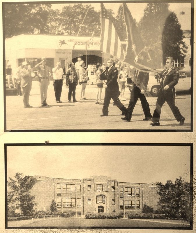
5. Marker detail: Memorial Day Parade
(top) American Legion Color Guard, (left to right) Clayton Bullock, Bob Fitch and George Jackson march in a 1960's Memorial Day Parade on Route 20; (Bottom) Sharon Springs Central School, opened in 1931, combined six area schools. By 1941 nine other rural schools had joined.
Credits. This page was last revised on April 12, 2023. It was originally submitted on April 24, 2018, by Cosmos Mariner of Cape Canaveral, Florida. This page has been viewed 202 times since then and 12 times this year. Photos: 1, 2, 3, 4, 5, 6. submitted on April 24, 2018, by Cosmos Mariner of Cape Canaveral, Florida. • Andrew Ruppenstein was the editor who published this page.
