Near LaGrange in Troup County, Georgia — The American South (South Atlantic)
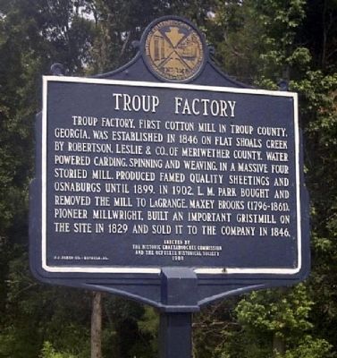
Troup Factory
Erected 1980 by Historic Chattahoochee Commission and the Ocfuskee Historical Society.
Topics. This historical marker is listed in this topic list: Industry & Commerce. A significant historical year for this entry is 1846.
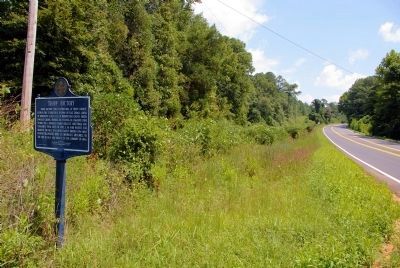
Location. 32° 56.703′ N, 84° 55.405′ W. Marker is near LaGrange, Georgia, in Troup County. Marker is on Hamilton Road (U.S. 27) 0.1 miles south of Smokey Road, on the left when traveling south. The marker is at the US 27 bridge over Flat Shoals Creek, between Pine Mountain and Hilyer, GA. Touch for map. Marker is in this post office area: Lagrange GA 30241, United States of America. Touch for directions.
Other nearby markers. At least 8 other markers are within 8 miles of this marker, measured as the crow flies. Salem Road Bridge (approx. 3.6 miles away); Noted Indian Trail (approx. 4.8 miles away); Chipley - Pine Mountain, Georgia (approx. 6.8 miles away); The Iron Horse (approx. 6.8 miles away); Bethany Baptist Church (approx. 7 miles away); Union Cemetery (approx. 7 miles away); Mountville Methodist (approx. 7.1 miles away); Mountville Community (approx. 7.1 miles away). Touch for a list and map of all markers in LaGrange.
Credits. This page was last revised on June 18, 2019. It was originally submitted on September 22, 2008, by David Seibert of Sandy Springs, Georgia. This page has been viewed 1,785 times since then and 74 times this year. Photos: 1. submitted on September 22, 2008, by David Seibert of Sandy Springs, Georgia. 2. submitted on September 3, 2009, by David Seibert of Sandy Springs, Georgia. • Bill Pfingsten was the editor who published this page.

