Near Virginia City in Madison County, Montana — The American West (Mountains)
Gold in Alder Gulch
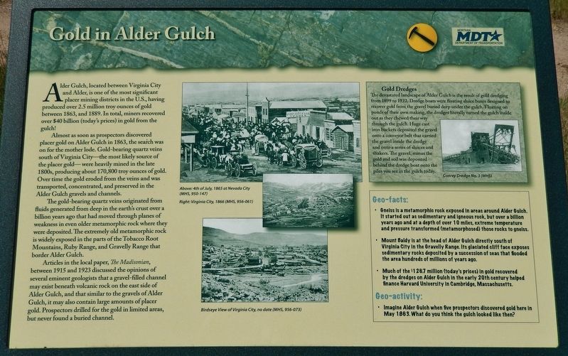
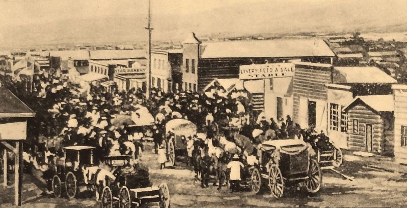
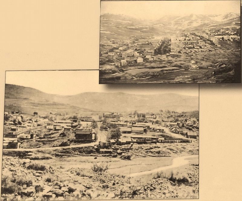
Alder Gulch, located between Virginia City and Alder, is one of the most significant placer mining districts in the U.S., having produced over 2.5 million troy ounces of gold between 1863, and 1889. In total, miners recovered over $40 billion (today's prices) in gold from the gulch!
Almost as soon as prospectors discovered placer gold on Alder Gulch in 1863, the search was on for the mother lode. Gold-bearing quartz veins south of Virginia City – the most likely source of the placer gold – were heavily mined in the late 1800s, producing about 170,800 troy ounces of gold. Over time the gold eroded from the veins and was transported, concentrated, and preserved in the Alder Gulch gravels and channels.
The gold-bearing quartz veins originated from fluids generated from deep in the earth's crust over a billion years ago that had moved through planes of weakness in even older metamorphic rock where they were deposited. The extremely old metamorphic rock is widely exposed in the parts of the Tobacco Root Mountains, Ruby Range, and Gravelly Range that border Alder Gulch.
Articles in the local paper, The Madisonian, between 1915 and 1923 discussed the opinions of several eminent geologists that a gravel-filled channel may exist beneath volcanic rock on the east side of Alder Gulch, and that similar to the gravels of Alder Gulch, it may also contain large amounts of placer gold. Prospectors drilled for the gold in limited areas, but never found a buried channel.
Gold Dredges
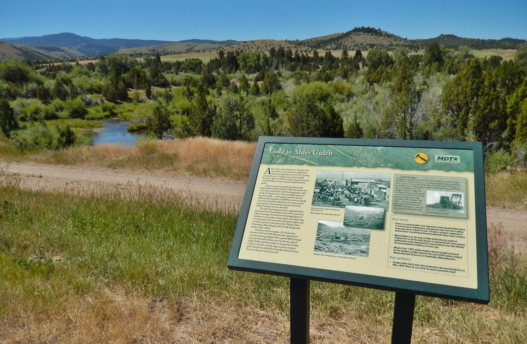
The devastated landscape of Alder Gulch is the result of gold dredging from 1899 to 1922. Dredge boats were floating sluice boxes designed to recover gold from the gravel buried deep under the gulch. Floating on ponds of their own making, the dredges literally turned the gulch inside out as they chewed their way through the gulch. Huge cast iron buckets deposited the gravel onto a conveyor belt that carried the gravel inside the dredge and onto a series of sluices and shakers. The gravel, minus the gold and soil was deposited behind the dredge boat onto the piles you see in the gulch today.
Geo-facts:
• Gneiss is a metamorphic rock exposed in areas around Alder Gulch. It started out as sedimentary and igneous rock, but over a billion years ago and at a depth of over 10 miles, extreme temperature and pressure transformed (metamorphosed) those rocks to gneiss.
• Mount Baldy is at the head of Alder Gulch directly south of Virginia City in the Gravelly Range. Its glaciated cliff face exposes sedimentary rocks deposited by a succession of seas that flooded the area hundreds of millions of years ago.
• Much of the $126.7 million (today's prices) in gold recovered by the dredges on Alder Gulch in the early 20th century helped finance Harvard University in Cambridge, Massachusetts.
Geo-activity:
• Imagine Alder Gulch when five prospectors discovered gold here in May 1863. What do you think the gulch looked like then?
Erected by Montana Department of Transportation.
Topics. This historical marker is listed in these topic lists: Industry & Commerce • Settlements & Settlers. A significant historical year for this entry is 1863.
Location. 45° 18.847′ N, 111° 58.812′ W. Marker is near Virginia City, Montana, in Madison County. Marker is on State Highway 287, half a mile north of Brown's Gulch Road, on the left when traveling north. Marker is located in a pull-out on the west side of the highway. Touch for map. Marker is in this post office area: Virginia City MT 59755, United States of America. Touch for directions.
Other nearby markers. At least 8 other markers are within walking distance of this marker. Adobetown (here, next to this marker); Finney House (approx. 0.7 miles away); Montana’s Oldest Standing School (approx. 0.7 miles away); Site of the Trial and Hanging of George Ives (approx. 0.7 miles away); Gallows Barn (approx. ¾ mile away); Nevada City (approx. ¾ mile away); History Wins! (approx. ¾ mile away); An Important Era in Railroad History (approx. ¾ mile away). Touch for a list and map of all markers in Virginia City.
Also see . . .
1. River of Gold. Montana State website entry:
In July 1863, hard rock gold was discovered nearly eight miles above Virginia City and the town of Summit soon grew. By fall of 1863, an estimated 10,000 people were living in Alder Gulch and the towns of Junction, Adobetown, Nevada City, Central City, Virginia City, Highland, Pine Grove, and Summit formed a nearly continuous settlement eleven miles long. Through the later 1860's placer claims were consolidated and hydraulicking began to replace shaft and drift placer operations. A complex and expensive system of dams and ditches brought water from the mountains to hydraulic mines near Nevada City. (Submitted on May 2, 2018, by Cosmos Mariner of Cape Canaveral, Florida.)
2. Bill Fairweather. Missoulian website entry:
Bill Fairweather was one of Montana’s most intriguing characters. His find in Alder Gulch in 1863 could have set him up for life. Instead he died 12 years later, an alcoholic with nary a flake of gold to his name. “It (gold) just really didn’t mean much to Bill Fairweather,” said Ellen Baumler, interpretive historian at the Montana Historical Society. “He liked the excitement of the gold runs, but gold itself didn’t have any meaning.” Fairweather was known to throw nuggets in the street as he rode by, “letting the Chinese and kids scramble for it,” said Baumler. “He supposedly fed gold dust to his horse, Old Antelope. He would say if it’s good
enough for me, it’s good enough for my horse, and he would put gold dust in the hay.” (Submitted on May 2, 2018, by Cosmos Mariner of Cape Canaveral, Florida.)
Credits. This page was last revised on April 27, 2021. It was originally submitted on May 2, 2018, by Cosmos Mariner of Cape Canaveral, Florida. This page has been viewed 700 times since then and 80 times this year. Photos: 1, 2, 3, 4. submitted on May 2, 2018, by Cosmos Mariner of Cape Canaveral, Florida. • Andrew Ruppenstein was the editor who published this page.


