Marshall in Fauquier County, Virginia — The American South (Mid-Atlantic)
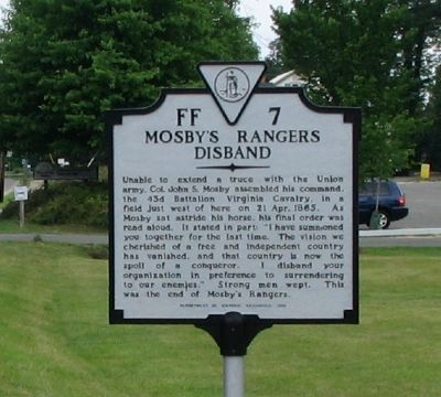
Mosby’s Rangers Disband
Erected 1996 by Department of Historic Resources. (Marker Number FF-7.)
Topics and series. This historical marker is listed in this topic list: War, US Civil. In addition, it is included in the Virginia Department of Historic Resources (DHR) series list. A significant historical date for this entry is April 21, 1865.
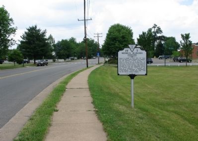
Location. 38° 52.026′ N, 77° 51.299′ W. Marker is in Marshall, Virginia, in Fauquier County. Marker is on Rectortown Road (Virginia Route 710), on the right when traveling north. Just North of the intersection of VA 55 and 710. Touch for map. Marker is in this post office area: Marshall VA 20115, United States of America. Touch for directions.
Other nearby markers. At least 8 other markers are within 3 miles of this marker, measured as the crow flies. McClellan Relieved From Command (about 300 feet away, measured in a direct line); Salem (about 400 feet away); Mosby’s Rangers Disband Site (approx. 0.2 miles away); Campaign of Second Manassas (approx. 0.4 miles away); Lee’s Narrow Escape (approx. 0.4 miles away); Confederate Memorial (approx. one mile away); Number 18 School (approx. 1.3 miles away); The Rosenwald School in Rectortown, "No. 12" (approx. 3 miles away). Touch for a list and map of all markers in Marshall.
Also see . . . Stone Marker on Main Street... ... marks the site where the Rangers disbanded. (Submitted on June 25, 2007, by Craig Swain of Leesburg, Virginia.)
Additional keywords. Mosby's confederacy
Credits. This page was last revised on February 11, 2021. It was originally submitted on June 17, 2007, by Craig Swain of Leesburg, Virginia. This page has been viewed 2,721 times since then and 226 times this year. Photos: 1, 2. submitted on June 17, 2007, by Craig Swain of Leesburg, Virginia. • J. J. Prats was the editor who published this page.

