Bandera in Bandera County, Texas — The American South (West South Central)
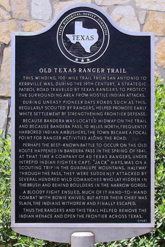
Old Texas Ranger Trail
During uneasy pioneer days roads such as this, regularly scouted by Rangers, helped promote early white settlement by strengthening frontier defense.
Because Bandera was located midway on the trail and because Bandera Pass, 10 miles north, frequently harbored Indian ambushers, the town became a focal point for Ranger activities along the road.
Perhaps the best-known battle to occur on the old route happened in Bandera Pass in the spring of 1841. At that time a company of 40 Texas Rangers, under intrepid Indian fighter Capt. "Jack" Hays, was on a scouting mission in the Guadalupe Mountains. Halfway through the pass, they were suddenly attacked by several hundred wild Comanches who lay hidden in the brush and behind boulders in the narrow gorge.
A bloody fight ensued, much of it hand-to-hand combat with Bowie knives; but after their chief was slain, the Indians withdrew and finally escaped. Thus the Rangers and this trail helped remove the Indian menace and open the frontier across Texas.
Erected 1968 by State Historical Survey Committee. (Marker Number 3823.)
Topics. This historical marker is listed in these topic lists: Native Americans • Roads & Vehicles • Settlements & Settlers • Wars, US Indian. A significant historical year for this entry is 1841.
Location. 29° 43.587′ N, 99° 4.403′ W. Marker is in Bandera, Texas, in Bandera County. Marker is at the intersection of Main Street (State Highway 16) and Pecan Street, on the right when traveling south on Main Street. Touch for map. Marker is at or near this postal address: 515 Main St, Bandera TX 78003, United States of America. Touch for directions.
Other nearby markers. At least 8 other markers are within walking distance of this marker. Captain Jack Phillips (here, next to this marker); Mormon Settlers in Bandera County (within shouting distance of this marker); Amasa Clark (within shouting distance of this marker); Tribute to Valor (within shouting distance of this marker); Bandera County War Memorial (within shouting distance of this marker); Bandera County Courthouse (within shouting distance of this marker); Camp Montel C.S.A. / Texas Civil War Frontier Defense (within shouting distance of this marker); Bandera, Texas USA (about 400 feet away, measured in a direct line). Touch for a list and map of all markers in Bandera.
Also see . . . Texas Rangers. from the Handbook of Texas Online (Submitted on May 24, 2018, by Larry D. Moore of Del Valle, Texas.)
Credits. This page was last revised on May 25, 2018. It was originally submitted on May 24, 2018, by Larry D. Moore of Del Valle, Texas. This page has been viewed 497 times since then and 38 times this year. Photos: 1, 2. submitted on May 24, 2018, by Larry D. Moore of Del Valle, Texas. • Bernard Fisher was the editor who published this page.

