Texon in Reagan County, Texas — The American South (West South Central)
Santa Rita No. 1
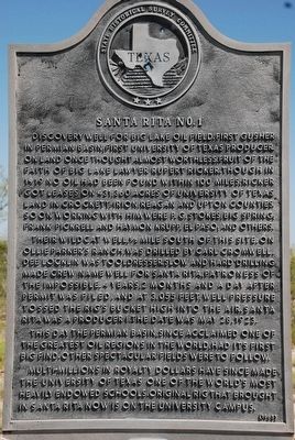
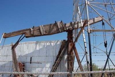
Discovery well for Big Lake Oil Field. First gusher in Permian Basin, first University of Texas producer on land once thought almost worthless. Fruit of the faith of Big Lake lawyer Rupert Ricker. Though in 1919 no oil had been found within 100 miles, Ricker got leases on 431,360 acres of University of Texas Land in Crockett, Irion, Reagan and Upton counties. Soon working with him were P.G Stokes, Big Spring; Frank Pickrell and Haymon Krupp, El Paso; and others.
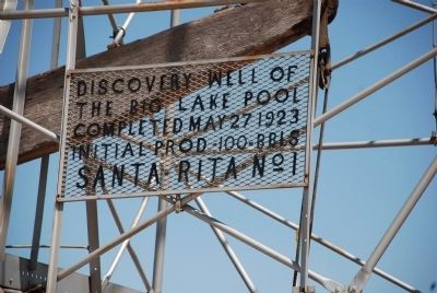
Their wildcat well ½ mile south of this site, on Ollie Parker's ranch, was drilled by Carl Cromwell. Dee Locklin was tooldresser. Slow and hard drilling made crew name well for Santa Rita, Patroness of the Impossible. 4 years, 2 months and a day after permit was filed, and at 3055 feet, well pressure tossed the rig's bucket high into the air. Santa Rita was a producer! The date was May 28, 1923.
This day the Permian Basin, since acclaimed one of the greatest oil regions in the world, had its first big find. Other spectacular fields were to follow.
Multi-millions in royalty dollars have since made the University of Texas one of the world's most heavily endowed schools. Original rig that brought in Santa Rita now is on the University campus.
Erected 1965 by State Historical Survey Committee . (Marker Number 4587.)
Topics. This historical marker is listed in these topic lists: Exploration • Industry & Commerce. A significant historical date for this entry is May 28, 1923.
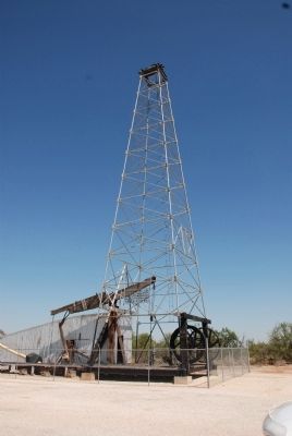
Location. 31° 13.868′ N, 101° 41.612′ W. Marker is in Texon, Texas, in Reagan County. Marker is on U.S. 67, on the right when traveling north. The marker is on the main highway, the drill site and drilling rig is off FM 1675 not far from the highway. The top of the derrick is visible across the highway from the marker location. Touch for map. Marker is in this post office area: Big Lake TX 76932, United States of America. Touch for directions.
Other nearby markers. At least 5 other markers are within 15 miles of this marker, measured as the crow flies. The Town of Texon (approx. ¼ mile away); Upton County (approx. 8.8 miles away); Rankin (approx. 8.8 miles away); Stiles Cemetery (approx. 13.9 miles away); Site of the First Court House Built in Reagan County (approx. 14.4 miles away).
Credits. This page was last revised on November 28, 2020. It was originally submitted on August 21, 2010, by Steve Henderson of Marble Falls, Texas. This page has been viewed 2,668 times since then and 153 times this year. Last updated on May 31, 2018, by Brian Anderson of Humble, Texas. Photos: 1, 2, 3, 4. submitted on August 21, 2010, by Steve Henderson of Marble Falls, Texas. 5. submitted on August 22, 2010, by Steve Henderson of Marble Falls, Texas. • Bill Pfingsten was the editor who published this page.
